Angola is divided into eighteen top administrative units called province.
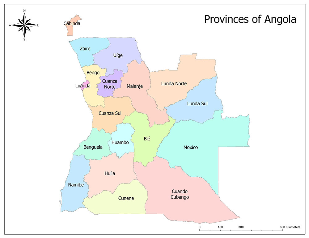
Eighteen Provinces of Angola
Angola is divided into eighteen provinces. These provinces are Bengo, Benguela, Bié, Cabinda, Cuando Cubango, Cuanza Norte, Cuanza Sul, Cunene, Huambo, Huíla, Luanda, Lunda Norte, Lunda Sul, Malanje, Moxico, Namibe, Uíge and Zaire.
Bengo
The Bengo Province is one of the eighteen provinces of Angola. It is located in the north of the country. The city of Caxito, which is the administrative center, has a surface area of 41,000 square kilometers and an estimated population of 429,300 in 2018. The Bengo Province is divided into 5 municipalities. These municipalities are Ambriz, Dande, Ícolo e Bengo, Nambuangongo, and Quicama.
Benguela
Benguela Province is one of the eighteen provinces of Angola. It is located on the Atlantic Ocean on the west of the country. The administrative center of Benguela Province is Benguela City. It has an area of 39,827 square kilometers and the estimated population of 2018 is 2,477,600. The municipalities of the province are Lobito, Bocoio, Balombo, Ganda, Cubal, Caimbambo, and Baia-Farta Chongorói. Sisal, cotton, sugar, coffee, banana, bean and horticultural activities are the main products of agriculture in the region. Livestock activities are based on the production of pork and beef, milk and milk products. Minerals in the region; tungsten, graphite and other minerals. Its industry is based on the production of metals, petroleum refining, construction materials, textiles, and food.
Bié
Bié Province is one of the eighteen provinces of Angola. It is located in the middle part of the country. The center of the province is Kuito. The total area of the province is 70,314 square kilometers and the estimated population of 2018 is 1,654,700. In the central part of the country are Malanje to the north, Lunda Sul to the northeast, Moxico to the east, Cuando Cubango to the south and Huila, Huambo and Cuanza Sul to the west. Bié’s climate is cool and rainy. Therefore, it is a suitable area for agriculture. Corn, sugar cane, rice, coffee, and peanuts are made from cultivation. In the geographical structure of the region, the characteristic Angola highlands, with an altitude of 1,852 meters, are observed.
Cabinda
Cabinda is one of the eighteen provinces of Angola. There is no terrestrial connection with Angola territory. The province has a controversial status among many political institutions. The management center of the province is Cabinda with the same name. The area is 7,270 square kilometers. According to 2018 estimates, the Cabinda province has a population of 801,400 people. The population growth rate in the region is rising very fast.
Cuando Cubango
Cuando Cubango Province is one of the eighteen provinces of Angola. It is located in the south of the country. The management center is in the city of Menongue. The province has an area of 199,335 square kilometers and the estimated population of 2018 is 601,500.
Cuanza Norte
Cuanza Norte Province is one of the eighteen provinces of Angola. It is located in the northwest of the country. The administrative center of N’Dalatando is 24,110 square kilometers and the estimated population of 2018 is 495,800.
Cuanza Sul
Cuanza Sul Province is one of the eighteen provinces of Angola. It is located to the west of the country. The city of Sumbe, whose headquarters is the city of Sumbe, has an area of 58,698 square kilometers and an estimated population of 2,110,000 in 2018.
Cunene
Cunene Province is one of the eighteen provinces of Angola. Cunene Province is located to the south of the country. The administrative center is Ondjiva. The province has a surface area of 77,213 square kilometers and the estimated population of 2018 is 1,121,700. It was named after the Cunene River.
Huambo
Huambo Province is one of the eighteen provinces of Angola. It is located in the north of the country. The management center is Huambo. The province has a surface area of 35,771 square kilometers and the estimated population of 2018 is 2,309,800.
Huíla
Huíla Province is one of the eighteen provinces of Angola. It is located in the south of the country. The center of management is Lubango. The province has a surface area of 79,022 square kilometers and an estimated population of 2,819,300 in 2018.
Luanda
Luanda Province is one of the eighteen provinces of Angola. It is located in the north of the country. Luanda, whose headquarters is the capital city of Luanda, has an area of 2,418 square kilometers and an estimated population of 7,976,900 in 2018.
Lunda Norte
Lunda Norte Province is one of the eighteen provinces of Angola. It is located in the northeast of the country. The management center is the city of Lucapa. The area has a surface area of 103,760 square kilometers and the estimated population of 2018 is 972,200.
Lunda Sul
Lunda Sul Province is one of the eighteen provinces of Angola. It is located in the northeast of the country. The administrative center is Saurimo. The province has a surface area of 77,637 square kilometers and an estimated population of 2018 is 609,900.
Malanje
Malanje Province is one of the eighteen provinces of Angola. It is located in the north of the country. The administration center is Malanje. The province has an area of 93,302 square kilometers and the estimated population of 2018 is 1,108,300.
Moxico
Moxico Province is one of the eighteen provinces of Angola. It is located to the east of the country. The administrative center is Luena. The province has an area of 223,023 square kilometers, and the estimated population of 2018 is 854,300.
Namibe
Namibe Province is one of the eighteen provinces of Angola. It is located in the south of the country. The administrative center is the city of Namibe. The province has a surface area of 57,091 square kilometers and the estimated population of 2018 is 568,700.
Uíge
Uíge Province is one of the eighteen provinces of Angola. It is located in the north of the country. The administrative center is Uíge The province has an area of 58,698 square kilometers and an estimated population of 1,662,000 in 2018.
Zaire
Zaire Province is one of the eighteen provinces of Angola. It is located in the north of the country. The headquarters is Mbanza Congo. The province has a surface area of 40,130 square kilometers and the estimated population of 2018 is 676,600.
Angola / Maps, Geography, Facts
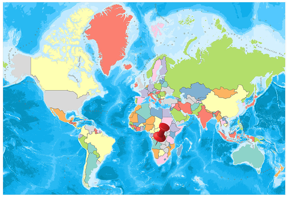
The neighbors of Angola, located in the southwest of Africa, are Namibia in the south, the Democratic Republic of Congo in the northeast and Zambia in the east. The Atlantic Ocean is located in the west of the country.
Geography
The narrow plains starting from the shore leave their places to the wide plateaus as they go to the interior. The lowest point is the Atlantic Ocean 0 m. The highest point is Morro de Moco 2,620 m. Natural resources of the country are petroleum, diamond, iron deposits, phosphate, copper, gold, bauxite, and uranium.
Governance
In Angola, the form of government is the presidential system. With the new Constitution adopted in 2010, the Office of the Prime Minister was abolished and replaced by the position of Vice President. Furthermore, the new Constitution stipulates that the term of office of the President shall be 5 years, that a candidate may be elected President for a maximum of two times, and that the chairman of the party who receives the highest number of votes in the general elections is elected by the President.
Climate
The tropical climate is dominant in Angola. The coastal and northern regions have high temperatures throughout the year. It is between 25-30 degrees during the day. There is a rainy season between November and April. During the same period, the region is under the influence of the cold Benguela Stream and dense fog is seen.
A more moderate tropical climate prevails in the high areas in the central part of the country and in the south. The differences between day and night temperatures are particularly high in winter. For example, in July, the daytime temperature in Huambo is 25 degrees, while night temperatures are 7-8 degrees. There is a rainy season between October and April. In the southeastern part of Angola, there is a very hot and dry climate. There is little rainfall in the area where the night temperatures are low.
Religion
More than 50 percent of the population is Christian. Both Catholics and Protestants exist. The majority of the Kala population believes in local religions.
The population of approximately 500 thousand people, formed by immigrants from West Africa and the Middle East, believes in the religion of Islam. In October 2013, however, the Angola government declared the Islamic faith as an illegal religion within the country and closed or demolished mosques by banning all Islamic elements.
Industry and Tourism
According to 2012 data, Angola has a gross domestic product of USD 114.2 billion and the third largest economy of the African continent after South Africa and Nigeria. However, the majority of the population still lives at the border of hunger. The effects of many years of civil war are still felt today.
Especially in recent years, thanks to the oil reserves and other underground riches, good economic development has been experienced. However, as these incomes are not delivered to the public properly, the majority of the country’s population is unemployed and some of them live below the hunger limit. According to the 2013 Human Development Index report published by the United Nations, the country is in the category of ‘little human development’ and ranked 148 out of 186 countries.
85 percent of the working population of the country’s population is in the agricultural sector. The most important agricultural product of the country is sugar cane, corn, coconut oil, potato, rice, and cocoa. Cattle and goats are grown in terms of livestock.
The most important trading partners in the country’s exports are the United States, the People’s Republic of China, France, Belgium, and Spain. Imports work with Portugal, South Africa, USA, France, and Brazil.
Art
Like all other African countries, the wooden masks and sculptures of Angola are not only aesthetic creations. In cultural rituals, life and death play an important role, representing the transition from childhood to adulthood, the celebration of a new harvest and the marking of the hunting season. Angola artisans work in wood, bronze, ivory, malachite or ceramic environments.
- Population: 31,375,184
- Population Density: 25 per Km2
- Land Area: 1,246,700 Km ²