Australia is located in the Australia and Oceania region at latitude -25.274398 and longitude 133.775136 and is part of the Oceania continent.
The DMS coordinates for the center of the country are:
- 25° 16' 27.83'' S
- 133° 46' 30.49'' E
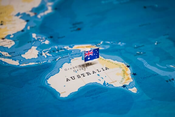
You can see the location of Australia on the world map below:
The country has no neighboring countries/land borders.
Maritime Borders
Australia borders with the Indian Ocean, the Pacific Ocean, and the Coral Sea.
Australia Related Content
- Australian States and Territories
- Australia Flag Map and Meaning
- What is the Capital of Australia?
- World Heritage Sites in Australia
- Australia Oceania Maps
Australia Key Facts
| Country | Australia |
| Coordinates | Latitude: -25.274398 Longitude: 133.775136 |
| Country Codes | Alpha 2: AU Alpha 3: AUS |
| Country Flag Emoji | 🇦🇺 |
| Int. Phone Prefix | +61 |
| Capital city | Canberra |
| Continent Subcontinent | Oceania Australia and Oceania |
| Country Area | 7,741,220 sq km |
| Population 2021 | 25,739,256 World Rank: 55 |
| Median Age | 37 |
| Life expectancy | 84.5 |
| Major languages | English 72.7%, Mandarin 2.5%, Arabic 1.4%, Cantonese 1.2%, Vietnamese 1.2%, Italian 1.2%, Greek 1%, other 14.8%, unspecified 6.5% (2016 est.) |
| UTC/GMT Time | Number of time zones: 9
|
| Internet TLD | .au |
| Biggest Airport | Sydney Airport (SYD) |
| Average temperature | 21.65 °C 70.97 °F |
| Administrative Divisions | 6 states 2 territories |
| Political system | Federal parliamentary democracy and constitutional monarchy |
Australia Economy Facts
| World Bank Income Group | High income |
| World Bank Region | East Asia & Pacific |
| Currency | Australian Dollar (AUD) |
| GDP in 2020 | $1327.8 (billions of USD) World Rank: 13 |
| GDP per capita in 2020 | $51,680 World Rank: 13 |
| Major Industries / Economic Sectors | Mining, agriculture, manufacturing, tourism, services |
| Top 5 Import Countries | China, United States, Japan, South Korea, Germany |
| Top 5 Export Countries | China, United States, Japan, South Korea, India |
Biggest Cities in Australia
Here are the largest cities in Australia based on 2021 data:
| City | Population |
|---|
| Sydney | 4,840,600 | Melbourne | 4,529,500 | Brisbane | 2,360,241 | Perth | 2,039,200 | Adelaide | 1,295,714 | Gold Coast | 638,090 | Cranbourne | 460,491 | Canberra | 381,488 | Central Coast | 297,713 | Wollongong | 261,896 |