Belgium is a federal state with three communities, three regions and four languages.
The establishment date of language divisions is 2 August 1963, Second Gilson Act. The division into language territories was a subject in the Belgian Constitution in 1970. Through constitutional reforms in the 1970s and 1980s, federal, regional and community governments were formed.
The three communities of Belgium are:
- the Dutch-speaking Flemish Community (Vlaamse Gemeenschap),
- the French-speaking French Community (Communauté française), and
- the German-speaking German-speaking Community (Deutschsprachige Gemeinschaft, DG)
The three regions in Belgium are:
- the Brussels-Capital Region (Brussels, Région de Bruxelles-Capitale in French, Brussels Hoofdstedelijk Gewest in Dutch),
- the Flemish Region (Flanders, Vlaams Gewest) and
- the Walloon Region (Wallonia, Région wallonne).
Regions of Belgium
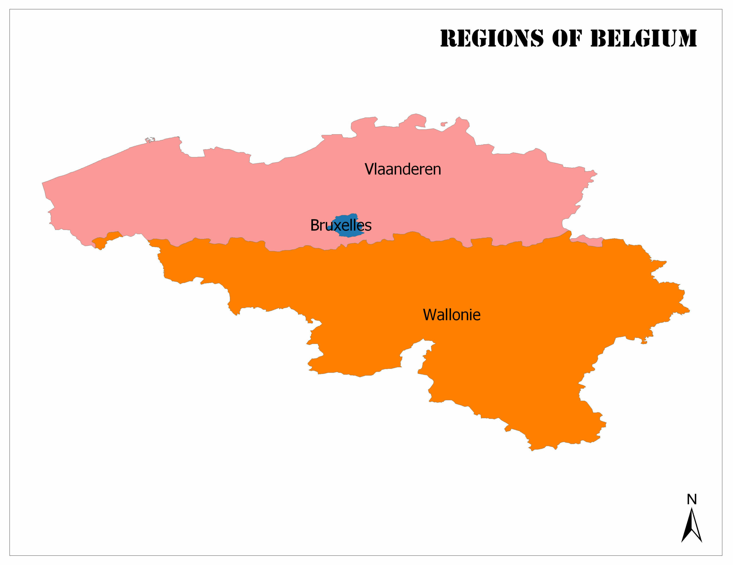
Flemish Region
The population by the 2017 census is 6,516,011. The surface area is 13,522 square kilometers. Flemish region consists of 308 municipalities in total. The region’s official language is Dutch.
Walloon Region
According to the population census of the year 2017, the population is 3,614,473. Area, 16.844 km². Moreover, Walloon region consists of 262 municipalities in total. In Walloon region German and French are the official languages. And also Dutch is spoken for only administrative purposes in some areas.
Brussels-Capital Region
The population by the 2017 census is 1,191,604. The surface area is 161 square kilometers. Brussels-Capital region consists of 19 municipalities in total. Official languages are French and Dutch.
Belgium Geography and Facts
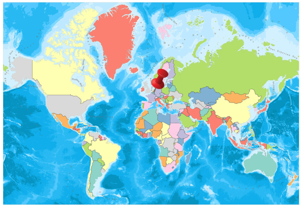
Belgium is one of the countries in the north-western part of Europe. France, Germany, Luxembourg and the Netherlands, the country has borders by countries on an area of about 31 thousand square meters.
- Population: 11,533,459
- Population Density: 382 per Km2
- Land Area: 30,280 Km ²
Belgium is known as a welfare center in terms of trade and culture in history. Its name is a mixture of Celtic and Germanic. Furthermore, the country, which is mostly known for undertaking the administration of the European Union, is attracting great interest from the Middle Ages and Renaissance works.
Geography
Belgium’s neighbors are France, Germany, Luxembourg, and the Netherlands, which have coasts on the Atlantic Ocean in the northwest. Covering an area of 33,990 square kilometers together with inland waters, the country covers an area of 30,528 square kilometers outside the inland waters. Belgium has three main geographical regions. The north-western coastal plains of the Anglo-Belgian Basin and Ardennes land which is part of the central plateau and the southeast Hercynian orogenic belt. On the southern tip of the country, the Paris Basin reaches a small fourth area named Lorraine of Belgium.
Governance
Although the Kingdom of Belgium was founded by the Constitution of 1831 with a state structure, it turned to a more federal structure with the constitutional reforms of 1970, 1980, 1988/89, 1993, 2001 and lastly in 2011. There are 6 governments in the country, each controlled by a separate legislative body.
- Federal Government
- Flemish Government
- Valonian Government
- Brussels-Capital Territory Government
- French Community Government
- German Community Government
According to the original constitutional structure of Belgium, the federal government has no authority over the federal units, the federal units have no control over the federal government. The legislation of the federal government and the legislation of the federated units are considered equal. The regional and community parliamentary powers have the power to determine both their own structures and the structure of the relevant regional and community government.
Climate
A temperate climate prevails. The average temperature in January is 3 degrees, 18 degrees in June. The winter season does not exceed extreme cold, but it is rainy.
Religion
A large majority of Belgium’s population is Christians.
Here is a complete list of all religions in Belgium:
- Catholics: 58.1%
- Ateizm: 3%
- Islam: 3.6%
- Protestantism: 1.1%
- Orthodox: 0.6%
- Buddhism: 0.3%
- Judaism: 0,2%
Industry and Tourism
Belgium’s strongly globalized economy and transport infrastructure are integrated with the rest of Europe. The position of the country at the heart of the advanced industrializing region has helped the world become the 15th largest trading country in 2007. It has characterized economy, labor, high GNP and high per capita exports.
The main export products of Belgium are food products, machinery, raw diamonds, petroleum and petroleum products, chemicals, clothing and accessories, and textile products while the main export products are automobiles, food products, iron and steel, processed diamonds, textile, plastic, petroleum products and non- metals.
Apart from my impression that Belgium is a small country, it amazes everyone, rich and wonderful. Medieval and Art-Nouveau style architecture and a long history attract many tourists to the country. Furthermore, the best time to travel is from May to September.