Bolivia is located in the South America region at latitude -16.290154 and longitude -63.588653 and is part of the South American continent.
The DMS coordinates for the center of the country are:
- 16° 17' 24.55'' S
- 63° 35' 19.15'' W
You can see the location of Bolivia on the world map below:
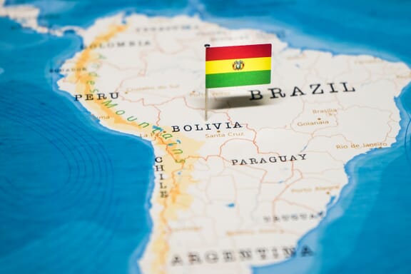
Bolivia Neighboring Countries
The neighboring countries of Bolivia (BO) are:
- Argentina (AR)
- Brazil (BR)
- Chile (CL)
- Paraguay (PY)
- Peru (PE)
Bolivia is a landlocked country, which means it does not have direct access to the open ocean.
Bolivia (Plurinational State of) Related Content
Bolivia Key Facts
| Country | Bolivia (Plurinational State of) |
| Coordinates | Latitude: -16.290154 Longitude: -63.588653 |
| Country Codes | Alpha 2: BO Alpha 3: BOL |
| Country Flag Emoji | 🇧🇴 |
| Int. Phone Prefix | +591 |
| Capital city | Sucre |
| Continent Subcontinent | South America South America |
| Country Area | 1,098,581 sq km |
| Population 2021 | 11,832,936 World Rank: 79 |
| Median Age | 23.9 |
| Life expectancy | 63.6 |
| Major languages | Spanish |
| UTC/GMT Time | Number of time zones: 1
|
| Internet TLD | .bo |
| Biggest Airport | Viru Viru International Airport (VVI) |
| Average temperature | 16.00 °C 60.80 °F |
| Administrative Divisions | 9 departments |
| Political system | Presidential representative democratic republic |
Bolivia Economy Facts
| World Bank Income Group | Lower middle income |
| World Bank Region | Latin America & Caribbean |
| Currency | Boliviano (BOB) |
| GDP in 2020 | $36.6 (billions of USD) World Rank: 92 |
| GDP per capita in 2020 | $3,138 World Rank: 131 |
| Major Industries / Economic Sectors | Agriculture, mining, manufacturing, energy |
| Top 5 Import Countries | Brazil, China, United States, Argentina, Chile |
| Top 5 Export Countries | Brazil, United States, China, Argentina, Chile |
Biggest Cities in Bolivia
Here are the largest cities in Bolivia based on 2021 data:
| City | Population |
|---|
| Santa Cruz | 3,151,676 | La Paz | 2,867,504 | Cochabamba | 632,013 | Sucre | 300,000 | Oruro | 264,683 | Warnes | 214,216 | Potosi | 189,652 | Tarija | 179,528 | Sacaba | 172,466 |
Map of Bolivia with the Largest Cities
Other Countries in the South America Region
Image Sources and Copyright Information
- Bolivia Flag Pin on Map: © hyotographics/Shutterstock