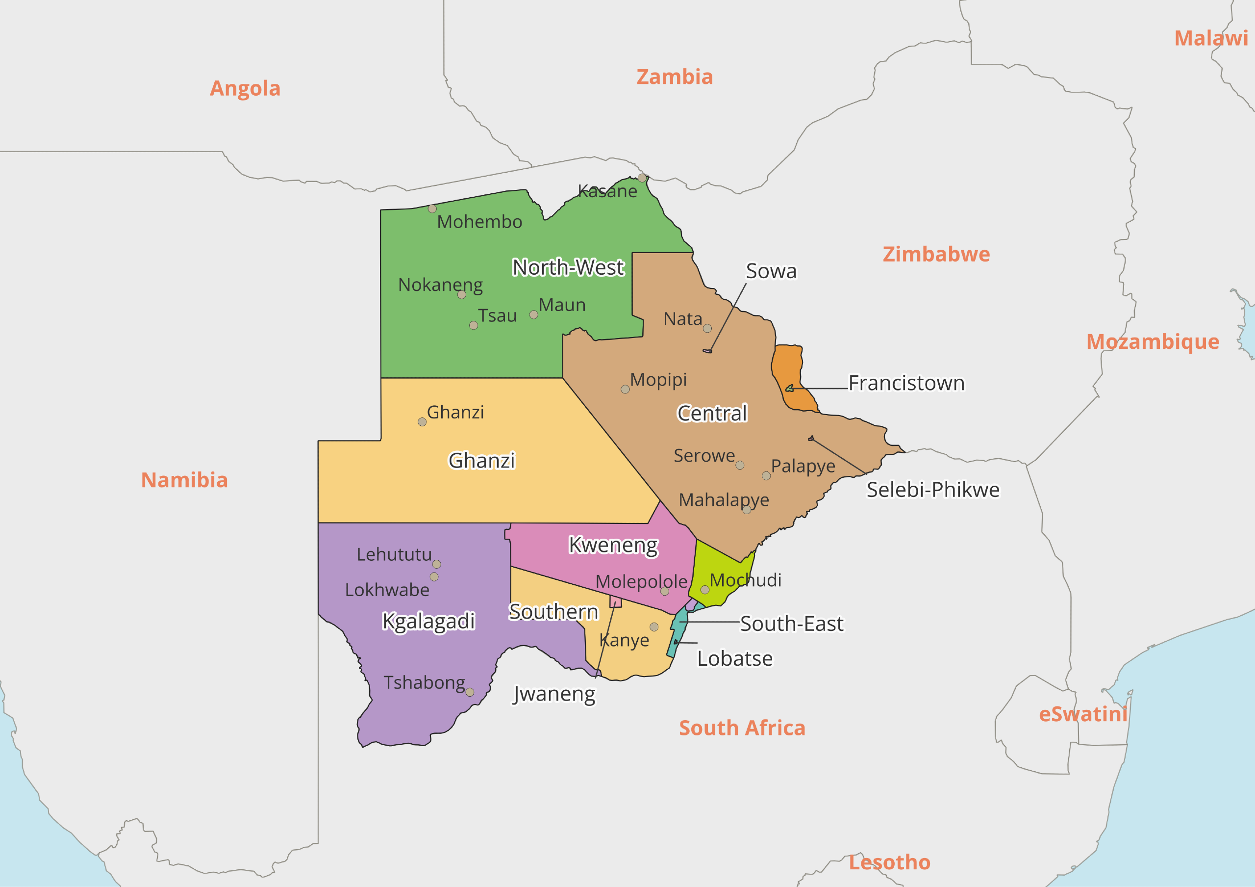
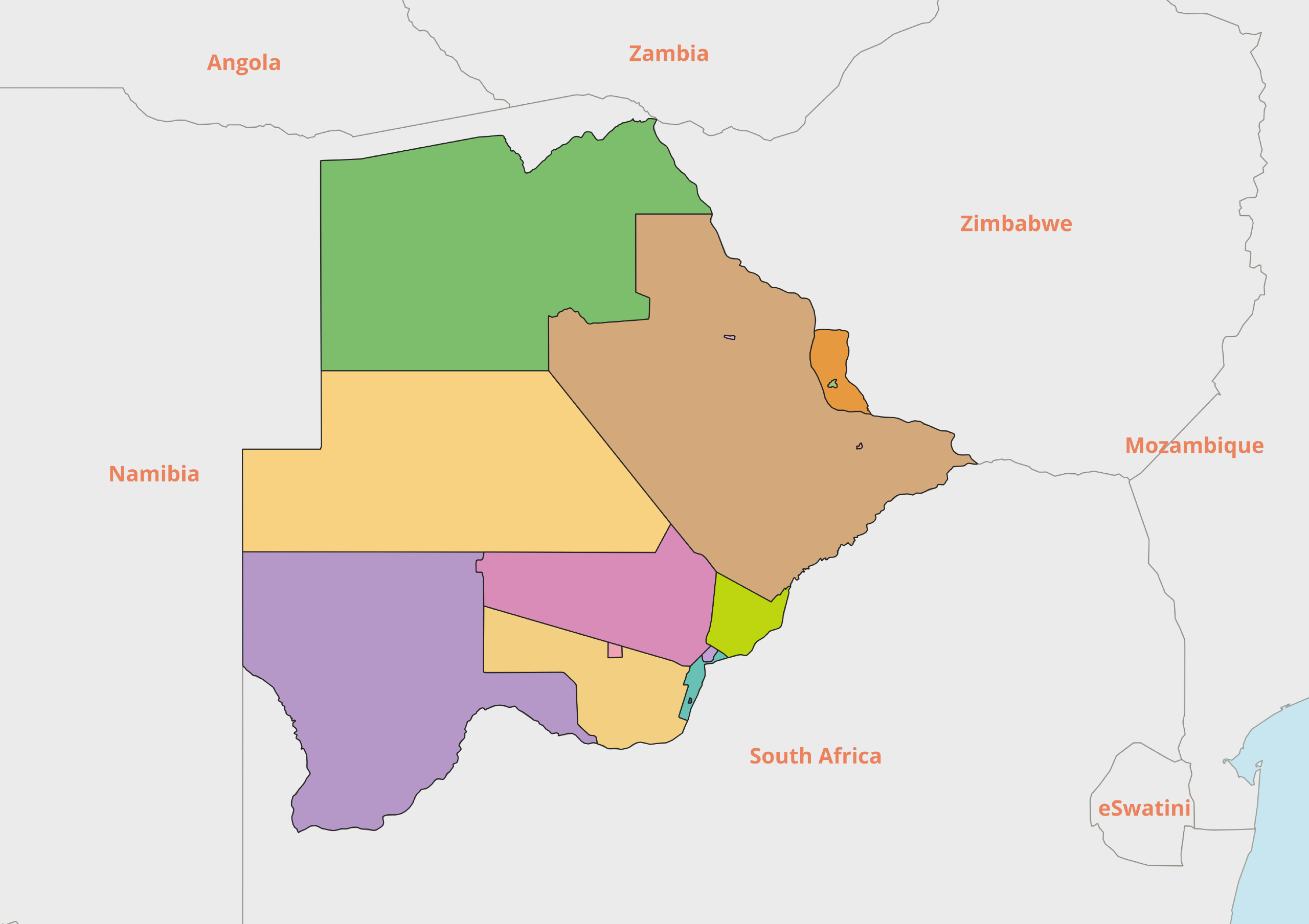
Botswana, an African country, is divided into nine districts.
Some of the districts which are formed by taking into consideration the administrative and geographical conditions are also divided into subdivisions.
Chobe and Ngamiland, which were separate districts until 2001, merged in the year and formed the Northwest district.
Nine Districts of Botswana
Botswana is divided into nine districts. These nine districts are Central, Ghanzi, Kgalagadi, Kgatleng, Kweneng, North East, North West, South East, and Southern.
Central
The Central district is one of the nine districts of Botswana. It is the largest district in the country in terms of both its surface area and population.
The district is neighbor to Zimbabwe and Northeast District in the east, South Africa in the South, Kgatleng District in the south, Kweneng District in the southwest, Ghanzi District in the west and Northwest District in the northwest.
Serove is the capital of the district and the district itself is divided into Bobonong, Boteti, Mahalapye, Orapa, Selibe-Phikwe, Serowe / Palapye, Sowa Town and Tutume.
Ghanzi
Ghanzi District is one of the nine districts of Botswana. The Ghanzi District, which is located in the western part of the country and which extends to the inner parts of the country, is one of the largest districts of the country.
District is adjacent to Namibia in the west, Central District in the east, Kweneng District in the south and Kgalagadi District in the south and Northwestern District in the north. Central Kalahari Game Reserve is located in the eastern part of the region.
Ghanzi is the administrative capital and the district is divided into two districts. These districts are Charles Hill and Ghanzi.
Kgalagadi
The Kgalagadi District is one of the nine districts of Botswana. Although the Kgalagadi district is one of the largest districts of the country, it is the second district with the lowest population and the least population density.
A third of the District is covered by the Kalahari Desert. District is adjacent to Namibia in the west, Kweneng District in the east and South District in the east, South Africa in the south and southwest, and Ghanzi District in the north. The Kgalagadi Transfrontier National Park in the District covers one-third of the district.
Tsabong city is the administrative capital of the district, the district itself is divided into two districts. These districts are Hkuntsi and Tshabong.
Kgatleng
The Kgatleng District is one of the nine districts of Botswana. Kgatleng District is one of the smallest districts in the country. The District is neighbor to the Central District in the north, the Kweneng District in the west, the Southeastern District in the southwest and the Republic of South Africa in the east and south.
The city of Mochudi is the capital of the district and the district itself is not divided into districts, as is the case in other districts in the country.
Kweneng
The Kweneng District is one of the nine districts of Botswana. Kweneng District is located in the southern part of the country. It is neighbor to the Ghanzi District in the north, the Central District in the northeast, the Southeast District in the southeast, the Kgatleng District in the east, the South District in the south, and the Kgalagadi District in the west.
Molepolole is the capital and the city is the third most populous city after the capital Gaborone and Francistown. The district itself is divided into two districts, Lethlakeng and Molepolole.
North East
Northeastern District is one of the nine districts of Botswana. Although it is one of the smallest districts of the country, it is a district with high population density. The district is located in the east and north of Zimbabwe, in the west and in the south it is adjacent to the Central Region.
The city of Masunga is the administrative capital of the district and the district itself is not divided into counties as it has been carried out in many other Botswana towns.
North West
The Northwest District is one of the nine districts in Botswana. The Northwest District, which was formed by the merger of Chobe and Ngamiland districts in 2001, is in the second largest district of the country. The district is adjacent to Namibia in the west and north, Zimbabwe in the east, Ghanzi District in the south and the Central District in the southeast.
The city of Maun is the capital of the district and the district itself is divided into three districts. These districts are Ngamiland-East, Ngamiland-West and Delta.
South East
The Southeast District is one of the nine districts of Botswana. The Southeastern District is the smallest district in the country, although it has the highest population density. It is neighbor to the South District in the west, Kweneng District in the north, Kgatleng District in the northeast and South Africa in the south.
In addition to being the capital of the country, Gaborone is also the administrative capital of the Southeastern District and the District itself is divided into two districts. These districts are Ramotswa and Tlokweng.
Southern
The Southern District is one of the nine districts in Botswana. South District is located in the southern part of the country. Kweneng District in the north, Southeastern District in the east, Kgalagadi District in the west and South Africa in the south.
Kanye is the administrative capital of the city. The district is divided into three districts, namely Goodhope, Kanye / Moshupa and Mabutsane.
Botswana: Maps, Geography, Facts
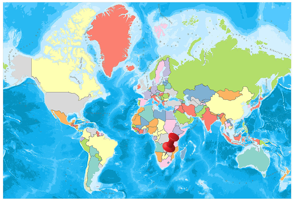
Botswana, located in the south of the African continent, is neighbor with South Africa in the south and southeast, Namibia in the north and west, and Zambia and Zimbabwe in the northeast.
Its largest city is Gaborone, which is also the capital. Apart from that, Francistown and Molepolole are the two other important and big cities. Although the official language of the country is both English and Setswana, the local people mostly use the Setswana language except for official issues.
Botswana, a landlocked country located in Southern Africa, does not have states.
Rather, it is divided into nine districts and five town councils.
The districts and town councils of Botswana are:
Districts:
- Central District
- Ghanzi District
- Kgalagadi District
- Kgatleng District
- Kweneng District
- North-East District
- North-West District
- South-East District
- Southern District
Town Councils:
- Francistown
- Gaborone
- Jwaneng
- Lobatse
- Selebi-Phikwe
Geography
The whole country is highland. The western sides of Botswana, which is a very steep plateau, have an average height of 55 m and an average height of 1000 m.
The famous Kalahari Desert covers the western part of the country. The eastern part of the Kalahari Desert, which is dry in the middle, is covered with bushes. Important rivers of Botswana are the Okavango and Chobe rivers.
These rivers come here after they were born in Angola. When the Okavango River forms a swamp of 16,835 km2, it flows into Ngami, one of the most important lakes in the country near the swamp. Makarikari, another important lake, is in the east.
Governance
Botswana, affiliated to the Commonwealth of Nations, is governed by a parliamentary regime based on the presidential system. The president is elected by the 35-member assembly. 31 members of the Assembly elected for a period of 5 years, while the remaining four members were appointed by the president.
Climate
In Botswana, the arid and semi-desert climate prevails. For this reason, temperatures are 35 degrees during the year, while in winter it is 20 degrees. However, there are great temperature differences between day and night in winter; sometimes the difference is 20 degrees. The nine months of the year are dry and the rainfall is seen between December and March.
Religion
The proportion of people who believe in local religions in Botswana is about half of the population. While 49.2 percent of the people believe in local religions, 29 percent live in the Protestant sect of the Christian religion and 9 percent in their religious beliefs according to the Catholic sect.
Industry and Tourism
The country’s economy is mostly based on animal husbandry as there are no suitable areas for agriculture in Botswana. Mining has started to be effective in the country’s economy with the introduction of rich underground resources. Diamonds account for 70 percent of the country’s exports. In addition, minerals such as copper, nickel, salt, silver, and coal are extracted.
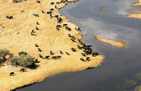
Another source of income is tourism. Major national parks such as Chobe National Park, Gemsbok National Park or Makgadikgadi Pans National Park in Botswana are among the top reasons tourists visit this country.
Pula, the country’s currency, has a solid structure against the Dollar and the Euro. The economy of Botswana, which grew by 9 percent annually in recent years, has made it a middle-level country, one of the poorest countries.
Art
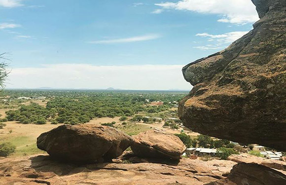
Tsodilo Hills in Botswana is a rock art site dating back thousands of years in the Okavango Delta. Each consists of four quartzite hills located in rock art created by the ancestors of the San and Hambukushu tribes who lived in the land for millenia.
The site is listed in the UNESCO World Heritage List in 2001 and is not the most popular place in the country, but Tsodilo Hills has attracted the attention of visitors who are curious about the ancient rock paintings and mysticism. Tsodilo is home to the richest rock art paintings in the world. There are an estimated 4500 pictures in the desert that gave the nickname the Louvre.
Sports
Botswana National Football Team is a team that is managed by the Botswana Football Association and represents the country of Botswana. He has not yet been successful in participating in the World Cup and Africa Cup of Nations. It is currently competing in the preliminary qualifiers to advance in the continental tournament.
- Population: 2,358,520
- Population Density: 4 per Km2
- Land Area: 566,730 Km2
Botswana Outline Map
Botswana Black and White Map
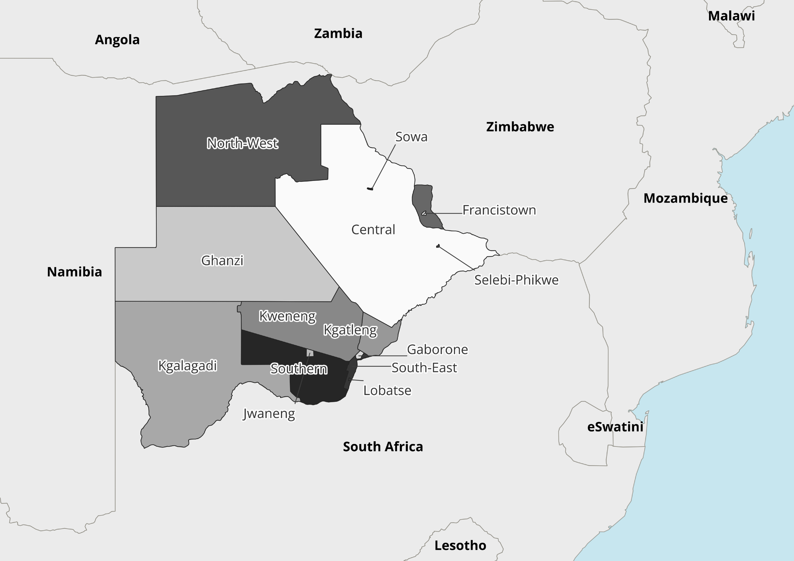
Image Sources and Copyright Information
- image-1279: © Mappr
- Botswana political map with cities: © Mappr
- Bostswana outline map: © Mappr
- Bostwana political map black and white: © Mappr