The Caribbean Islands are famous for white-sand beaches, diverse populations, beautiful landscapes, incredible wildlife, and a relaxed atmosphere, among other things.
Hundreds of islands are in the Caribbean region, and in this post we’ll explore a Caribbean Islands Map in addition to specific information about each of the region’s territories in detail.
Caribbean Islands Map

Antilles and the Lucayan Archipelago

Greater Antilles and the Lesser Antilles Maps


Map of the Greater Antilles and the Bahamas

Here is a list of all the countries and territories with capitals in the Caribbean Sea:
| Country or Territory | Sovereignty | Capital |
|---|---|---|
| Federal Dependencies of Venezuela | Venezuela | None |
| Nueva Esparta | Venezuela | La Asunción |
| Navassa Island | United States / Haiti | None |
| Puerto Rico | United States | San Juan |
| United States Virgin Islands | United States | Charlotte Amalie |
| Anguilla | United Kingdom | The Valley |
| British Virgin Islands | United Kingdom | Road Town |
| Cayman Islands | United Kingdom | George Town |
| Montserrat | United Kingdom | Plymouth (de jure), Brades (de facto) |
| Turks and Caicos Islands | United Kingdom | Cockburn Town |
| Aruba | Kingdom of the Netherlands | Oranjestad |
| Bonaire | Kingdom of the Netherlands | Kralendijk |
| Curaçao | Kingdom of the Netherlands | Willemstad |
| Saba | Kingdom of the Netherlands | The Bottom |
| Sint Eustatius | Kingdom of the Netherlands | Oranjestad |
| Sint Maarten | Kingdom of the Netherlands | Philipsburg |
| Antigua and Barbuda | Independent | Saint John’s |
| The Bahamas | Independent | Nassau |
| Barbados | Independent | Bridgetown |
| Cuba | Independent | Havana |
| Dominica | Independent | Roseau |
| Dominican Republic | Independent | Santo Domingo |
| Grenada | Independent | St. George’s |
| Haiti | Independent | Port-au-Prince |
| Jamaica | Independent | Kingston |
| Saint Kitts and Nevis | Independent | Basseterre |
| Saint Lucia | Independent | Castries |
| Saint Vincent and the Grenadines | Independent | Kingstown |
| Trinidad and Tobago | Independent | Port of Spain |
| Guadeloupe | France | Basse-Terre |
| Martinique | France | Fort-de-France |
| Saint Barthélemy | France | Gustavia |
| Saint Martin | France | Marigot |
| San Andrés and Providencia | Colombia | San Andrés |
Federal Dependencies of Venezuela

Sovereignty: Venezuela
Capital: N/A
Population: Approximately 2,300
The Federal Dependencies of Venezuela is a group of islands and archipelagos off the coast of Venezuela. There are 12 islands or archipelagos that fall into this category, and only three of them have a regular population. In total, the population on these islands is less than 3,000, most of whom live in the Los Roques archipelago on the island of Gran Roque.
These dependencies are technically controlled by Venezuela, which means that local governments are officially under the authority of the country’s central government in Caracas.
The Los Roques Archipelago National Park was established in 1972 to protect the valuable biodiversity in the area as well as the natural beauty of clear waters and white sands.
Nueva Esparta

Sovereignty: Venezuela
Capital: La Asunción
Population: 491,610 in the 2011 Census
Nueva Esparta is an insular Venezuelan state in the Caribbean made up of three islands: Margarita Island, Coche, and Cubagua. It’s the smallest of Venezuela’s 23 states, and Margarita Island is the largest of the three.
As the largest and most populous island, Margarita is the center of economic activity in the state. Trade, fishing, and tourism are industries that are active on the island, and the state produces some crops such as eggplant, corn, and melons.
Porlamar is the largest town in Nueva Esparta, and the capital is La Asunción, which is known for its architecture.
Navassa Island

Sovereignty: United States / Haiti
Capital: N/A
Population: 0
Navassa Island is an uninhabited island in the Caribbean that is claimed by both Haiti and the United States. The United States Fish and Wildlife Service currently administers the island, which has been used for various purposes throughout the last century such as an observation post during World War II, building a lighthouse, and scientific studies.
The island is roughly 5.4 km2 (2.1 mi2) in area and is surrounded by a rocky coastline with white cliffs. Animals on the island include at least four species of endemic reptiles, red-footed boobies, and feral dogs, cats, and pigs.
Puerto Rico

Sovereignty: United States
Capital: San Juan
Population: 3,263,584
Located about 1,600 km (1,000 mi) south of Miami, Florida, Puerto Rico is a Caribbean Island that’s classified as an unincorporated territory of the United States. It was inhabited for thousands of years by indigenous peoples before becoming a Spanish colony and then ultimately acquired by the United States in 1898.
Puerto Ricans have been US citizens since 1917, but they are unable to vote in presidential elections; the political status of the island has been a contentious issue for many years.
The largest sectors in country’s economy are manufacturing and financial services, though tourism also makes up about 10% of its GDP, as there are many reasons to visit Puerto Rico.
United States Virgin Islands

Sovereignty: United States
Capital: Charlotte Amalie
Population: 87,146
Like Puerto Rico, the US Virgin Islands make up an unincorporated territory of the United States. There are roughly 90 small islands, and land masses that make up the US Virgin Islands, but the three main islands are Saint Croix, Saint John, and Saint Thomas.
Tourism is one of the biggest supporters of the local economy, as the islands are popular locations for cruise ships. Around 2.5 million tourists visit the islands each year. Hiking, diving, snorkeling, and exploring beautiful beaches are some of the most popular activities here.
The closest Caribbean islands are Puerto Rico and the British Virgin Islands.
Anguilla

Sovereignty: United Kingdom
Capital: The Valley
Population: 15,753
The island of Anguilla is located to the east of the Virgin Islands and north of Saint Martin. It is a popular tourist location for its pristine beaches and peaceful atmosphere, and it is a British territory. Interestingly, Anguilla gained independence from Britain in 1967 but elected to regain its status as a British territory after its people were unhappy with the control Saint Kitts had over the island.
Anguilla is mostly flat, has a low elevation, and is made of coral and limestone. The main island is notable for its important coral reefs and beaches, and there are a number of smaller islands and cays that are a part of the territory.
British Virgin Islands

Sovereignty: United Kingdom
Capital: Road Town
Population: 30,030
Part of the larger Virgin Islands Archipelago, the British Virgin Islands are located just east of the US Virgin Islands. They are made up of about 60 small islands, 16 of which are inhabited. Tortola is the largest island of the group and is the home of the capital, Road Town.
The two most important industries in the territory’s economy are tourism and financial services. The tourism industry employs far more people on the islands, but the financial industry generates much more wealth overall as an offshore financial center.
Cayman Islands

Sovereignty: United Kingdom
Capital: George Town
Population: 78,554
The Cayman Islands are the largest British Overseas Territory by population in the Caribbean Sea. There are three islands that make up the Caymans, of which Grand Cayman is the largest, most populous, and home of the capital, George Town.
Some things the Cayman Islands are known for are its diverse population, its role as a major offshore financial center, and having the highest standard of living in the Caribbean. There are immigrants from over 130 countries in the Caymans, and its GDP per capita of $91,392 is the highest in the Caribbean.
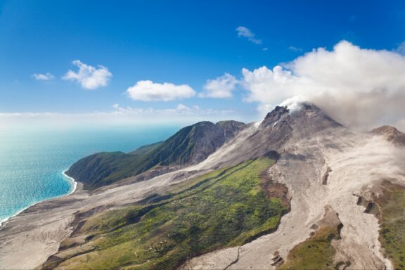
Montserrat
Sovereignty: United Kingdom
Capital: Plymouth, Brades
Population: 4,649
Another British Overseas Territory, Montserrat located in the Leeward Islands between St Kitts and Nevis, Antigua and Barbuda, and Guadeloupe. Many of the inhabitants of the island have Irish ancestry, and this paired with its coastline that resembles that of Ireland has given it the nickname, “The Emerald Isle of the Caribbean.”
The geography of Montserrat is volcanic, and an eruption in 1995 covered the capital of Plymouth in ash and rendered the area uninhabitable. While Plymouth remains the capital by law, the current de-facto capital is Brades. A new capital is being constructed at Little Bay.
Turks and Caicos Islands

Sovereignty: United Kingdom
Capital: Cockburn Town
Population: 44,542
Turks and Caicos Islands are two groups of islands located in the Lucayan Archipelago that are a British Overseas Territory. As is the case with several Caribbean territories, Turks and Caicos is known for its tourism industry as well as for being a major offshore financial center. It is the third-most populous of the British Overseas Territories.
These islands are on the UK’s tentative list for UNESCO World Heritage Sites due to the significant biodiversity and endemic species that live here.
Aruba

Sovereignty: Kingdom of the Netherlands
Capital: Oranjestad
Population: 107,819
Known for its white-sand beaches, Aruba is a popular tourist destination in the Caribbean Sea just off the coast of Venezuela. It is a constituent country of the Kingdom of the Netherlands and is located next to Curaçao and Bonaire, which also have ties to the Netherlands. Together, these islands are referred to as the ABC islands.
Luxury hotels, upscale shopping malls, and other hospitality facilities are common on Aruba, and cruise ships commonly stop at the island. The official languages are Papiamento and Dutch, though the former is more commonly spoken on the island.
Bonaire

Sovereignty: Kingdom of the Netherlands
Capital: Kralendijk
Population: 20,104
The Dutch island of Bonaire is located just off the Venezuelan coast in the Caribbean Sea next to Curaçao. Until 2010, Bonaire was part of the Netherlands Antilles, a constituent country of the Kingdom of the Netherlands made up of several other islands in the Dutch Caribbean. Since the dissolution of the country, Bonaire is a special municipality of the Netherlands.

Bonaire is an ideal location for tourism activities such as scuba diving and snorkeling because of its easy-to-access and well preserved coral reefs. Its reputation as a world-class dive site makes tourism a central part of the island’s economy. With a population of just over 20,000, around 80% of Bonaire’s inhabitants have Dutch ancestry.
Curaçao

Sovereignty: Kingdom of the Netherlands
Capital: Willemstad
Population: 155,000
The country of Curaçao is the third in the list of the Dutch-affiliated ABC islands in the Caribbean. It has been a constituent country of the Kingdom of the Netherlands since it attained country status in 2010, previously making up part of the Netherlands Antilles.
Originally settled by the Arawak people from South America, Europeans arrived on the island in 1499. The Spanish deported almost the entire Arawak population to its colony of Hispaniola as slaves to perform forced labor.
Curaçao is a narrow, generally hilly island, and the much smaller, uninhabited Klein Curaçao island is located to its southeast. Tourism, international trade, shipping services, and oil refining are some of its most important economic sectors.
Saba

Sovereignty: Kingdom of the Netherlands
Capital: The Bottom
Population: 1,911
The island of Saba in the Caribbean is the smallest special municipality of the Netherlands. It’s located southeast of the Virgin Islands and makes up the BES islands together with Bonaire and Sint Eustatius. At just 13 square kilometers (5 mi2) and with a population of less than 2,000, this is the territory with the smallest permanent population in the Americas.
Geologically, Saba is interesting because the bulk of the island is made up of the active Mount Scenery Volcano, whose last eruption was sometime before the 1630s. The oldest rocks on Saba are around 400,000 years old. There is also a cloud forest located at the top of the mountain that is referred to as the “Elfin Forest Reserve” for its appearance and high altitude.
Sint Eustatius

Sovereignty: Kingdom of the Netherlands
Capital: Oranjestad
Population: 3,138
Sint Eustatius is another special municipality of the Netherlands in the Caribbean and is known locally as Statia. The nearest island to Sint Eustatius is Saint Kitts, which lies about 8km to the southeast. Together with Bonaire and Saba, Sint Eustatius makes up one of the BES islands.
Geographically, Sint Eustatius is made up of two extinct volcanos and the flat, central plain that separates them. The majority of the island’s population lives on this flat plain, and it is where the capital of Oranjestad is located.
Sint Eustatius was the first foreign government to officially recognize the United States in November of 1776. A canon was fired as a salute welcoming a US ship.
Sint Maarten

Sovereignty: Kingdom of the Netherlands
Capital: Philipsburg
Population: 41,486
Sint Maarten is a constituent country of the Kingdom of the Netherlands in the Caribbean Sea, near the island of Anguilla. Sint Maarten is comprised of the southern third of Saint Martin island, the northern two-thirds of which belong to the overseas collectivity of France, also called Saint Martin. It is the world’s smallest island that is divided between two countries.
Economically, tourism is the most important industry in Sint Maarten. It employs about 80% of the country’s population and accommodates both long-stay tourists and those stopping over from cruise ships. Most of the country’s food is imported, though there is a small amount of agriculture happening in Sint Maarten.
Antigua and Barbuda

Sovereignty: Independent
Capital: St. John’s
Population: 100,772
Antigua and Barbuda is a sovereign country located where the Caribbean Sea and the Atlantic Ocean meet, in the West Indies. The country is made up of the islands of Antigua, Barbuda, and several smaller islands. 97% of its population lives on the island of Antigua, which is also where the capital city is located.
Before gaining full independence in 1981, Antigua and Barbuda was a colony of Britain and then an associate state. Before the arrival of Europeans, the islands were inhabited by Amerindians since around 3100 BCE, and subsequently the Saladoid people. Most of the native population was either sent away for slavery or succumbed to European or African diseases or malnutrition before Spanish colonization.
The Bahamas

Sovereignty: Independent
Capital: Nassau
Population: 400,516
The Bahamas is an independent country in the Lucayan Archipelago in the Caribbean, which it shares with Turks and Caicos. There are more than 3,000 islands, cays, and islets that make up the Bahamas, which accounts for 97% of the land area in the Lucayan Archipelago.

The Lucayans were the native inhabitants of what is now the Bahamas, and they were enslaved and sent to the island of Hispaniola by Spanish colonists around the 16th century. The Bahamas then became a British colony in 1718 and remained so until its independence in 1973.
Economically, The Bahamas has one of the highest GDPs per capita in the Americas. Its economy is based largely on tourism and offshore finance.
Barbados

Sovereignty: Independent
Capital: Bridgetown
Population: 287,000
Barbados is a small country in the West Indies and the farthest east of the Caribbean Islands. Although its location means it is technically an Atlantic Island, Barbados is closely linked to the Caribbean. It’s been an independent nation since 1966 after being an English and British colony since 1627.
The capital of Barbados is Bridgetown, which is a port for cruise ships and is known for its colonial architecture. One of the most densely populated islands in the Caribbean, Bridgetown has the highest concentration of people. More than 90% of the population in Barbados has African or mixed African-European descent.
Cuba

Sovereignty: Independent
Capital: Havana
Population: 11,008,112
Located at the juncture of the Caribbean Sea, the Gulf of Mexico, and the Atlantic Ocean is the island country of Cuba. It consists of the island of Cuba, Isla de la Juventud, and other minor archipelagos. The main island of Cuba is the largest in the Caribbean, and the country is the second-most populous in the Caribbean after Haiti.
The territory of modern-day Cuba was settled by the Ciboney Taíno people who inhabited the land sometime in the 4th millennium BCE until Spanish colonization in the 15th century. Cuba was a territory of Spain before being occupied by the United States and then gaining independence in 1902.
Cuba is a multiethnic country that is considered to be part of Latin America; the official language is Spanish.
Dominica

Sovereignty: Independent
Capital: Roseau
Population: 72,412
Dominica is an island country in the Caribbean that has earned the nickname, “Nature Island of the Caribbean” for its impressive flora, fauna, and landscapes. The island is located in the Lesser Antilles archipelago, and its two closest neighboring islands are Guadeloupe and Martinique.
The island is mountainous and features tropical rainforests and natural hot springs, the largest of which is named Boiling Lake and is the second-largest hot spring in the world. There are a number of rare plants and animals that call Dominica home, one of which is the Sisserou Parrot which is only found on the island.
Dominican Republic

Sovereignty: Independent
Capital: Santo Domingo
Population: 10,694,700
The Dominican Republic is a Caribbean country that occupies the eastern portion of the island of Hispaniola. The western section of the island is occupied by Haiti. Along with Saint Martin, Hispaniola is one of only two islands in the Caribbean that is shared by two sovereign nations.
The highest mountain in the Caribbean, Pico Duarte, is located in the Dominican Republic, as are rainforests, savannahs, and highlands. Also known for long stretches of white-sand beaches and resorts, the Dominican Republic is visited by more tourists than any other country in the Caribbean. The capital is Santo Domingo, which is the most populated metropolitan area in the Caribbean.
Grenada

Sovereignty: Independent
Capital: St. George’s
Population: 124,610
Grenada is a Caribbean country consisting of an island chain at the southern end of the Grenadine Islands. The country’s main island is named Grenada, and the two main smaller islands are named Carriacou and Petite Martinique. There are also a number of additional smaller islands that are part of the country.
There are a number of nutmeg plantations on the main island of Grenada, and this has lent the name “Spice Isle” to the country. The capital of Grenada is St. George’s, which is known for its colorful houses, Fort George built in the 18th century, and its harbor, making it a popular tourist destination.
Haiti

Sovereignty: Independent
Capital: Port-au-Prince
Population: 11,334,637
Haiti is a country located on the eastern third of the island Hispaniola, sharing the island with the Dominican Republic. It is the most populous country in the Caribbean with a population of over 11.3 million, and it is the third-largest country in the Caribbean by size.
The island of Hispaniola and Haiti were colonized by the Spanish and then the French, and Haiti became the only nation to have a successful slave revolt after years of conflict against France between 1791 and 1804. Haiti was occupied by the United States from 1915 to 1934 during a period of economic turmoil and international activity.
Today, Haiti is in the middle of an ongoing socioeconomic and political crisis fueled by a massive earthquake, coup d’état, and presidential assassination all within the last 20 years.
Saint Kitts and Nevis

Sovereignty: Independent
Capital: Basseterre
Population: 47,606
Saint Kitts and Nevis are two Caribbean islands that make up the sovereign nation of the same name. The country is located in the Leeward Islands between the Caribbean Sea and the Atlantic Ocean, and it is the smallest sovereign state in the western hemisphere by both size and population.
Tourism is one of the biggest industries in Saint Kitts and Nevis along with agriculture and light manufacturing. Mountains, beaches, and hiking trails through rainforests are some of the natural tourist attractions. The capital is Basseterre, which is located on Saint Kitts and is the main port for entry and exit in the country.
Saint Lucia

Sovereignty: Independent
Capital: Castries
Population: 184,961
Located in the eastern Caribbean Sea on the boundary with the Atlantic Ocean, Saint Lucia is an island nation that has been independent of the United Kingdom since 1979. Originally inhabited by the Arawak and the Carib peoples, Europeans arrived in 1660. After this date, control of the island passed between France and Britain many times until the British took control in 1814.
Tropical weather, excellent beaches, and resorts attract many tourists to Saint Lucia, and tourism is one of the nation’s most important industries. Reef-diving is another popular activity, as are natural attractions like waterfalls. Many cruise ships stop at Castries, the capital of Saint Lucia.
Saint Vincent and the Grenadines

Sovereignty: Independent
Capital: Kingstown
Population: 104,332
Saint Vincent and the Grenadines is a Caribbean island country located in the Lesser Antilles between Saint Lucia and Grenada that is made up of 32 islands and cays. Saint Vincent is the main island of this nation and the home of its capital and main port, Kingstown.
Kingstown is a major entry point for tourists, and some of the smaller islands are popular sailing destinations. The tourism industry is still growing in Saint Vincent and the Grenadines, and the filming of The Pirates of the Caribbean has helped the location gain attention.
Trinidad and Tobago

Sovereignty: Independent
Capital: Port of Spain
Population: 1,405,646
Trinidad and Tobago is an island nation just off the coast of Venezuela in the Caribbean Sea. It is the southernmost country of the Caribbean islands and consists of its two main islands, Trinidad and Tobago, as well as many smaller islands. The largest ethnic groups in the country are of African and Indian descent, many of whom have retained cultural practices from their ancestral homeland.
Unlike many other Caribbean islands, the economy of Trinidad and Tobago is not primarily supported by tourism. The petroleum and petrochemical industries are the largest sectors in the country’s economy, as the nation has large reserves of oil and natural gas.
Guadeloupe

Sovereignty: France
Capital: Basse-Terre
Population: 384,239
Guadeloupe, an overseas department of France, is a group of islands in the Caribbean Sea near its border with the Atlantic Ocean. The capital city of this region is Basse-Terre, which is located on the island of the same name, but its most populous city is Les Abymes, which is located on the island of Grande-Terre.
The most important city for Guadeloupe economically is Pointe-à-Pitre, which is where the region’s biggest port is located as well as most commercial activity. Light industrial activity and agricultural production both happen here in addition to trade. The major exports of Guadeloupe are food crops, animal products, and manufactured goods like refined petroleum and textiles.
As a part of France, European Union citizens can freely travel to and work in Guadeloupe for an indefinite period of time.
Martinique

Sovereignty: France
Capital: Fort de France
Population: 364,508
Martinique is another overseas department of France located in the Caribbean. The region consists of one island that is about 1,128 km2 (436 mi2) in size and is located between Dominica and Saint Lucia. As a part of France, Martinique is both an Outermost Region and a special territory of the European Union. The official language is French, which the vast majority of the population speaks along with Martinican Creole.
The island is of volcanic origin and so is very mountainous. With fewer hills and easier to traverse, the southern portionfda popular beaches, some of which are home to many sea turtles.
Saint Barthélemy

Sovereignty: France
Capital: Gustavia
Population: 9,947
Saint Barthélemy is an overseas department of France located in the Caribbean just 30 kilometers south of Saint Martin. It was a part of Guadeloupe until recent history when the local population approved a referendum in 2003 to create a separate overseas collectivity.
The culture, language, and cuisine of the island are heavily influenced by France, as those in its population are French citizens. The great majority of the population is Christian, which makes Saint Barthélemy the most religiously homogenous territory in the Caribbean.
Tourism is a mainstay of the island’s economy, and it caters to high-end, luxury tourists. Picturesque white-sand beaches and designer shops are among the top attractions.
Saint Martin

Sovereignty: France
Capital: Marigot
Population: 32,489
Officially the Collectivity of Saint Martin, this overseas collectivity of France is located on the island of the same name along with Sint Maarten, a constituent country of the Kingdom of the Netherlands. The island is located near the island of Anguilla, separated by the Anguilla Channel.
The island was inhabited by Amerindian peoples as early as 2000 BCE and subsequently by the Carib people. The arrival of the Europeans brought disease to the island which significantly reduced the island’s indigenous population.
After years of Spanish control of the island, it was colonized by the French and Dutch who agreed to split the territory with the signing of the Treaty of Concordia, creating Dutch Sint Maarten and French Saint Martin.
San Andrés and Providencia

Sovereignty: Colombia
Capital: San Andrés City
Population: 61,280
San Andrés and Providencia is an archipelago consisting of two island groups and is a department of Colombia. San Andrés is the largest island in the archipelago and is located off the coast of Nicaragua in the Caribbean Sea. The smaller island of Providencia is located to the northeast of San Andrés, as is the even smaller Santa Catalina.
The islands are home to the Raizal Afro-Caribbean ethnic group, who made up the majority of the population before the 1960s. In more recent history, mainland Colombians and a minority of English-speaking whites of British descent have populated the island, reducing the Raizal population to 30% of the total in 2005.
Image Sources and Copyright Information
- Map of Caribbean Regions: © Peter Hermes Furian/Shutterstock
- Map of the Caribbean Islands: © Peter Hermes Furian/Shutterstock
- Map of Florida, Cuba, and the Caribbean Islands: © Peter Hermes Furian/Shutterstock
- Bonaire Island Map with Major Towns and Caribbean Sea Label: © Peter Hermes Furian/Shutterstock
- Map of The Bahamas Highlighting Nassau: © Peter Hermes Furian/Shutterstock