Cambodia is located in the Southeastern Asia region at latitude 12.565679 and longitude 104.990963 and is part of the Asian continent.
The DMS coordinates for the center of the country are:
- 12° 33' 56.44'' N
- 104° 59' 27.47'' E
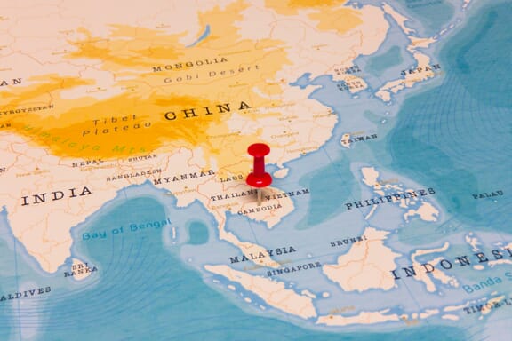
You can see the location of Cambodia on the world map below:
Cambodia Neighboring Countries
The neighboring countries of Cambodia (KH) are:
- Lao People's Democratic Republic (LA)
- Thailand (TH)
- Vietnam (VN)
Maritime Borders
Cambodia borders with the Gulf of Thailand.
Cambodia Related Content
Cambodia Key Facts
| Country | Cambodia |
| Coordinates | Latitude: 12.565679 Longitude: 104.990963 |
| Country Codes | Alpha 2: KH Alpha 3: KHM |
| Country Flag Emoji | 🇰🇭 |
| Int. Phone Prefix | +855 |
| Capital city | Phnom Penh |
| Continent Subcontinent | Asia Southeastern Asia |
| Country Area | 181,035 sq km |
| Population 2021 | 16,946,446 World Rank: 70 |
| Median Age | 26.5 |
| Life expectancy | 69.6 |
| Major languages | Khmer (official) 96.3%, other 3.7% (2008 est.) |
| UTC/GMT Time | Number of time zones: 1
|
| Internet TLD | .kh |
| Biggest Airport | Phnom Penh International Airport (PNH) |
| Average temperature | 26.80 °C 80.24 °F |
| Administrative Divisions | 1 autonomous municipality 24 provinces |
| Political system | Multiparty liberal democracy |
Cambodia Economy Facts
| World Bank Income Group | Lower middle income |
| World Bank Region | East Asia & Pacific |
| Currency | Riel (KHR) |
| GDP in 2020 | $25.9 (billions of USD) World Rank: 102 |
| GDP per capita in 2020 | $1,548 World Rank: 153 |
| Major Industries / Economic Sectors | Agriculture, manufacturing, tourism, construction |
| Top 5 Import Countries | China, Vietnam, Thailand, Singapore, Taiwan |
| Top 5 Export Countries | United States, European Union, China, Japan, Vietnam |
Biggest Cities in Cambodia
Here are the largest cities in Cambodia based on 2021 data:
| City | Population |
|---|
| Phnom Penh | 2,129,371 | Siem Reap | 147,866 | Battambang | 130,000 | Kampong Cham | 118,242 | Prey Veng | 74,000 | Kratie | 60,000 | Pursat | 52,476 | Takeo | 52,000 | Sisophon | 50,302 | Kampong Chhnang | 41,700 |