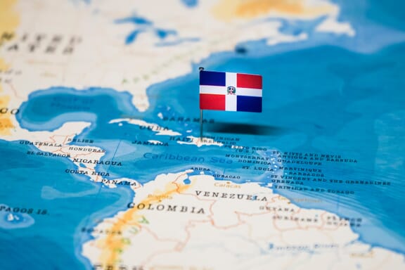
Dominican Republic is located in the Caribbean region at latitude 18.735693 and longitude -70.162651 and is part of the North American continent.
The DMS coordinates for the center of the country are:
- 18° 44' 8.49'' N
- 70° 9' 45.54'' W
You can see the location of Dominican Republic on the world map below:
Dominican Republic Neighboring Countries
The neighboring countries of Dominican Republic (DO) are:
- Haiti (HT)
The country has no neighboring countries/land borders.
Maritime Borders
Dominican Republic borders with the Caribbean Sea.
Dominican Republic (the) Related Content
Dominican Republic Key Facts
| Country | Dominican Republic (the) |
| Coordinates | Latitude: 18.735693 Longitude: -70.162651 |
| Country Codes | Alpha 2: DO Alpha 3: DOM |
| Country Flag Emoji | 🇩🇴 |
| Int. Phone Prefix | +1-809, 1-829, 1-849 |
| Capital city | Santo Domingo |
| Continent Subcontinent | North America Caribbean |
| Country Area | 48,670 sq km |
| Population 2021 | 10,953,714 World Rank: 84 |
| Median Age | 27.1 |
| Life expectancy | 72.6 |
| Major languages | Spanish |
| UTC/GMT Time | Number of time zones: 1
|
| Internet TLD | .do |
| Biggest Airport | Punta Cana International Airport (Punta Cana) |
| Average temperature | 27.00 °C 80.60 °F |
| Administrative Divisions | 10 regions 1 district 31 provinces |
| Political system | Presidential representative democratic republic |
Dominican Republic Economy Facts
| World Bank Income Group | Upper middle income |
| World Bank Region | Latin America & Caribbean |
| Currency | Dominican Peso (DOP) |
| GDP in 2020 | $78.8 (billions of USD) World Rank: 67 |
| GDP per capita in 2020 | $7,268 World Rank: 80 |
| Major Industries / Economic Sectors | Manufacturing, tourism, agriculture, energy |
| Top 5 Import Countries | United States, China, Mexico, Colombia, Brazil |
| Top 5 Export Countries | United States, China, Canada, Colombia, Mexico |
Biggest Cities in Dominican Republic
Here are the largest cities in Dominican Republic based on 2021 data:
| City | Population |
|---|
| Santo Domingo | 2,581,827 | Santiago | 1,343,423 | Santo Domingo Este | 948,855 | Los Alcarrizos | 272,776 | Higuey | 251,243 | San Cristobal | 232,769 | La Vega | 220,279 | San Pedro de Macoris | 195,307 | San Francisco de Macoris | 188,118 | Moca | 172,294 |
Map of Dominican Republic with the Largest Cities
Other Countries in the Caribbean Region
Map of the Provinces of the Dominican Republic

Dominican Rep. Provinces (List & Population)
Here is a table of the provinces of the Dominican Republic and their approximate populations based on the latest available data:
| Province | Approx. Population |
|---|---|
| Azua | 221,900 |
| Baoruco | 101,800 |
| Barahona | 189,600 |
| Dajabón | 66,200 |
| Distrito Nacional | 1,016,000 |
| Duarte | 294,800 |
| Elías Piña | 63,600 |
| El Seibo | 92,200 |
| Espaillat | 237,000 |
| Hato Mayor | 87,100 |
| Hermanas Mirabal | 93,100 |
| Independencia | 53,200 |
| La Altagracia | 355,400 |
| La Romana | 274,100 |
| La Vega | 419,300 |
| María Trinidad Sánchez | 145,300 |
| Monseñor Nouel | 178,800 |
| Monte Cristi | 114,500 |
| Monte Plata | 192,300 |
| Pedernales | 34,100 |
| Peravia | 194,800 |
| Puerto Plata | 330,600 |
| Samaná | 114,300 |
| Sánchez Ramírez | 161,100 |
| San Cristóbal | 619,600 |
| San José de Ocoa | 60,400 |
| San Juan | 234,400 |
| San Pedro de Macorís | 210,000 |
| Santiago | 1,110,000 |
| Santiago Rodríguez | 59,600 |
| Santo Domingo | 3,934,000 |
| Valverde | 183,700 |
Image Sources and Copyright Information
- Dominican republic regions mappr map: © Mappr