French Guiana: Overview
- Population: 296,389 (March 2020) [1]
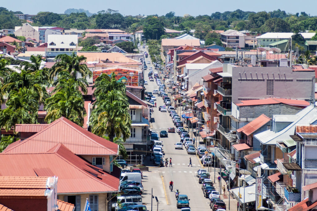
- Capital: Cayenne
- Language: French
- Bordering Countries: Suriname, Brazil
- Land Area: 32,253 square miles (83,534 square km)
- Coastline: 170 miles
- Highest Point: Bellevue de l’Inini at 851m
- Latitude & Longitude: 3.9339 Degrees North, 53.1258 Degrees West

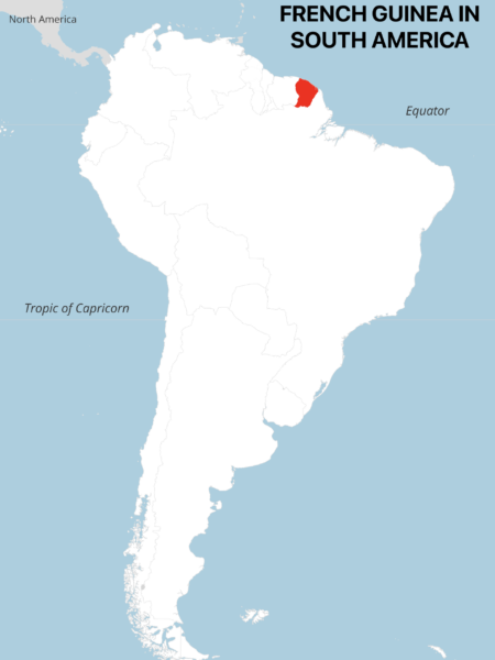
It’s worth noting that French Guiana’s border with Suriname is currently disputed, and has been for well over a century. The two nations agreed to a boundary delimitation in 2021 that accounts for two-thirds of their shared border, though they have not agreed on where their borders extend to Brazil.
Transport Systems
Transport in French Guiana is generally not well-developed. The transport network in place can accommodate tourism and locals, however. The main form of transport used by locals is the bus network – French Guiana has a reliable bus network that transports people between the major cities. There is also a host of minibuses that specialize in transportation between major regions of French Guiana. There has never been a railway in French Guiana.
Aside from buses, the other main form of transport is water taxis. There are an estimated 2000+ miles of waterways in French Guiana. Most of this water network can be navigated via small water crafts. You can also cross intro Brazil and Suriname across the Oyapock River (Brazil), and Maroni River (Suriname).
French Guiana operates three public airports – Cayenne, Camopi, and Saint-Laurent-du-Maroni. Cayenne Felix Eboue Airport is the main international airport and has limited flights to France and Brazil.
Famous Tourist Attractions
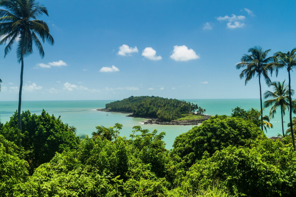
Despite its relatively small size (as seen on the Map of French Guiana) , French Guiana has an amazing range of tourist attractions and famous sites. Due to its location on the Atlantic Ocean and its coastline, French Guiana has some beautiful pristine beaches. Furthermore, the capital city of Cayenne is vibrant and great to explore. The following are some of the main tourist attractions in this French overseas territory [4]:
- Iles du Salut
- Hattes Beach
- Guiana Space Centre
- Tresor Nature Reserve
- Ilet la Mere
- Remire-Montjoly Beach
- Pirogue River
- City of Cayenne
- Zoo de Guyane
For tourists, there is an interesting mix of outdoor exploration, and fine-weather relaxation. Intrepid adventurers can venture into the Amazon and take guided river tours. Alternatively, sun-lovers can relax on the beaches and soak up the glorious weather.
Currency
As this overseas territory is part of the French Republic, it also uses the same currency – the Euro. Until 2002, the French Franc was the national currency. French Guiana actually had its own printed Franc notes. When France adopted the Euro, French Guiana did too – it is considered part of the European union, despite being in South America.
The Banque de France controls circulation of the Euro within France and its overseas territories. Furthermore, the Banque de France controls inflation. As many goods and foods are imported, the cost of items compared to mainland France is more expensive in French Guiana.
Political System & Economy
French Guiana is an overseas region of France – it therefore complies to the same government institutes as mainland France. The President of France has governance over French Guiana, however, they elect a prefect who oversees the local government of the region. This prefect has residence in the prefecture building in the capital of Cayenne.
French Guiana also has two representatives in the French senate. The local government and administration of French Guiana is formed of two main bodies – the general council (19 members), and the regional council (34 members). These bodies make the Assembly of French Guiana and are responsible for administration within the region.
Administration is split into two main arrondissements – Saint-Laurent-du-Maroni, and Cayenne. These two divisions are further split into 22 communes.
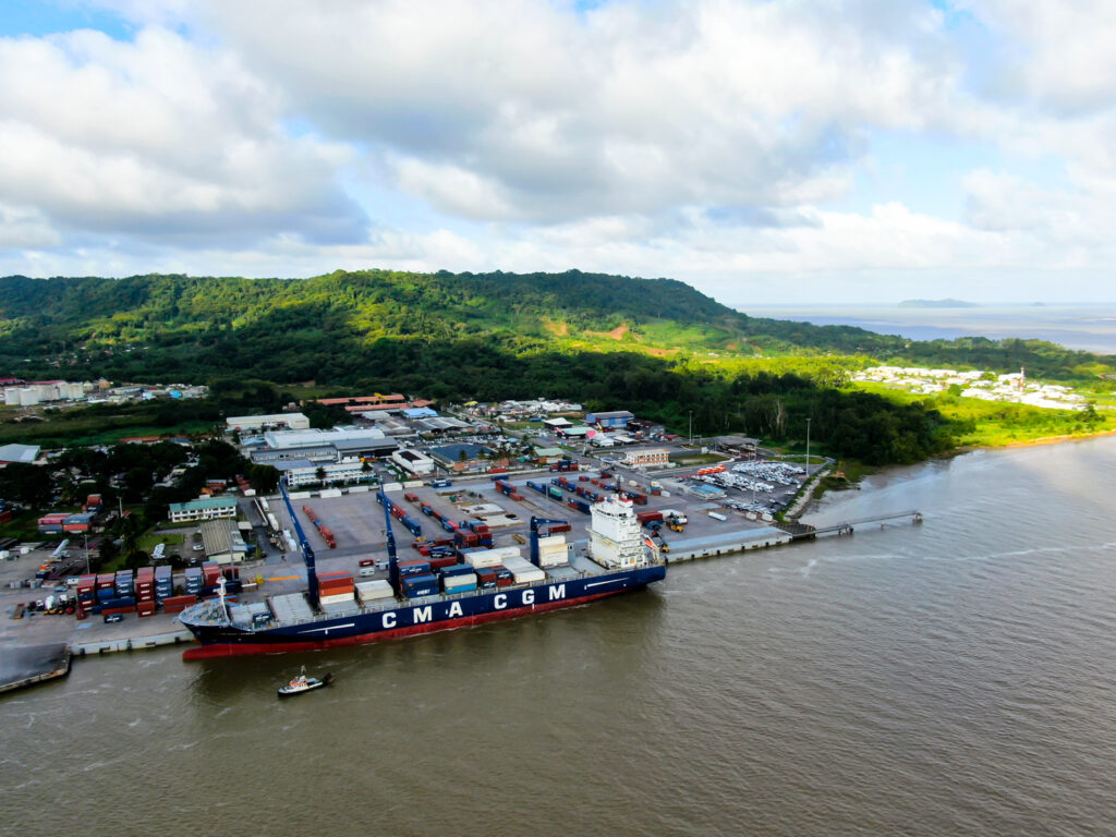
The economy of French Guiana is developing and relies heavily on subsidies from mainland France. There are high levels of unemployment – currently hovering around 20%. Furthermore, a large portion of the population are living in poverty. The economy relies on:
- French Space Centre at Kourou
- Fishing
- Forestry
- Tourism
- Agriculture
French Guiana has a large forestry industry and great reserves of hardwoods that it does not fully utilize. Furthermore, production of rice, sugar, cocoa, and bananas in the coastal areas is also a great source of employment.
Geography
French Guiana is split into two main regions – the coastal area facing the North Atlantic Ocean, and the southern wilderness which is predominantly Amazon Rainforest [6].
The citizens of French Guiana mainly live in the coastal regions – only a few small villages and tribes live in the rainforest area. This overseas region has a plethora of rivers and waterways – in fact, it’s natural land borders with Brazil and Suriname are formed by two rivers.
The coastline features beautiful beaches and a handful of small islands like the Iilet le Mare as seen on the French Guiana map.
Sources
- https://www.worldometers.info/world-population/french-guiana-population/
- http://whc.unesco.org/en/statesparties/GY
- https://www.planetware.com/tourist-attractions/french-guiana-fgu.htm
- https://www.iexplore.com/articles/travel-guides/central-and-south-america/french-guiana/transportation
- https://borgenproject.org/poverty-in-french-guiana/
- https://www.worldatlas.com/webimage/countrys/samerica/frenchguiana/gfland.htm
French Guiana FAQs
Is French Guiana rich or poor?
French Guiana is the second-poorest of France’s overseas territories [5]. There is high levels of unemployment in younger generations – the overall unemployment rate is indeed 20%. A large percentage of households are also below the poverty line.
Where is French Guiana located?
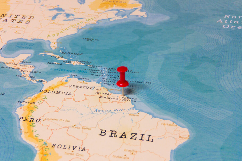
French Guiana is an overseas territory located in South America. It has borders with Suriname and Brazil and lies on the northeastern coast, facing the North Atlantic Ocean. It also lies in close proximity to the equator.
Is French Guiana safe to visit?
Generally yes – crime levels are low, but serious crimes do occur. To improve safety, it is advisable to avoid isolated areas during nighttime. Furthermore, avoid showing wealth and carrying large amounts of cash.
Is French Guiana Schengen?
The Schengen Area is a group of countries in Europe that have abolished passport control between borders. Although France is part of the Schengen area, French Guiana is not. In fact, none of France’s overseas territories are part of the Schnegen agreement.
Is French Guiana a country?
No, French Guiana is not a country. It is an overseas department of the French Republic. As part of France, it is the only territory in South America that is fully integrated into a European country.