Italy is located in the Southern Europe region at latitude 41.87194 and longitude 12.56738 and is part of the European continent.
The DMS coordinates for the center of the country are:
- 41° 52' 18.98'' N
- 12° 34' 2.57'' E
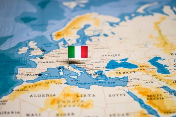
You can see the location of Italy on the world map below:
Italy Neighboring Countries
The neighboring countries of Italy (IT) are:
- Austria (AT)
- France (FR)
- San Marino (SM)
- Slovenia (SI)
- Switzerland (CH)
- Holy See (VA)
Maritime Borders
Italy borders with Mediterranean Sea, the Tyrrhenian Sea, the Adriatic Sea, and the Ionian Sea.
Italy Related Content
Italy Key Facts
| Country | Italy |
| Coordinates | Latitude: 41.87194 Longitude: 12.56738 |
| Country Codes | Alpha 2: IT Alpha 3: ITA |
| Country Flag Emoji | 🇮🇹 |
| Int. Phone Prefix | +39 |
| Capital city | Rome |
| Continent Subcontinent | Europe Southern Europe |
| Country Area | 301,340 sq km |
| Population 2021 | 59,066,225 World Rank: 25 |
| Median Age | 46.8 |
| Life expectancy | 82.9 |
| Major languages | Italian (official), German (parts of Trentino-Alto Adige region are predominantly German speaking), French (small French-speaking minority in Valle d'Aosta region), Slovene (Slovene-speaking minority in the Trieste-Gorizia area) |
| UTC/GMT Time | Number of time zones: 1
|
| Internet TLD | .it |
| Biggest Airport | Rome Leonardo da Vinci-Fiumicino (FCO) |
| Average temperature | 13.45 °C 56.21 °F |
| Administrative Divisions | 15 regions 5 autonomous regions 80 provinces 2 autonomous provinces 6 free municipal consortiums 14 metropolitan cities 4 decentralized regional entities |
| Political system | Parliamentary republic |
Italy Economy Facts
| World Bank Income Group | High income |
| World Bank Region | Europe & Central Asia |
| Currency | Euro (EUR) |
| GDP in 2020 | $1892.6 (billions of USD) World Rank: 8 |
| GDP per capita in 2020 | $31,835 World Rank: 28 |
| Major Industries / Economic Sectors | Manufacturing, services, agriculture, energy |
| Top 5 Import Countries | Germany, China, France, Netherlands, United States |
| Top 5 Export Countries | Germany, France, United States, Spain, United Kingdom |
Biggest Cities in Italy
Here are the largest cities in Italy based on 2021 data:
| City | Population |
|---|
| Rome | 2,872,800 | Milan | 1,366,180 | Naples | 966,144 | Turin | 870,952 | Palermo | 668,405 | Genoa | 580,097 | Bologna | 389,261 | Florence | 380,948 | Bari | 323,370 | Catania | 311,584 |
Map of Italy with the Largest Cities
Other Countries in the Southern Europe Region
- Where is Albania?
- Where is Andorra?
- Where is Bosnia and Herzegovina?
- Where is Croatia?
- Where is Cyprus? Maps and Facts
- Where is Greece?
- Where is Kosovo?
- Where is Malta?
- Where is Montenegro?
- Where is North Macedonia?
- Where is Portugal?
- Where is San Marino?
- Where is Serbia?
- Where is Slovenia?
- Where is Spain?