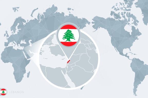
Lebanon is located in the Middle East region at latitude 33.854721 and longitude 35.862285 and is part of the Asian continent.
The DMS coordinates for the center of the country are:
- 33° 51' 17.00'' N
- 35° 51' 44.23'' E
You can see the location of Lebanon on the world map below:
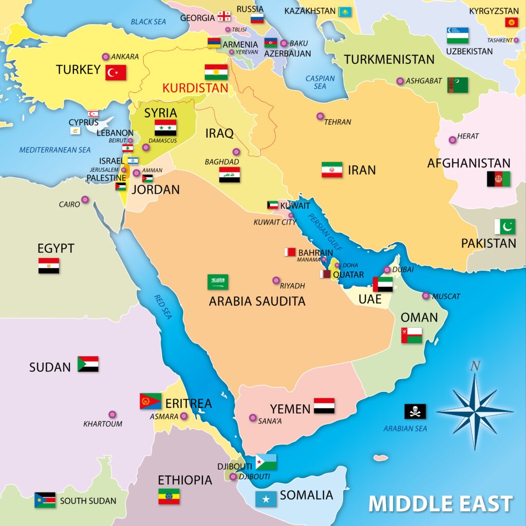
Lebanon Neighboring Countries
The neighboring countries of Lebanon (LB) are:
- Israel (IL)
- Syrian Arab Republic (SY)
Maritime Borders
Lebanon borders with the Mediterranean Sea.
Lebanon Key Facts
| Country | Lebanon |
| Coordinates | Latitude: 33.854721 Longitude: 35.862285 |
| Country Codes | Alpha 2: LB Alpha 3: LBN |
| Country Flag Emoji | 🇱🇧 |
| Int. Phone Prefix | +961 |
| Capital city | Beirut |
| Continent Subcontinent | Asia Middle East |
| Country Area | 10400 sq km |
| Population 2021 | 6,769,151 World Rank: 107 |
| Median Age | 28.3 |
| Life expectancy | 75 |
| Major languages | Arabic (official), French, English, Armenian |
| UTC/GMT Time | Number of time zones: 1
|
| Internet TLD | .lb |
| Biggest Airport | Beirut Rafic Hariri International Airport (BEY) |
| Average temperature | 15.00 °C 59.00 °F |
| Administrative Divisions | 8 governorates |
| Political system | Parliamentary democracy |
Lebanon Economy Facts
| World Bank Income Group | Lower middle income |
| World Bank Region | Middle East & North Africa |
| Currency | Lebanese Pound (LBP) |
| GDP in 2020 | $25.9 (billions of USD) World Rank: 101 |
| GDP per capita in 2020 | $3,802 World Rank: 118 |
| Major Industries / Economic Sectors | Manufacturing, services, agriculture, energy |
| Top 5 Import Countries | China, United States, Italy, France, Germany |
| Top 5 Export Countries | Saudi Arabia, United Arab Emirates, China, Italy, France |
Biggest Cities in Lebanon
Here are the largest cities in Lebanon based on 2021 data:
| City | Population |
|---|
| Tripoli | 530,000 | Beirut | 361,366 | Sidon | 200,000 | Tyre | 160,000 | Jounie | 102,221 | Zahle | 100,000 | Nabatiye | 80,000 | Baalbek | 24,000 | El Qaa | 12,000 | Amioun | 10,000 |
Map of Lebanon with the Largest Cities
Other Countries in the Middle East Region
Geography
Lebanon is a West Asian country that lies on the eastern end of the Mediterranean Sea. It is bordered by Syria to the north and east, and Israel is to the south. The island nation of Cyprus is approximately 260 km to the west over the Mediterranean Sea.
It is home to some of the oldest continually inhabited cities in the world and has been referred to as the Switzerland or Paris of the Middle East.
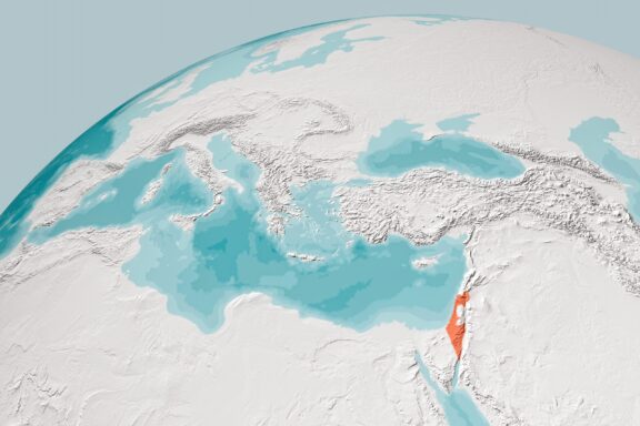
Lebanon is part of the Middle East and the Mediterranean Countries.
Other than the Mediterranean Sea, Lebanon only shares its borders with two countries: Syria and Israel. Both of these countries are more populous than Lebanon, and each are larger in total land mass.
The current events and recent histories of Lebanon’s neighbors make for a tumultuous location in the world: the ongoing Syrian war to the north and the Israeli-Palestine conflict to the south both contribute to the region’s instability.
During times of political unrest or economic struggles, many Lebanese people have sought better quality of life in nearby Cyprus in the Mediterranean Sea.
Lebanon’s location also gives it unique access to both the Mediterranean and Middle East regions, which creates opportunities for trade as well as contributes to the country’s unique culture and cuisine.
The mix of eastern and western influence has made Lebanese food one of the most popular middle eastern foods worldwide. Its location has also made the territory important for several ruling powers over the course of history.
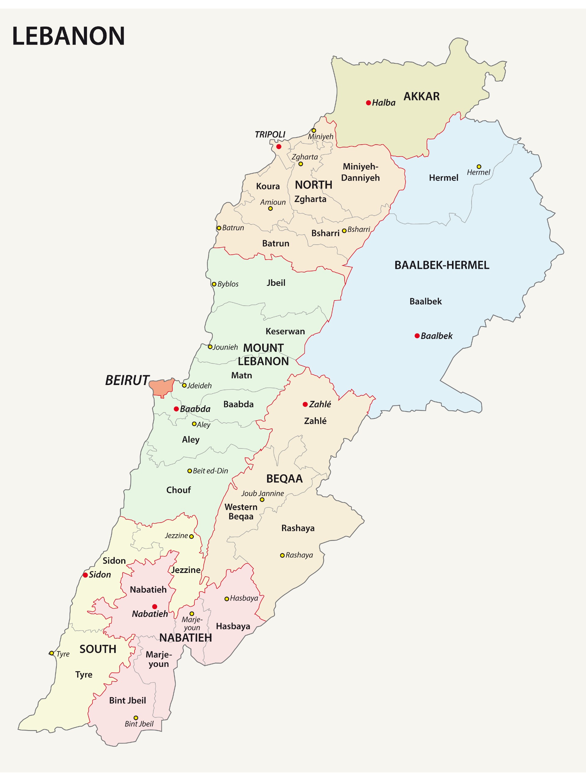
Governorates of Lebanon

The governorates of Lebanon are administrative regions of the country that are further broken down into districts and municipalities. The only two governorates that are not made up of multiple districts are Beirut and Akkar.
By total area, Baalbek-Hermel is easily the largest governorate of Lebanon, but it has one of the smallest population numbers. Occupying the northeastern corner of the country, it is divided into two districts and 74 municipalities.
Related Article: Richest Arab Countries
The most populous governorate in Lebanon is Mount Lebanon, which is the third-largest in terms of landmass. It lies on the Mediterranean coast, surrounds Beirut, and its capital is Baabda.
| Governorate | Area in km2 | Population |
| Akkar | 776 | 423,596 |
| Baalbek-Hermel | 3,009 | 416,427 |
| Beirut | 18 | 433,249 |
| Beqaa | 1,271 | 534,342 |
| Keserwan-Jbeil | 722 | 282,222 |
| Mount Lebanon | 1,238 | 1,802,238 |
| Nabatieh | 1,058 | 383,839 |
| North | 1,205 | 790,951 |
| South | 943 | 590,087 |
Districts of Lebanon
There are 25 districts of Lebanon, and they are divided among the country’s nine governorates. The largest district in the country by total area is Baalbek, which extends for 2,319 km2 and is one of two districts in the Baalbek-Hermel Governorate.
The district with the largest population is decidedly Matn, which is home to approximately 750,000 people. Matn’s population is almost entirely Christian, although there are also some Lebanese Druze and Shias living in the district.
| District | Area in km2 | Population |
| Aakkar | 776 | 330,000 |
| Baalbek | 2,319 | 333,000 |
| Hermel | 731 | 48,000 |
| Rachaiya | 485 | 50,000 |
| West Beqaa | 425 | 56,000 |
| Zahle | 425 | 300,000 |
| Aaley | 263 | 136,320 |
| Baabda | 194 | 500,000 |
| Chouf | 495 | 166,140 |
| Jbeil (Byblos) | 430 | 100,000 |
| Keserwan | 336 | 182,834 |
| Matn | 265 | 750,000 |
| Bint Jbeil | 264 | 53,000 |
| Hasbaya | 265 | 19,000 |
| Marjeyoun | 265 | 41,000 |
| Nabatieh | 304 | 92,000 |
| Batroun | 268 | 51,120 |
| Bsharri | 156 | 32,000 |
| Koura | 173 | 68,160 |
| Minieh-Danniyeh | 409 | 96,000 |
| Tripoli | 24 | 31,980 |
| Zgharta | 182 | 91,000 |
| Jezzine | 241 | 31,575 |
| Saida (Sidon) | 275 | 207,500 |
| Tyr (Sour) | 418 | 178,920 |
Major Cities of Lebanon
Beirut
Beirut is the capital city of Lebanon and is one of the oldest cities on earth. It’s also the most populous city in Lebanon with approximately 2 million people, but there have been no official population statistics published since the last official census in 1932.
Beirut is located on a peninsula that extends into the Mediterranean Sea and is backed by the Lebanon Mountains.

As the most populous and capital city of Lebanon, Beirut is the most economically important city in the country. Banking, tourism, and trade are just some of the diverse industries that financially support the city and country.
Tripoli
This is Lebanon’s second largest city, and the largest city in the northern part of the country. Like Beirut, Tripoli extends into the Mediterranean Sea and is one of the oldest cities on the planet. It is also the northernmost seaport in the country.
To distinguish it from the capital city of Libya with the same name, it is sometimes referred to as “Levantine Tripoli.”
One unique feature of Tripoli is that there are several islands located just off its shores, such as the Palm Islands Nature Reserve, which has been declared a protected area by UNESCO and is home to turtles, rare birds, and rabbits.
Sidon
Lebanon’s third largest city, Sidon is located on the Mediterranean coast to the south of Beirut in the South Governorate. This was one of the most important cities to the Phoenicians, and the name likely comes from the Phoenician word for “fishing town.”
Today, the majority of its inhabitants belong to the Sunni sect of Islam, and the city maintains a fairly conservative atmosphere. It’s also famous for its fresh fruits and sweet foods.
Tyre
The city of Tyre is the fourth largest in Lebanon and is located in the Tyre District of the South Governorate. This is another of the world’s oldest continually inhabited cities in the world. There are so many important ruins here that the entire city has been declared a UNESCO World Heritage Site.

Tyre enjoys approximately 300 days of sunshine each year and has a reputation for having some of Lebanon’s cleanest beaches and waters. It also has some of the most biodiverse flora and fauna in the region.
Jounieh
Jounieh is the coastal capital city of the Keserwan-Jbeil Governorate, and it has a population of 115,500 people. The city attracts tourists with a variety of attractions, including seaside resorts, the biggest casino in the Middle East, an interesting nightlife, paragliding, and more.
Most of the residents of Jounieh are Maronite Catholics, and the seat of the Patriarch of the Maronite Catholic Church is located on a hill that overlooks Jounieh and its bay.
Byblos
Among the contenders for world’s oldest city is Byblos, which has been continuously inhabited for over 7,000 years. Now listed as a UNESCO World Heritage Site, Byblos was an ancient Phoenician city that was an important center for trade with Egypt and Greece. Byblos is also noted for being one of the first cities to perfect shipbuilding.

In modern times, the city has become a popular locale for tourists in the region because of its many ruins, sandy beaches, and surrounding mountains.
Aley
The city of Aley is only 15 km from Beirut, located in the Mount Lebanon Governorate, and is the capital of the Aley District. It has several nicknames, two of which are “Capital of the Mountain,” and “Lebanese City of Fog.”
Aley is a popular resort city for wealthy tourists due to its location and pleasant climate; shopping, and dining are some of the main attractions. It’s also home to a wide diverse group of residents, which makes it representative of many different Lebanese demographics.
Nabatieh
The name of this city comes from a Phoenician word meaning “the appearance,” and it’s home to Lebanon’s largest fortress, the Beaufort Castle. The city is also notable for having been the birthplace of several famous linguists, writers, politicians, and scientists. It is the capital city of the district and governorate of the same name.
Baalbek
Baalbek is the capital city of the Baalbek-Hermel Governorate and was known as Heliopolis when Greeks and Romans dominated the area, which means “Sun City” in Greek. This city is another UNESCO World Heritage site, in part because it houses two of the largest Roman temple ruins: the Temple of Bacchus and the Temple of Jupiter.

The city was also the site of a military operation carried out by Israeli Defense Forces during the Lebanon War of 2006. There was some minor damage to ruins near the city because of bombing, but repair efforts have been made.
Zahle
This is another Lebanese city known by multiple nicknames: “The Neighbor of the Gorge” and “The City of Wine and Poetry” are two. The latter name comes from the fact that the city is the birthplace of at least 50 noteworthy writers and poets over the last 100 years. Wine is another celebrated part of the city’s culture; the Festival of the Vine is one of the city’s most important cultural events, celebrated each September.
Image Sources and Copyright Information
- Color-coded Map of Lebanon’s Governorates: © vectorissimo/Shutterstock