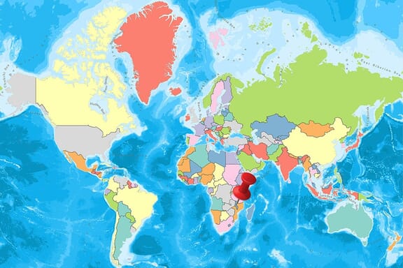
Malawi is located in the Southern Africa region at latitude -13.254308 and longitude 34.301525 and is part of the African continent.
The DMS coordinates for the center of the country are:
- 13° 15' 15.51'' S
- 34° 18' 5.49'' E
You can see the location of Malawi on the world map below:
Malawi Neighboring Countries
The neighboring countries of Malawi (MW) are:
- Mozambique (MZ)
- Tanzania (TZ)
- Zambia (ZM)
Malawi is a landlocked country, which means it does not have direct access to the open ocean.
Malawi Related Content
Malawi Key Facts
| Country | Malawi |
| Coordinates | Latitude: -13.254308 Longitude: 34.301525 |
| Country Codes | Alpha 2: MW Alpha 3: MWI |
| Country Flag Emoji | 🇲🇼 |
| Int. Phone Prefix | +265 |
| Capital city | Lilongwe |
| Continent Subcontinent | Africa Southern Africa |
| Country Area | 118,484 sq km |
| Population 2021 | 19,647,681 World Rank: 60 |
| Median Age | 16.8 |
| Life expectancy | 62.9 |
| Major languages | English (official), Chewa (common), Lambya, Lomwe, Ngoni, Nkhonde, Nyakyusa, Nyanja, Sena, Tonga, Tumbuka, Yao |
| UTC/GMT Time | Number of time zones: 1
|
| Internet TLD | .mw |
| Biggest Airport | Kamuzu International Airport (LLW) |
| Average temperature | 21.90 °C 71.42 °F |
| Administrative Divisions | 3 regions 28 districts |
| Political system | Presidential representative democratic republic |
Malawi Economy Facts
| World Bank Income Group | Low income |
| World Bank Region | Sub-Saharan Africa |
| Currency | Malawian Kwacha (MWK) |
| GDP in 2020 | $12.2 (billions of USD) World Rank: 137 |
| GDP per capita in 2020 | $636 World Rank: 181 |
| Major Industries / Economic Sectors | Agriculture, manufacturing, energy, services |
| Top 5 Import Countries | South Africa, China, Zambia, India, Zimbabwe |
| Top 5 Export Countries | South Africa, China, United Arab Emirates, United States, India |
Biggest Cities in Malawi
Here are the largest cities in Malawi based on 2021 data:
| City | Population |
|---|
| Blantyre | 1,895,973 | Lilongwe | 781,538 | Mzuzu | 150,100 | Zomba | 101,140 | Salima | 71,181 | Nkhotakota | 59,854 | Mangochi | 51,429 | Karonga | 34,207 | Chiromo | 25,235 | Nkhata Bay | 22,108 |
Map of Malawi with the Largest Cities
Other Countries in the Southern Africa Region
- Where are the Seychelles?
- Where is Angola?
- Where is Botswana?
- Where is Burundi?
- Where is Eswatini (formerly named Swaziland)?
- Where is Kenya?
- Where is Lesotho?
- Where is Madagascar?
- Where is Mauritius?
- Where is Mozambique?
- Where is Namibia?
- Where is Rwanda?
- Where is South Africa?
- Where is South Sudan?
- Where is the Congo?
- Where is Uganda?
- Where is Zambia?
- Where is Zimbabwe?
Geography
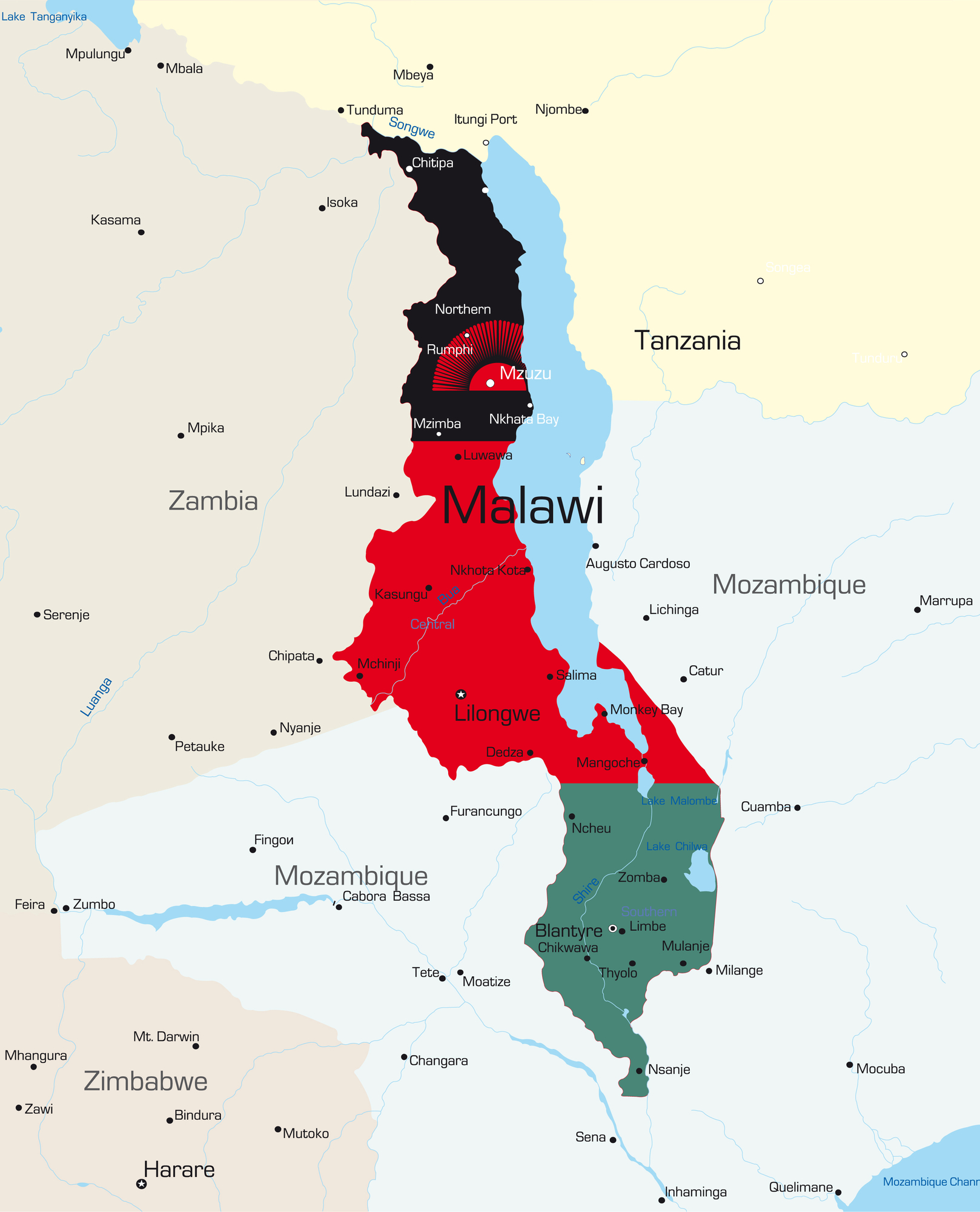
Malawi has long and narrow country lands extending in the north-south direction in the southeastern part of the African continent. The country is adjacent to Tanzania in the north, Zambia in the west, Mozambique in the south, southeast and southwest.
The country has a length of 850 km in the north-south direction and 350 km in the west-east direction. The entire border length of the country is 2,881 km, of which 475 km is Tanzania, 1,569 km is Mozambique and 837 km is Zambia.
Of the country’s 118,484 km², 31% consists of forests, 25% of wetlands, 20% of agricultural land and 15% of pastures. The northern part of the country is more mountainous than the other regions and the elevations can reach 3,000 m above sea level.
The highest mountain in the country is Sapitwa Mountain with 3,002 m. Covering almost the entire eastern part of the country and dominated by Malawi for the most part, Lake Malawi is the largest lake in Malawi with the total area of 29,600 km², 570 km in length and 80 km in width. The Shire River is the longest river in the country with a length of 402 km.
Governance
According to the constitution discussed in 1966, the country is governed by the presidential system. Malawi Congress Party (MCP) was the only party allowed by this constitution in the country that was a member of the Commonwealth.
With the referendum held in 1993, the possibility of transition from a single-party system to a multi-party system was provided. The Malawi parliament has a total of 177 deputies elected every five years. Like the deputies, the president is elected every five years, and a president can be elected for a maximum of two consecutive terms.
Climate
The dry season is experienced from May to November. During this period, the air temperatures are quite high. December to April is the rainy period.
Temperatures are around 20 degrees between May and September, and around 30 degrees in October and November.
Religion
According to the 2015 estimated data of the country’s population, 86.9% live according to Christian religious beliefs. The rate of 12.5% of the population living in Malawi according to the Islamic faith is a high rate for this part of the African continent.
The other population believes in local religions. Islam is more prevalent among the Yao ethnic group in the southern parts of the country. The religion, which first came to this land in the 1890s through Arab merchants and Mozambique, was later adopted and practiced especially by Yao.
According to 2015 estimates, 26.9% of the Christian population believes in Protestantism and 18.1% in the Catholic sect, while 41% adopts other Christian beliefs, especially African Christianity, taught by Presbyterian and European missionaries.
Industry and Tourism
Malawi is one of the less developed countries in the world and its economy is generally based on agriculture. 90 percent of gross national product and export income comes from agriculture and agricultural products. Approximately 85 percent of the population live in rural areas and engage in agriculture.
Main export products are:
- Tobacco
- Cotton
- Tea
- Coffee
- Candy
- Chili pepper
- Peanut,
- Processed wood products
- The fish
- Bauxite
- Uranium
- Gold
Export partners are the USA, South Africa and Egypt. The main import products are; wheat products, dairy products, canned goods, textile products, fertilizer, mine, all kinds of machinery, construction materials, electrical systems, agricultural machinery, vehicles, leather and footwear manufacturing and pharmaceutical. Import partners; mainly South Africa and several African countries with small shares.