North America continent is in the northern hemisphere, surrounded by the Arctic Ocean in the north, the Atlantic Ocean in the east, the Caribbean Sea in the south, and the northern Pacific Ocean to the west.
- North American Population: 579 million
- North America Continent Area: 24,700,000 km2
It is the third-largest continent after Asia and Africa and is the fourth most populous continent after Asia, Africa, and Europe.
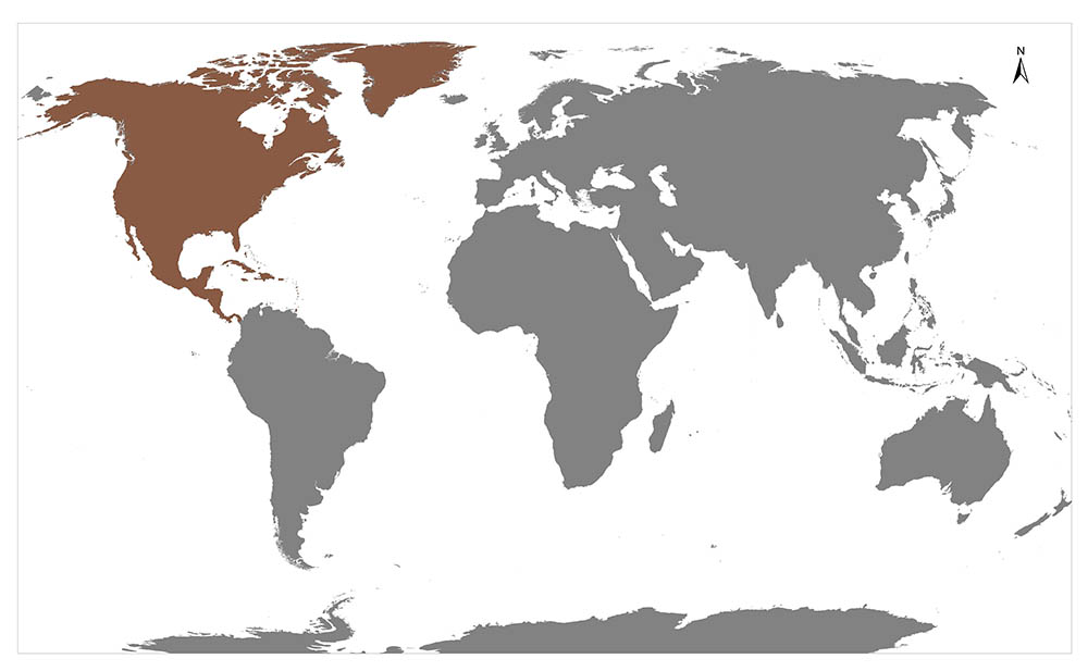
It is located in the northern part of the land mass, also called the New World. North America’s only land link to South America is the narrow Panama Canal.
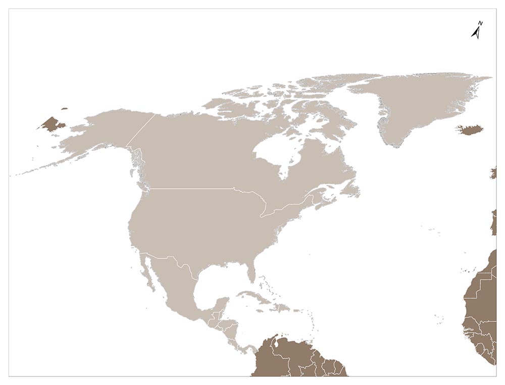
The continent can be divided into four major regions: from the Gulf of Mexico to the Canadian Arctic, Great Plains; Rocky Mountains, Great Basin, California and Alaska, geologically young, mountainous west; high in the northeast but relatively flat in the Canadian region; and the eastern region that includes the Appalachian Mountains and the Florida peninsula.
The only connection to South America is the Panama Canal. Thanks to this channel, the four sides of the North American Continent are actually sea/ocean waves. It is surrounded by the Arctic Ocean in the north, the Caribbean Sea in the South, the Atlantic Ocean in the East and the Pacific Ocean in the West.
Since it is spread over a large continent, different climate types are seen. Greenland is part of the continent. It is also rich in natural resources. There are iron ore and silver mines.
North American Countries List
Number of Countries in North America: There are 23 countries recognized by the United Nations. The number of lands dependent on other countries; 20 is.
| COUNTRY | CAPITAL |
|---|---|
| USA | Washington D.C. |
| ANTIGUA AND BARBUDA | Saint John’s |
| BAHAMAS | Nassau |
| BARBADOS | Bridgetown |
| BELIZE | Belmopan |
| DOMINICAN REPUBLIC | Santo Domingo |
| DOMINICAN the | Roseau |
| EL SALVADOR | San Salvador |
| GRENADA | Saint George’s |
| GUATEMALA | Guatemala |
| HAITI | Port-au-Prince |
| HONDURAS | Tegucigalpa |
| JAMAICA | Kingston |
| CANADA | Ottawa |
| COSTA RICA | San José |
| CUBA | Havana |
| MEXICAN | Mexico |
| NICARAGUA | Managua |
| PANAMA | Panama |
| SAINT KITTS AND NEVIS | Basseterre |
| SAINT LUCIA | Castries |
| SAINT VINCENT AND GRENADINS | Kingstown |
| TRINIDAD AND TOBAGO | Port of Spain |
| US VIRGIN ISLANDS | Charlotte Amalie |
| NAVASSA ISLAND | |
| PORTO RICO | Porto Rico |
| ANGUILLA | Anguilla |
| BERMUDA | Bermuda |
| BRITAIN VIRGIN ISLANDS | Road town |
| CAYMAN ISLANDS | Cayman Islands |
| MONTSERRAT | Plymouth (de jure) / Brades (de facto) |
| TURKS AND CAICOS ISLANDS | Cockburn Town |
| GREENLAND | Nuuk |
| CLIPPERTON ISLAND | |
| GUADELOUPE | Basse-Terre |
| MARTINIQUE | Fort-de-France |
| SAINT BARTHÉLEMY | Gustavia |
| SAINT MARTIN | Marigot |
| SAINT PIERER AND MIQUELON | Saint Pierre |
| ARUBA | Oranjestad |
| CURACAO | Willemstad |
| SINT MARTEN | Philipsburg |
| BES ISLANDS | Kralendijk |
History of North America
During the most severe period of the Ice Age, 34000-30000 BC, a significant part of the world’s water was in the form of large continental layers of ice. As a result, the Bering Sea was hundreds of meters lower than its current level, and a land bridge was formed between Asia and North America, called Beringia. It is believed to be about 1,500 kilometers in the widest period of Beringia. The region, which was a tundra with and without trees, was covered with grasses and other plants, which attracted large animals that the first people had hunted for.
The first to reach North America, they almost certainly wasn’t aware that they had set foot on a new continent. Probably, they had been hunting on the Siberian coast as their ancestors had done for thousands of years, and then they had crossed the land bridge.
After arriving in Alaska, the first North Americans crossed the passages between the glaciers and had to pass thousands of more years to reach the southern regions of the United States. The first evidence of life in North America continues to exist today. However, it can be proved that very few of them belong to an older than 12000 BC; For example, a hunting watch site located in the north of Alaska in the recent past may be from about these dates. The same can be said for carefully drawn arrowheads and some other objects found in the town of Clovis in New Mexico.
The presence of similar items in certain places in North and South America shows that the settlement of the Western Hemisphere (called the Western Hemisphere in the region formed by the islands of the North and South America and the surrounding islands) may have occurred in a large part of the settlement before 10,000 BC.
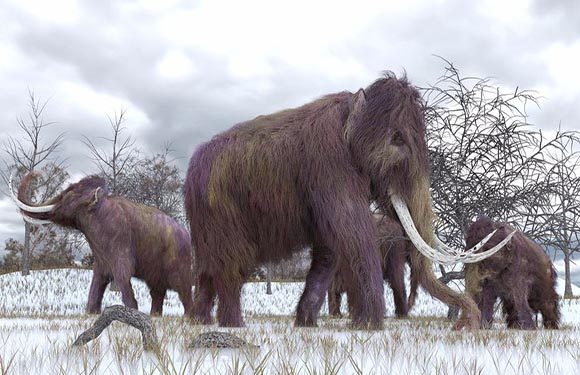
At that time, the mammoths began to disappear and their place was replaced by the bison, which first formed the main source of food and leather of the North Americans. Over time, due to overfishing and natural phenomena, many species of hunting animals have disappeared and increasingly began to create plants, nuts, and seeds as a source of nutrition for the first Americans.
Increasingly, plant-gathering efforts for nutrients and primitive agriculture experiments emerged. In this regard, Native North Americans and/or Indians in the Central Mexico region have now been pioneered, and perhaps have grown corn, squash, and beans from 8000 BC. The knowledge and experience gained in this regard slowly spread to the north.
By 3000 BC, a primitive corn species had been cultivated in the river valleys of New Mexico. After that, the first signs of village life were seen around 300 BC.
Discovery of America
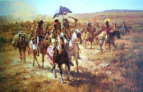
It is estimated that 2-18 million Indians lived here during the years when America was first discovered by the Europeans. Most of the inhabitants of the continent are expected to lose their lives as destructive wars with Europeans and infectious diseases brought by newcomers to the continent.
The Indian community in North America was tied to the ground in all respects. Commitment to land and natural conditions was an integral part of religious beliefs. The life of the Indians was basically based on clan and coexistence, and the children were given more freedom and tolerance than they had in Europe at that time.
While some North American tribes developed a kind of hieroglyphic to preserve certain texts, the Native American culture was basically spoken and given great value to telling tales and dreams.
It is clear that there is a great deal of trade between the various groups, and there is strong evidence that neighboring tribes are widely engaged in both friendly and hostile formal relationships.
First Europeans
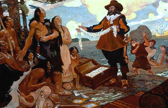
Europeans who first came to North America or had sound evidence of their arrival were Scandinavians traveling west from Greenland, where they established a settlement in 985.
The Scandinavian epics have stated that Viking sailors have discovered the Atlantic coast from North America to the Bahamas, but the aforementioned allegations have not been proven. In contrast, in 1963, certain Scandinavian house debris belonging to the period mentioned in L’Anse-aux-Meadows, north of Newfoundland, were found, thus confirming at least some of the claims put forward in Scandinavian epics.
Just five years after Christopher Columbus arrived ashore in the Caribbean, five years later, in 1497, the Venetian sailor John Cabot, commissioned by the King of England, set foot in Newfoundland. Cabot’s journey, though quickly forgotten, would serve as a basis for the British to claim North America over the years. The journey also paved the way for rich nests off the shores of Georgeyes Banks, and shortly thereafter, European and especially Portuguese fishermen began to arrive regularly.
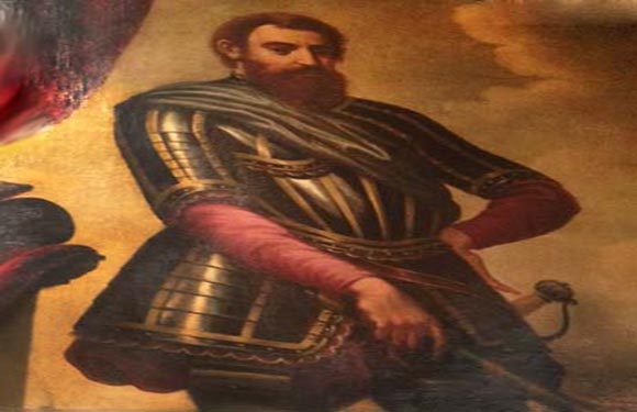
In fact, Columbus never saw the continental United States; however, the Spanish colonies, which he helped establish, became the starting point for the first discovery journeys in the United States. The first of these travels began in 1513 and a group led by Juan Ponce de Leon landed on the Florida coast near the city of St. Augustine.
After the conquest of Mexico in 1522, the Spanish empowered their position in the Western Hemisphere. The following discoveries made contributions to what the Europeans know about so-called America, referring to the Italian Amerigo Vespucci, whose writings on the journey to the New World were read with great admiration. While the prospects for discovering a Northwest Pass going to Asia will only be completely lost after century, by 1529, reliable maps of the Atlantic coast stretching from Labrador to Tierra del Fuego were drawn.
During the conquest of Peru, Hernando De Soto, who had served under Francisco Pizzaro, is one of the most important Spanish expeditions. The de Soto group campaign began in Havana in 1539, landed in Florida, and pursued wealth through the Mississippi River across the southeastern United States.
While the Spanish were spreading from the south, the northern part of the United States of America was also better known by travelers such as Giovanni da Verrazano. Verrazano, a Florentine traveling on behalf of the French, saw land in North Carolina in 1524 and headed north along the Atlantic coast to the present-day Port of New York.
The great wealth flowing into Spain from the colonies in Mexico, Antilles, and Peru attracted great interest from other European states. Over time, the seafaring countries like England, to some extent, began to deal with the New World as a result of the successful plundering attacks of Francis Drake against Spanish treasure ships.
Declaration of Independence
Colonies have become widespread, and agriculture-based settlements have been established, until the Declaration of Independence adopted on July 4, 1776. Thanks to the settlements established in the port circles, the trade of agricultural products have been ensured and the power of the colonies has increased. In the following period, the dependence on England left its place entirely to the will of freedom.
Although the paper is based on the political philosophy of the French and the English Enlightenment, the effect of a work is particularly remarkable: the Second Review of John Locke on the Government. Locke addressed the concepts of British traditional rights and universalized them as the natural rights of people. The well-known introduction of the paper reflects Locke’s theory of government-related social-contract.
The success of the revolution gave Americans the opportunity to identify their ideals in a legal way as described in the Declaration of Independence and to remedy some of their complaints through state constitutions. Furthermore, on May 10, 1776, the Congress took a decision and proposed to the colonies to form new governments that would best ensure the happiness and safety of their voters. Some of them had already done so, and as a result, a year after the Declaration of Independence was published, all colonies, except three, accepted their constitution.
North America Facts
- North America is the third-largest continent in the world. And it is called “fertile soils”.
- Dinosaur fossils found in North America are much more than those found on other continents.
- The first European settlement to Greenland was provided by the Vikings.
- Canada, where the population density is low, is one of the richest countries in the world.
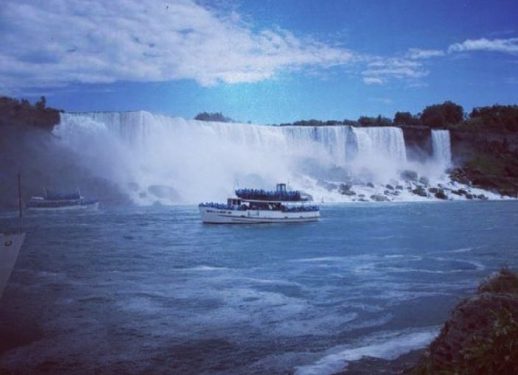
- Niagara Falls is one of the places you should visit if one day you go to Canada.
- Churchill in Hudson Bay, also known as “the capital of polar bears” in the world.
- Churchill in Hudson Bay, Manitoba, Canada, is flooded by thousands of polar bears every autumn. Waiting for the water to freeze polar bears can walk here easily.
- Canada’s capital, Ottawa, means trading in the native language. It was named after an American tribe who lived in the region. Already the merchants were known as very famous traders.
- The length of asphalt covered roads in the US is about 6.5 million kilometers.
- Today, Spain is the first colonies to establish the land of the USA. The locals lived in this region. Christopher Columbus, who departed from Spain, reached land in 1492. In 1497-1499, Italian Amerigo Vespucci changed the course of history by proving the existence of a continent which he named after his travels and letters.
- Those who introduced the chocolate to the Spanish conquistador were the Aztecs. In this way, it has spread to Europe.