Panama is located in the Central America region at latitude 8.537981 and longitude -80.782127 and is part of the North American continent.
The DMS coordinates for the center of the country are:
- 8° 32' 16.73'' N
- 80° 46' 55.66'' W
You can see the location of Panama on the world map below:
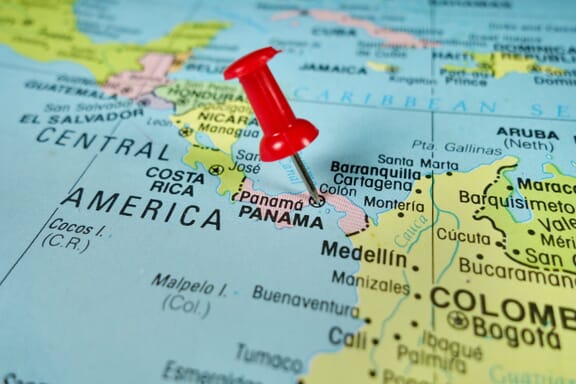
Panama Neighboring Countries
The neighboring countries of Panama (PA) are:
- Colombia (CO)
- Costa Rica (CR)
Maritime Borders
Panama borders with Pacific Ocean and the Caribbean Sea.
Panama Key Facts
| Country | Panama |
| Coordinates | Latitude: 8.537981 Longitude: -80.782127 |
| Country Codes | Alpha 2: PA Alpha 3: PAN |
| Country Flag Emoji | 🇵🇦 |
| Int. Phone Prefix | +507 |
| Capital city | Panama City |
| Continent Subcontinent | North America Central America |
| Country Area | 75,420 sq km |
| Population 2021 | 4,381,583 World Rank: 126 |
| Median Age | 28.8 |
| Life expectancy | 76.2 |
| Major languages | Spanish (official), indigenous languages (including Ngabere (or Guaymi), Buglere, Kuna, Embera, Wounaan, Naso (or Teribe), and Bri Bri), Panamanian English Creole (similar to Jamaican English Creole; a mixture of English and Spanish with elements of Ngabere; also known as Guari Guari and Colon Creole), English, Chinese (Yue and Hakka), Arabic, French Creole, other (Yiddish, Hebrew, Korean, Japanese) |
| UTC/GMT Time | Number of time zones: 1
|
| Internet TLD | .pa |
| Biggest Airport | Tocumen International Airport (PTY) |
| Average temperature | 25.40 °C 77.72 °F |
| Administrative Divisions | 10 provinces 4 indigenous regions |
| Political system | Presidential representative democratic republic |
Panama Economy Facts
| World Bank Income Group | High income |
| World Bank Region | Latin America & Caribbean |
| Currency | Balboa (PAB) |
| GDP in 2020 | $54 (billions of USD) World Rank: 80 |
| GDP per capita in 2020 | $12,510 World Rank: 59 |
| Major Industries / Economic Sectors | Manufacturing, services, agriculture, energy |
| Top 5 Import Countries | United States, China, South Korea, Japan, Colombia |
| Top 5 Export Countries | United States, China, Costa Rica, Colombia, Netherlands |
Biggest Cities in Panama
Here are the largest cities in Panama based on 2021 data:
| City | Population |
|---|
| Panama City | 880,691 | San Miguelito | 315,019 | Colon | 204,000 | David | 144,858 | La Chorrera | 68,896 | Balboa Heights | 62,882 | Pacora | 52,494 | Chitre | 46,191 | Santiago | 45,955 | Penonome | 28,766 |