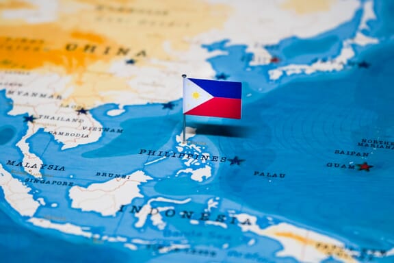
Philippines is located in the Southeastern Asia region at latitude 12.879721 and longitude 121.774017 and is part of the Asian continent.
The DMS coordinates for the center of the country are:
- 12° 52' 47.00'' N
- 121° 46' 26.46'' E
You can see the location of Philippines on the world map below:
The country has no neighboring countries/land borders.
Maritime Borders
The Philippines border with the South China Sea and the Philippine Sea.
Philippines (the) Related Content
Philippines Key Facts
| Country | Philippines (the) |
| Coordinates | Latitude: 12.879721 Longitude: 121.774017 |
| Country Codes | Alpha 2: PH Alpha 3: PHL |
| Country Flag Emoji | 🇵🇭 |
| Int. Phone Prefix | +63 |
| Capital city | Manila |
| Continent Subcontinent | Asia Southeastern Asia |
| Country Area | 300000 sq km |
| Population 2021 | 111,046,910 World Rank: 13 |
| Median Age | 24.5 |
| Life expectancy | 69.3 |
| Major languages | Filipino, English |
| UTC/GMT Time | Number of time zones: 1
|
| Internet TLD | .ph |
| Biggest Airport | Ninoy Aquino International Airport (Manila) |
| Average temperature | 27.00 °C 80.60 °F |
| Administrative Divisions | 17 regions 81 provinces |
| Political system | Presidential representative democratic republic |
Philippines Economy Facts
| World Bank Income Group | Lower middle income |
| World Bank Region | East Asia & Pacific |
| Currency | Philippines Peso (PHP) |
| GDP in 2020 | $407.4 (billions of USD) World Rank: 27 |
| GDP per capita in 2020 | $3,301 World Rank: 129 |
| Major Industries / Economic Sectors | Manufacturing, services, agriculture, energy |
| Top 5 Import Countries | China, Japan, United States, South Korea, Taiwan |
| Top 5 Export Countries | United States, Japan, China, Hong Kong, Singapore |
Biggest Cities in Philippines
Here are the largest cities in Philippines based on 2021 data:
| City | Population |
|---|
| Manila | 23,971,000 | Quezon City | 2,960,048 | Davao | 1,776,949 | Caloocan City | 1,661,584 | Zamboanga City | 977,234 | Cebu City | 964,169 | Antipolo | 887,399 | Taguig City | 886,722 | Pasig City | 803,159 | Cagayan de Oro | 728,402 |
Map of Philippines with the Largest Cities
Other Countries in the Southeastern Asia Region
Philippines Maps and Facts
The Philippines is located in Southeast Asia in the Pacific Ocean off the coasts of China and Vietnam. The three seas that surround the country are the Philippine Sea to the north, the South China Sea to the west, and the Celebes Sea to the south.
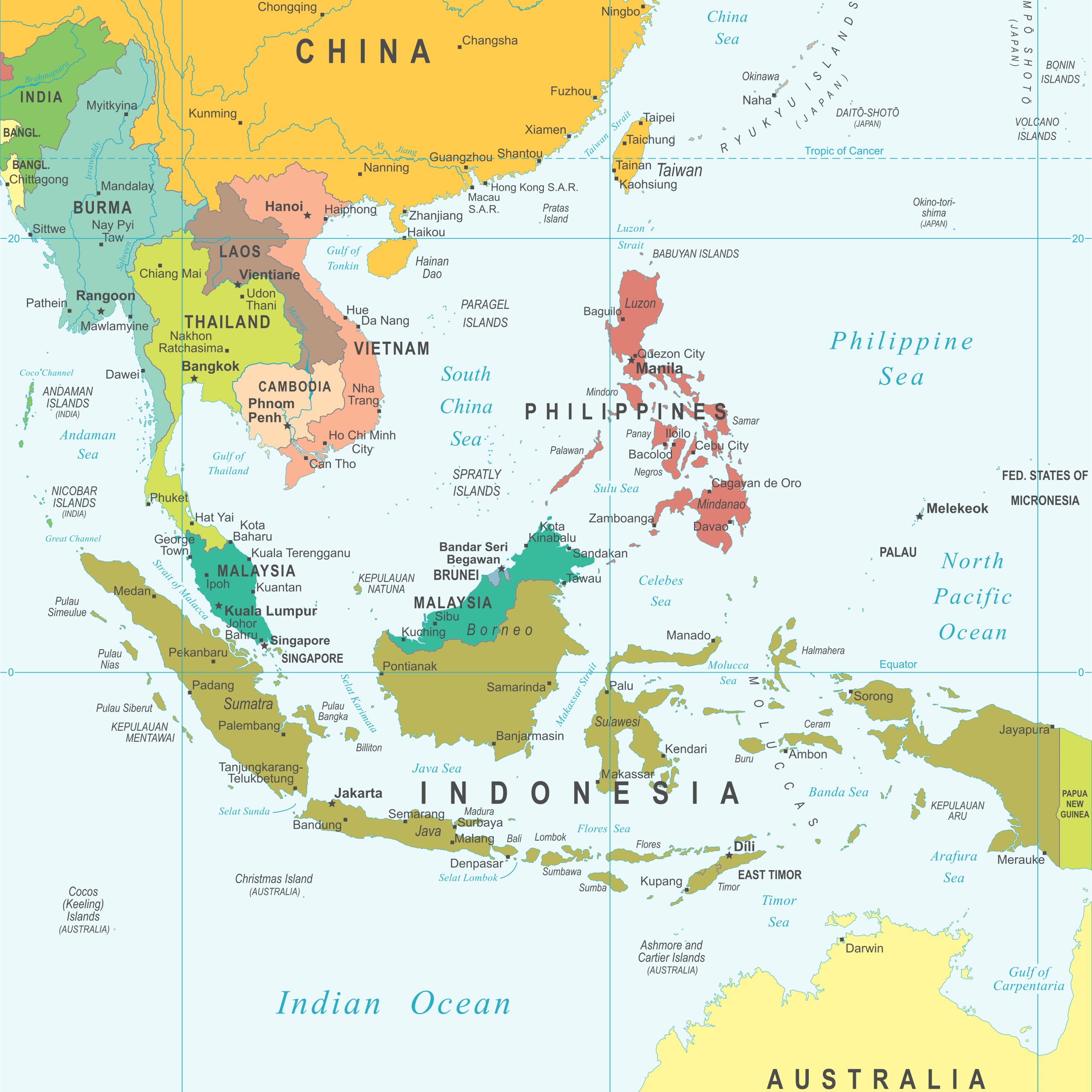
The Pacific Ocean is home to more than 25,000 islands, which can make distinguishing different countries a real challenge. As an archipelagic nation, the Philippines forms about 7,640 of these islands, and roughly 2,000 of them are inhabited.
The above political map of the Philippines labels the major islands and cities in the Philippines. Water features including surrounding seas, channels, straits, and rivers can also be seen on the map. The city of Manila, the capital of the Philippines, is marked with a red square.
Region and Bordering Countries

The nearest countries to the Philippines are Taiwan to the northwest, China and Vietnam to the west, and Malaysia and Indonesia to the south. It’s part of the region of Southeast Asia, which includes other countries in the southwest Pacific like Vietnam, Thailand, Malaysia, Indonesia, and Singapore.
The closest foreign country to the Philippines is Malaysia, and the nearby country with the most immigrants in the Philippines is China. China and the Philippines have a long history of migration and trade that dates back hundreds of years. The ties are so strong that there are many examples of Chinese-Filipino food that have been created in the Philippines.
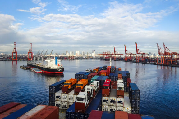
The Port of Manila is often considered the best natural harbor in East Asia, and it is connected to a vast network of international shipping channels. This helps make the Philippines an important economic force in the region.
Major Cities
Quezon City
Quezon City is the most populous city in the Philippines, with a population of over 2.9 million. It is located on the island of Luzon, near Manila, and is part of the Manila Metro Area. The city was founded in 1939 and became the national capital for some years before it was moved back to Manila in 1976. The name of the city comes from Manuel L. Quezon, the country’s second president.
The city is called the “City of Stars” by some for the very active entertainment and media industries that operate there. It’s also an economically and culturally important city, with strong commerce, education, technology, arts, and tourism sectors. There are also several governmental organizations headquartered here.
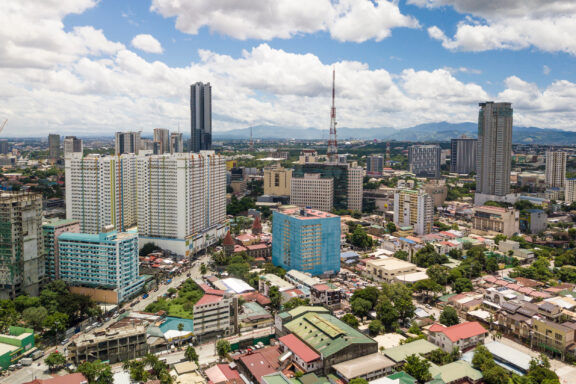
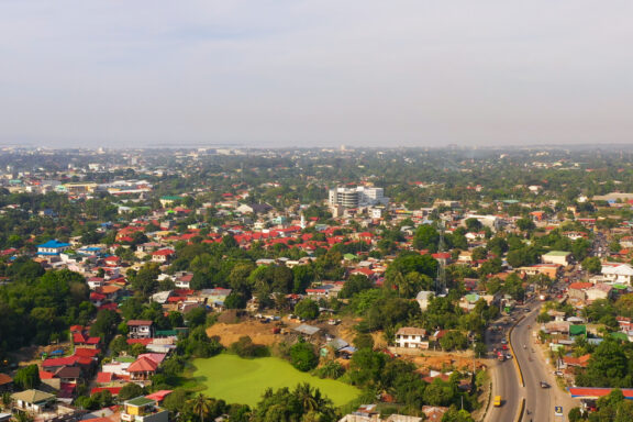
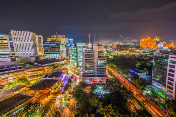
Manila

This is the capital city of the Philippines, located on Luzon Island in Manila Bay. It’s the second most populous city in the country after Quezon City and is one of the world’s most densely populated cities. The port of Manila is considered one of the best natural harbors in East Asia and is a major trade center in the region.
The area of present-day Manila has been inhabited for thousands of years, and it officially became a Spanish colonial city in 1571. It was the seat of power for most colonial rulers in the Philippines while it was under Spanish control.
Tourism in the Philippines is a major industry, and Manila sees about 1 million tourists each year. Some attractions that draw tourists to the city include fantastic shopping options, exciting nightlife, various green parks, the Manila Baywalk, museums, and more.
Davao City
Davao City has the distinction of being the largest city in the Philippines in terms of land area, and it’s located on the island of Mindanao. The city is the center of Metro Davao, which is the second-largest metro area in the country after the Manila Metro Area.
Mount Apo, the largest mountain in the Philippines, is situated at the southwestern corner of the city. It is a protected area which is part of the Mount Apo National Park, established in 1936 to protect the region’s flora and fauna. There are 111 endemic bird species in the national park, including the country’s national bird, the Philippine Eagle.
Davao City is also home to the Kadayawan Festival, an annual celebration of life, nature, culture, and gratitude. A main feature of the festival is the Indak-Indak sa Kadalanan, or street-dancing competition, where diverse indigenous cultures are represented.
Caloocan
This is the fourth-largest city in the Philippines, and it’s located in the Metropolitan Manila Area. The city is sometimes also spelled as “Kalookan,” and the name comes from the Tagalog word kalook-lookan, which means “innermost area.”
The city is interesting from a geographical perspective because it consists of two non-contiguous areas, North Caloocan and South Caloocan. The northern section of the city is more than twice the size of the southern section, and it is mostly divided into residential and industrial zones. South Caloocan is where most of the commercial and industrial establishments in the city are located.
Banks, shopping malles, hypermarkets, as well as factories and industrial areas make up the economic activity in both North and South Caloocan. Motorcycle dealers and spare-parts dealers can be found on Caloocan’s 10th Avenue.
Zamboanga City
This is the third-largest city in the Philippines by land area and the fifth most populous in the country. It’s located on the southwestern tip of the island of Mindanao on the Zamboanga Peninsula.
Economically, the city’s most important sectors are the sardine industry, shopping malls, international trade, and the seaweed industry. The vast majority of sardine production in the Philippines happens in Zamboanga; 11 out of the 12 sardine companies in the country operate in this city, which account for as much as 70% of the city’s economy. It’s been rightfully dubbed the Sardine Capital of the Philippines.
Tourism is popular and growing in Zamboanga City. One of the main attractions is the pink sand beach found on the city’s Santa Cruz island. There is also ferry access from the city to many other islands nearby.
Cebu
Cebu is the oldest city of the Philippines and is where the first national capital was located. It’s now the sixth most populous city in the country, as well as an important cultural center and popular tourist hub.
Some culturally significant elements of the city are Magellan’s Cross, the Basilica Minore del Santo Niño, and the Sinulog Festival. Magellan’s Cross is a wooden cross believed to have been placed in Cebu by explorers that were part of Spain’s first circumnavigation of the world, led by Ferdinand Magellan.
The cross is housed in a stone pavilion that is very near to the Basilica Minore del Santo Niño, which was founded in 1565 and is the oldest Roman Catholic Church in the country. The church also features the oldest relic in the Philippines, the Santo Niño de Cebú, a depiction of Jesus as a child.
The Sinulog Festival is considered the oldest and biggest festival in the entire country — its nickname is “the Grandest Festival in the Philippines.” Each year it attracts anywhere from 1 to 15 million people from all over the world. It is a cultural and religious festival that celebrates the image of the Santo Niño and is also famous for its street parties that happen on the nights before and at the end of the festival.
Geography
As an archipelago, the geography of the Philippines is defined by its many islands. In terms of the total area of land and water, the Philippines extends across approximately 300,000 square kilometers (115,831 square miles) of the Pacific Ocean.
With 36,289 km (22,549 miles) of coastline, the country has one of the longest coastlines in the world. The country is also full of mountainous terrain, and Mount Apo is the highest point in the country with an elevation of 2,954 meters (9,692 feet). The next highest peaks belong to Mount Dulang-Dulang and Mount Pulag.
While the country consists of thousands of islands, they can be grouped into just three geographic categories: Luzon, Visayas, and Mindanao. Luzon is the largest of these and includes the nation’s capital, and Visayas is the smallest.
The Philippines has a tropical and maritime climate that sees some variation across the country. There are rainy seasons, temperatures are generally fairly hot, and humidity is consistently high. The islands see plentiful rainfall, and the climate can be compared to that of Central American countries.
Economy
On a global scale, the Philippines has the 32nd largest economy by GDP and the 12th largest in Asia. Out of the ten nations that make up ASEAN (Association of Southeast Asian Nations), the Philippines ranks third in terms of economic size behind Singapore and Thailand.
The Philippine economy is in transition from one based largely on agriculture to one that focuses more on services and manufacturing activities. The primary exports from the Philippines are diverse and include semiconductors, electronic products, clothing, petroleum products, coconut oil, fruits, and more. Major international trading partners with the Philippines are the United States, China, Japan, Hong Kong, Singapore, and Germany.
Metro Manila is the economic center and largest metropolitan area in the country, and it’s also the location of Manila Port, a major port for international trade. The country is also heavily involved in shipbuilding and repair. In 2010, the Philippines became the fourth-largest shipbuilding nation in the world.
The currency used in the Philippines is the Philippine Peso, and it’s remained one of the most stable currencies in Southeast Asia over the past several decades.

Demographics and Culture
A mix of indigenous and Austronesian populations have called the Philippines home for thousands of years, and the country’s current cultural landscape is the result of their interaction with Spanish colonists, Chinese immigrants, and American intervention.
The three main groups of indigenous peoples in the Philippines are the Igorot who live in the mountainous region of northern Luzon, the Lumad who live on the island of Mindanao, and the Mangyan who make up smaller groups living on the central islands of the country. Each of these groups is made up of smaller distinct groups of people.
The influence of Chinese immigrants and a long history of trade with China have led to the adoption of some Chinese cultural elements in the Philippines, especially in Filipino cuisine.
Spanish explorers and colonists brought Catholocism with them, and the religion is still dominant in the country. Examples of Spanish architecture can also be seen. Time under the administration of the USA is partly responsible for the large number of English speakers in the country.
FAQs
Is it safe in the Philippines?
Travel to the Philippines is mostly safe, and millions of tourists have trouble-free visits to the country each year. The US Department of State periodically updates a travel regarding specific regions of the country that should be avoided.
Exercising normal precautions such as remaining aware of your surroundings and avoiding unlit spaces alone at night is recommended.
Do they speak English in the Philippines?
English is one of the official languages of the Philippines, along with Filipino. It is spoken by more than 14 million Filipinos, which makes the country one of the most proficient in English in the region. English is used widely in the tourism industry, higher education, and business.
What is the Philippines famous for?
As a popular tourist destination, the Philippines is well-known for its many impressive beaches, beautiful waters, and rich biodiversity. There are a number of world-class dive sites in the country, as well as UNESCO World Heritage Sites. Filipino cuisine is also world famous and features a Chinese influence.
What is the safest city in the Philippines?
The city with the lowest crime rate in the Philippines is Davao City, and it’s considered one of the safest cities in Southeast Asia. Another of the country’s safest cities is Dumaguete, which is sometimes called the of Gentle People. It has moderate protection from typhoons, even as a coastal city.
Image Sources and Copyright Information
- Political Map of the Philippines Showing Regions: © Rainer Lesniewski/Shutterstock
- Manila Bay with City Skyline and Boats: © Jomar Aplaon/Shutterstock
- Philippine Peso Currency Notes: © small1/Shutterstock