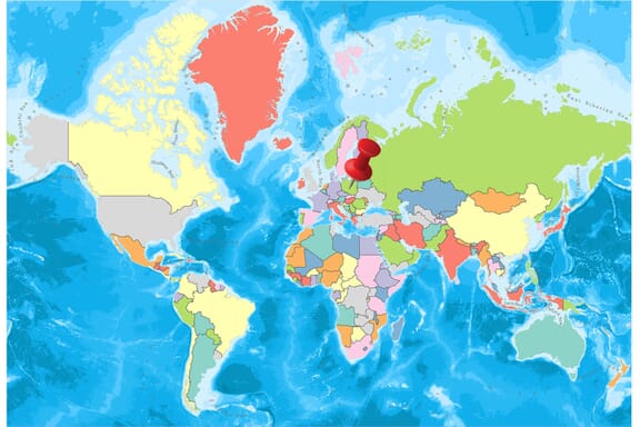
Poland is located in the Eastern Europe region at latitude 51.919438 and longitude 19.145136 and is part of the European continent.
The DMS coordinates for the center of the country are:
- 51° 55' 9.98'' N
- 19° 8' 42.49'' E
You can see the location of Poland on the world map below:
Poland Neighboring Countries
The neighboring countries of Poland (PL) are:
- Belarus (BY)
- Czechia (CZ)
- Germany (DE)
- Lithuania (LT)
- Russian Federation (RU)
- Slovakia (SK)
- Ukraine (UA)
Maritime Borders
Poland borders with the Baltic Sea.
Poland Related Content
Poland Key Facts
| Country | Poland |
| Coordinates | Latitude: 51.919438 Longitude: 19.145136 |
| Country Codes | Alpha 2: PL Alpha 3: POL |
| Country Flag Emoji | 🇵🇱 |
| Int. Phone Prefix | +48 |
| Capital city | Warsaw |
| Continent Subcontinent | Europe Eastern Europe |
| Country Area | 312,685 sq km |
| Population 2021 | 37,781,024 World Rank: 39 |
| Median Age | 40.9 |
| Life expectancy | 76.5 |
| Major languages | Polish (official) 98.2%, Silesian 1.4%, other 1.1%, unspecified 1.3% (2011 est.) |
| UTC/GMT Time | Number of time zones: 1
|
| Internet TLD | .pl |
| Biggest Airport | Warsaw Chopin Airport (WAW) |
| Average temperature | 7.85 °C 46.13 °F |
| Administrative Divisions | 16 voivodships |
| Political system | Parliamentary democracy |
Poland Economy Facts
| World Bank Income Group | High income |
| World Bank Region | Europe & Central Asia |
| Currency | Zloty (PLN) |
| GDP in 2020 | $596.6 (billions of USD) World Rank: 21 |
| GDP per capita in 2020 | $15,742 World Rank: 50 |
| Major Industries / Economic Sectors | Manufacturing, services, agriculture, energy |
| Top 5 Import Countries | Germany, China, Russia, Czech Republic, Netherlands |
| Top 5 Export Countries | Germany, Italy, Czech Republic, France, United Kingdom |
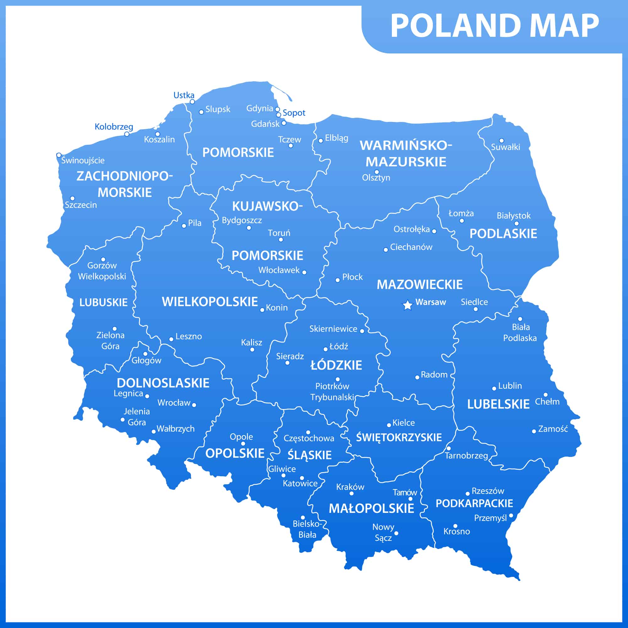
Biggest Cities in Poland
Here are the largest cities in Poland based on 2021 data:
| City | Population |
|---|
| Warsaw | 1,790,658 | Krakow | 766,739 | Lodz | 690,422 | Wroclaw | 638,586 | Poznan | 533,830 | Gdansk | 464,254 | Szczecin | 403,833 | Bydgoszcz | 346,739 | Lublin | 339,850 | Bialystok | 297,554 |
Map of Poland with the Largest Cities
Other Countries in the Eastern Europe Region
Poland is composed of sixteen top management units called Voivodeship.
Since the 14th century, these governance units, voivodeships of Poland (provinces of Poland), have become their current state with the reform of local governments, which came into force on 1 January 1999.
With this arrangement, 49 old voivodeships (from July 1, 1975), were merged into sixteen new voivodeships.
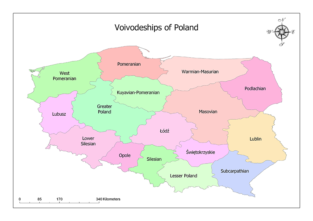
Voivodeships of Poland
Poland is made up of seventeen governing units called Voivodeships.
16 Voivodeships (Regions) of Poland:
Masovia
Mazovian Voivodeship is located in the middle-east of the country. It is neighbor with Warmia-Masuria in the north, Podlaskie in the northeast, Lublin in the southeast, Lubwi güneydoğutokrzyskie in the south, Masód Warm in the southwest and Kujawy-Pomerania in the northwest.
The population of the Voivodeship, whose surface area is 35,579 km², is 5,384,617 as of 2017 and is the largest voivodeship in Poland. The center of the voivodeship is also Warsaw, the capital of the country. Mazovian Voivodeship is divided into 43 counties, five of which are urban and 37 are rural. The districts are divided into 314 municipalities.
Lower Silesia
Lower Silesia Voivodeship in the south-west of Poland is one of the 16 voivodeships in which Poland is divided. The Lower Silesia has a surface area of 19,946 square kilometers. The population of the Voivodeship is 2,908,457 as of 2014, and the population density of the region is 150 / sq. km. The voivodeship includes 91 cities and towns. Lower Silesia Voivodeship is one of the most visited voivodeships in Poland.
Greater Poland
Greater Poland is a voivodeship in central and western Poland. Greater Poland has an area of 29,826 square kilometers. As of 2017, the population of the region is 3,489,210 and the population density is 120 / sq. km. The voivodeship consists of 109 cities and towns. The capital city of the region is Poznan.
Silesia
Silesia is the voivodeship in the southern part of Poland. The area of Silesia is 12,333 square kilometers. As of 2014, the population of the region is 4,593,358 and the population density is 370 / square kilometers. The voivodeship consists of 71 cities and towns. The capital of the region is Katowice. Silesia Voivodeship is the most densely populated voivodeship in Poland and is also the largest urbanized area in Central and Eastern Europe.
Pomerania
Pomerania is a voivodeship in the north of Poland. The surface area of Pomerania is 18,293 square kilometers. The population of the region is 2,324,251 as of 2017 and the population density is 130 / square km. The capital of the region is Gdańsk. The voivodeship consists of 42 cities and towns. Gdańsk, Gdynia and Sopot are one of the main cultural, commercial and educational centers of Poland.
Łódź
Łódź Voivodeship is a voivodeship in the center of Poland. The surface area of Łódź is 18,219 square kilometers. The population of the region is 2,470,610 by 2018 and the population density is 135 / square km. The capital of the region is Łódź. The voivodeship consists of 44 cities and towns. The Museum of Art in the region has one of Europe’s largest collections of modern art.
Lesser Poland
Lesser Poland Voivodeship is a voivodeship in the southeast of Poland. Lesser Poland has a surface area of 15,108 square kilometers. The population of the region is 3,406,000 by 2014 and the population density is 230 / sq. km. The capital of the region is Kraków. The voivodeship consists of 61 cities and towns. John Paul II International Airport the second largest international airport in Poland is in the region.
West Pomerania
West Pomerania Voivodeship is a voivodeship in the northwest of Poland. The area of West Pomerania is 22,896 square kilometers. The population of the region as of 2014 is 1,715,431 and the population density is 75 / square km. The capital of the region is Szczecin. The voivodeship consists of 64 cities and towns. Western Pomeranian Voivodeship is the fifth largest voivodeship in Poland in terms of the region. Among the largest cities in the region are Szczecin, Koszalin, and Stargard.
Lubusz
Lubusz Voivodeship is a voivodeship in western Poland. The surface area of Lubusz is 13,987 square kilometers. The population of the region is 1,016,652 as of 2017 and the population density is 73 / square km. Gorzów Wielkopolski and Zielona Góra share the capital of the region. The voivodeship consists of 42 cities and towns. The area is basically flat with many lakes and woodlands. Around the south in the vicinity of Zielona Góra world famous grapes are grown.
Kujawy-Pomerania
Kujawy-Pomerania is a voivodeship in central and northern Poland. Kujawy-Pomerania has a surface area of 17,969 square kilometers. The population of the region is 2,098,370 as of 2011 and the population density is 120 / sq. km. Bydgoszcz and Toruń share the capital city in the region. The voivodeship consists of 52 cities and towns. The administrative center of the Voivodeship is Bydgoszcz, and Toruń has a voivodeship council.
Opole
Opole is a voivodeship in the south of Poland. The surface area of Opole is 9,412 square kilometers. The population of the region is 1,000,858 by 2014 and the population density is 110 / sq. km. The capital of the region is the city of Opole. The voivodeship consists of 35 cities and towns. A large part of the territory of the Voivodeship is located in the historic Upper Silesia region. It is neighbor with Lower Silesia in the west, Greater Poland and esiaódź to the north, Silesia to the east and the Czech Republic to the south.
Świętokrzyskie
Świętokrzyskie is a voivodeship in central and southeastern Poland. The surface area of Świętokrzyskie is 11,672 square kilometers. The population of the region as of 2014 is 1,263,176 and the population density is 110 / sq. km. The capital of the region is Kielce. The voivodeship consists of 32 cities and towns.
Warmia-Masuria
Warmia-Masuria is located in the north of Poland. The area of Warmia-Masuria is 24,191 square kilometers. The population of the region as of 2014 is 1,443,967 and the population density is 60 / sq. km. Olsztyn is the capital of the region. The voivodeship consists of 49 cities and towns.
Podlaskie
Podlaskie is a voivodeship in the northeast of Poland. The surface area of Podlaskie is 20,180 square kilometers. As of 2014, the population of the region is 1,193,348 and the population density is 59 / square km. The capital of the region is Białystok. The voivodeship consists of 40 cities and towns.
Subcarpathian
Subcarpathian is located in the southeast of Poland, on the border between Slovakia and Ukraine. The Subcarpathian has a surface area of 17,844 square kilometers. The population of the region as of 2014 is 2,129,187 and the population density is 120 / sq. km. The capital of the region is Rzeszów. The voivodeship consists of 50 cities and towns.
Lublin
Lublin is a voivodeship in eastern Poland. The surface area of Lublin is 25,155 square kilometers. The population of the region is 2,147,746 as of 2014 and the population density is 85 / sq. km. The capital of the region is the city of Lublin. The voivodeship consists of 42 cities and towns.
Poland Geography and Facts
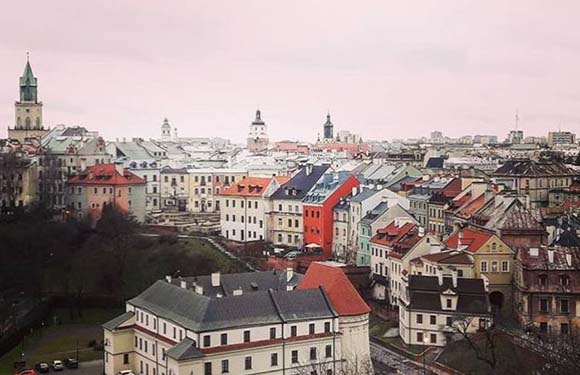
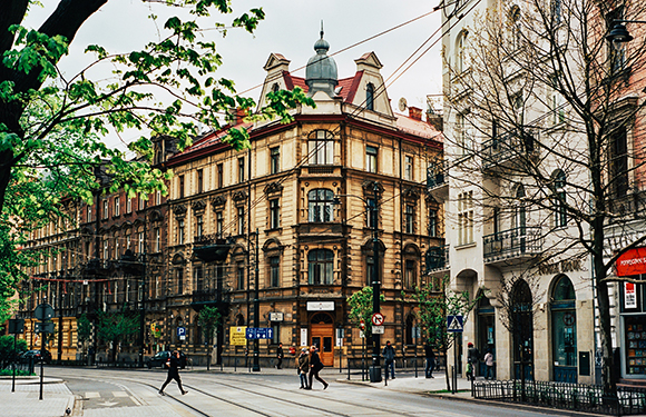
Poland is a country with historical, colorful buildings, nature and architecture. Warsaw is the largest city in the country. The city was rebuilt after a war of great destruction. The official language is Polish. The currency is the Polish Zloty. Poland, a country that has seen hundreds of battles throughout history, has come up from all these challenges and has preserved the values it has. The stability and the economy of the country are hardly affected by a number of global crises. This is why it has investors from other countries, especially in Europe.
To the east is Russia, the Czech Republic in the south, Germany in the west and the Baltic Sea in the north.
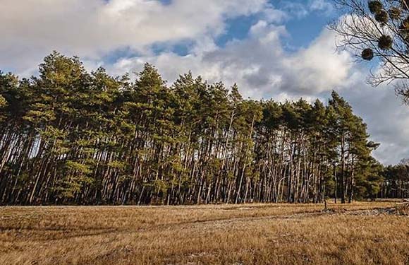
Most of the Polish territory forms part of the Northern European Plain covering almost all of Northern Europe. Outside the southern region, the country is covered with low and flat areas.
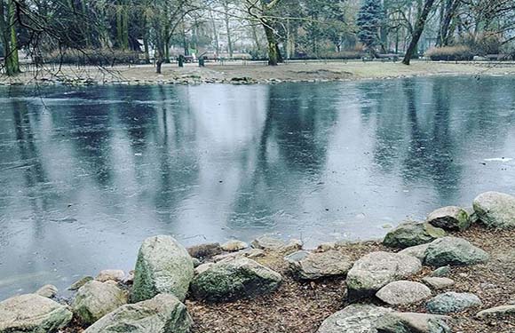
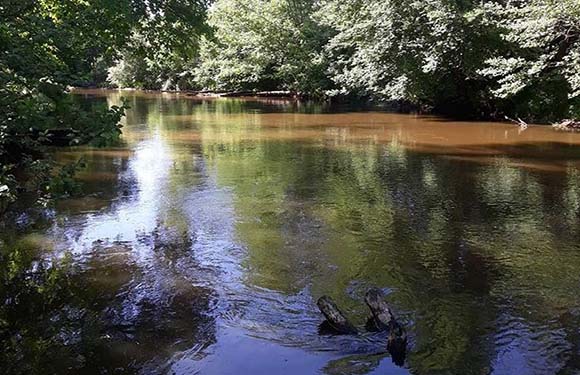
There are large sandy beaches, dunes, marshes and shallow lakes formed by overflowing the sea. In the inner regions, in the northern part of the plain, there is a large belt formed by moraines and covered with forests; Vistula River flowing in south-north direction divides the plain into two.
Governance
The socialist regime based on the one-party system in Poland left its place in the multiparty system in 1988. According to the 1952 Constitution, which is still in force today, legislative power belongs to the single-parliament, which is called the parliament. 460 members of this assembly are elected by the people every five years. The 17-member State Council elected among the members of the Assembly has legislative and some executive powers. The main executive body is the Council of Ministers, which is directly responsible to the parliament.
Climate
It is rainy in summer when it is hot in Poland. It rains a few days a week. In the winter months, the snowfall that started in November does not leave the country until March. You can even see snow in April even in the least. But under normal conditions after March the country is home to a warm wind together with reduced snowfall. The months in Poland where the most beautiful temperatures are felt and the sun is seen are June and July.
Religion
It is said to be the most religious country in Europe. 90% of Poles are Catholic.
Industry and Tourism
The Polish industry, which has been encouraged by large capital investments since the end of World War II, is among the leading countries in the world in terms of pace of development. Shipbuilding, industrial machinery, machine tools, railway equipment, automotive, iron and steel, cement, chemicals, paper, plastic, weaving, consumer durables (refrigerator, washing machine, TV and radio), sugar and food industries are major ones. In parallel with the development of the industry, annual electric energy production is also high.
Poland stands out as an example of success among “transition process economies”. Since 1990, it has been following a stable economic liberalization policy.
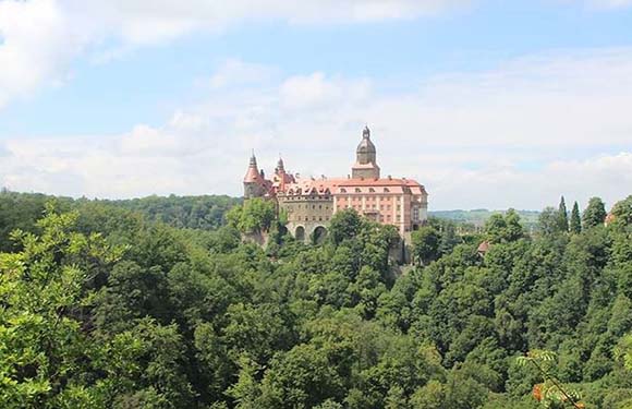
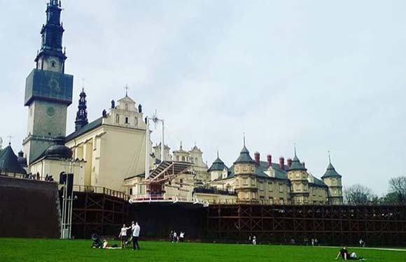
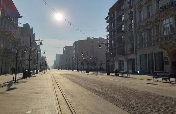
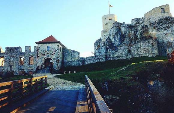
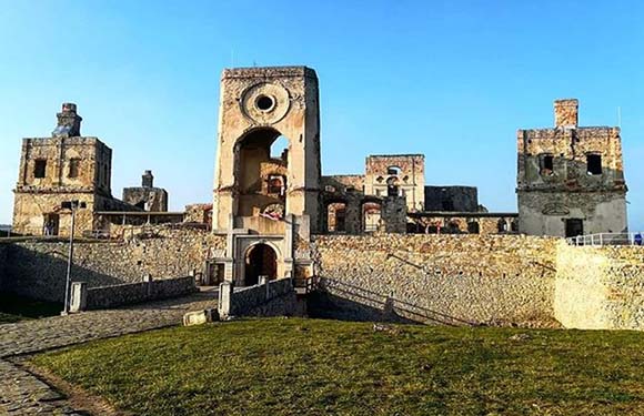
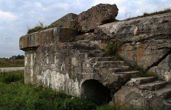
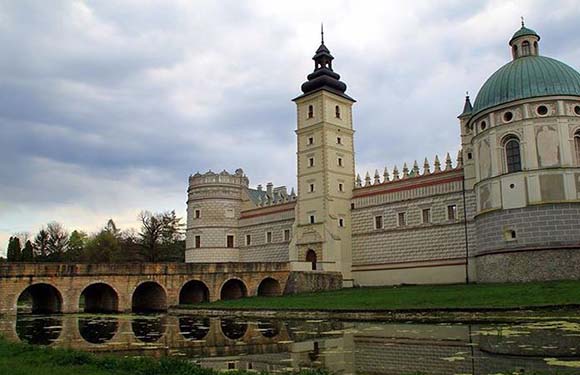
It is a wonderful country with medieval towns, impressive architecture, national parks, rivers, and protected natural areas. The capital of the country, Warsaw, is not only the business center of the country but also attracts attention with the historical artifacts it contains. The Old Town is the most important part of the capital. The Royal Castle and the Warsaw History Museum are among the places to visit. Krakow, considered as Poland’s most important tourism destination, is a city where the churches decorate the city with all its splendor.
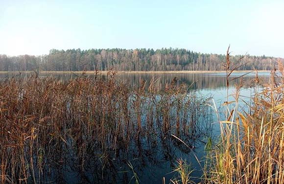
With its charming medieval atmosphere, it is one of the 12 most important historical sites of UNESCO. The Market Square in the Old Town is the daily magical atmosphere of the Middle Ages. Wawel Cathedral and Wawel Royal Castle are the most important works of the city. Located in northeastern Poland, Masuria is famous for its lakes and forests. It contains 15% of the lakes in the country. It is possible to go fishing, surfing and sailing sports in these areas which are suitable for boat trips. Besides, the Baltic Coast in the north of the country is a great place for sea and beach tourism. 10 Reasons to Visit Poland.
Art
There are well-known writers such as Adam Mickiewicz, Jan Kochanowski, Witold Gombrowicz, Stanisław Lem, Bruno Schulz, Stanisław Ignacy Witkiewicz, Jan Polkowski, Adam Zagajewski, Julian Kornhauser, Ewa Lipska and Rafal Wojaczek. In addition, Henryk Sienkiewicz, Władysław Reymont, Czesław Miłosz, and Wisława Szymborska are Nobel Prize-winning literary figures. The most famous artist in Poland was composer and pianist Fredric Chopin who lived in the nineteenth century.
Festivals in Poland
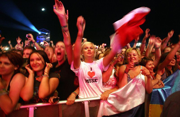
There are important music festivals that appeal to all kinds of tastes like Poland’s popular music, electronics, and jazz. One of them is the Open’er Festival. The festival is held in Gdynia-Kosakowo Airport. Also includes various branches such as alternative music, theater, film, fashion, and visual arts. The festival takes place at the end of June or the beginning of the year with the participation of many national and international artists.
Audioriver, Poland’s largest seaside festival, combines club music, electro and techno music classics. Moreover, the festival takes place in July every year on the banks of the famous Vistula river in Płock, north of Warsaw.
The Coke Live Music Festival
Held in the Polish Aviation Museum in Kraków, known for its historical beauty, welcomes world-famous musicians in August every year. Also, the festival, which is based on Hip-Hop, R & B and pop music style, has started to focus on Rock music in recent years.
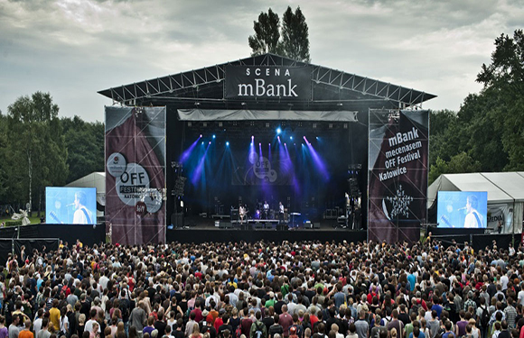
The OFF Festival
Held in the forest of the Three Ponds Valley in Katowice, brings together the latest music orientations. Moreover, Artur Rojek, the art director of the festival, who has a loyal audience from all over the world, brings together the great talents of carefully selected alternative music scenes every year at the festival scene in late July or early August.
Tauron New Music Festival
It is located in an old coal mine in the Three Ponds Valley in Katowice. Furthermore, beginning with a focus on jazz, Nu-jazz, electronic and dance music and appealing to a wide range of musical styles, the festival features Rock, pop, Hip-Hop, R & B and world/folk music. The festival takes in August every year since 2006.
Warsaw Summer Jazz Days
It takes place at the Congress Hall with a capacity of 2500 people in the Palace of Culture and Science in Warsaw. Furthermore, the event, which brings together creative artists with different musical backgrounds, is organized every year in July.
Other Important Events and Festivals in Poland
- Bialystok Up To Date, which takes place in September every year in Białystok, the largest city in northeastern Poland
- Sacrum Profanum, in September in Kraków.
- The Castle Party Festival is a Gothic music event of 20 years. Takes place every year in July where the audience attends the festival with a costume.
- Warsaw International Film Festival, every year in October.
- Mizdzynarodowego Biennale Plakatu, which is the world’s first poster biennial and every year in June.
Sports
The most popular sports throughout the country are volleyball and football. In addition, motorbikes, ski jump, athletics, basketball, boxing, fencing, rugby association, grass hockey, handball, ice hockey, swimming, and weightlifting are among the popular sports.
What is the Official Language of Poland?
The official language of Poland is Polish.
Polish, the official language of Poland, is spoken by 50 million people worldwide. The young population in the country generally speaks English. It is also spoken in Poznan and in German, because of its border with Germany. Due to the former Soviet pressures, the majority of the elderly population can speak Russian. Polish is spoken by 38 million in Poland, including a total of 50 million people in the world is estimated.
It is the 3rd most spoken language after Polish, Russian and Ukrainian. Polish’s roots are estimated to have been spoken for 1,500 years, even though they have reached 5000 years. With Christianity, Poland also accepted the Latin letters. Thus, the spoken language could now be written on paper.
Features of Polish
Polish has its own grammar and is a very complicated language. The word takes the addition from both the front and the end. Names and adjectives in Polish, depending on how they are used in different forms. Singular names are divided into three as masculine, feminine and neutral. Verbs are completed and in progress in two forms. There are formal and informal forms of appeal in Polish.
There are 32 letters in the alphabet and there are different sounds created by the two letters side by side. Especially when the silent 2 letters come side by side, the word can be quite difficult to make. One of the reasons that make this language difficult is that each word has a gender, including masculine, female and neutral. It is a language that can be easily learned in 2–3 months due to the similar grammatical structure and vocabulary of those coming from Russia and Ukraine. Even the Polish people express that they cannot use Polish regularly.
Polish Currency/What is the Currency of Poland?
The currency of Poland is Złoty.
Zloty’s sign is zł and its code is PLN. Złoty is only used for złoty, which is the singular figure, the złote is used for pluralities. Ziłoty in dialectic means polish in gold. 1 Złoty consists of 100 Groszy. If you have Euro or Dollars, you can exchange these currencies in almost every Foreign Exchange Office or Bank in Poland.
There have been serious debates over whether Poland should use the Euro for many years; however, according to the latest government statement; In the next 5 years, Poland will not leave Złoty and use the Euro.
At least the Polish economy is expected to reach a more stable point. Złoty, unaffected by the fluctuating exchange rate movements in the eurozone, is also gaining value at the same time. Economic reforms in Poland can be very effective in this regard.
Coins and Banknotes
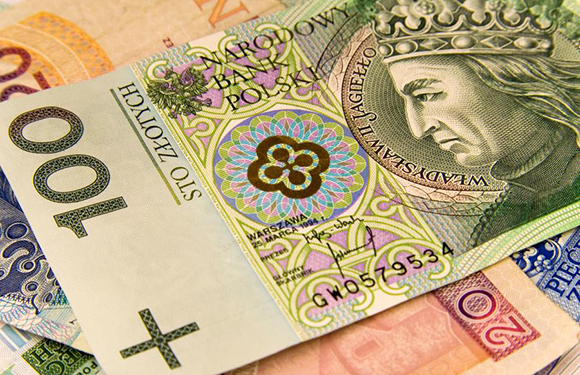
- Coins: 1gr, 2gr, 5gr, 10gr, 20gr, 50 gr, 1zł, 2zł, 5zł.
- Banknotes: 10zł, 20zł, 50zł, 100zł, 200zł, 500zł.