The Puerto Rico flag embodies the island’s vibrant character and enduring legacy. It is a vivid declaration of the Puerto Rican ethos woven into its history and forward-looking aspirations. Beyond marking a territory, this emblem narrates the rich tapestry of a resilient, diverse culture deeply connected to its roots.
Flag of Puerto Rico
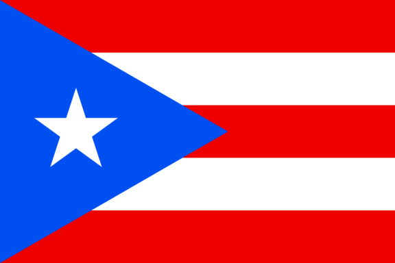
The flag of Puerto Rico has five horizontal stripes and a blue equilateral triangle on the hoist side. Within the triangle is a single, prominent, white, five-pointed star. The flag’s layout, with its stripes and geometric shapes, is recognized universally as a symbol of Puerto Rico’s unique status and political and cultural identity.
The design is a national emblem representing the island’s democratic values and distinct commonwealth position. The solitary star in the triangle is particularly significant, symbolizing Puerto Rico within its broader political and cultural context.
Flag of Puerto Rico: Color Palette
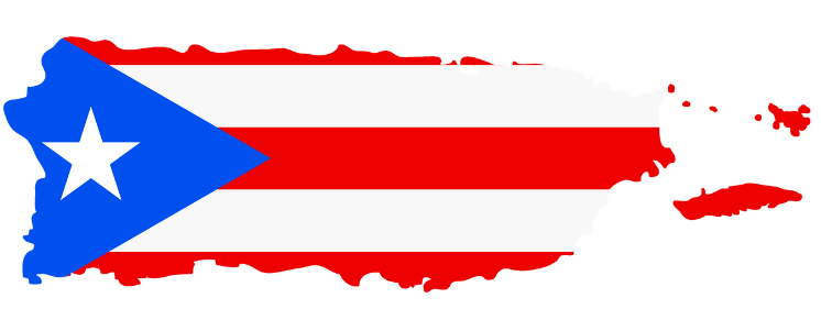
Puerto Rico Flag Map
Puerto Rico Flag Emoji: 🇵🇷
The color palette of the Puerto Rico flag consists of three fundamental hues – red, white, and blue. Each color contributes to the flag’s overall aesthetic and is imbued with deep symbolic meaning, representing various facets of Puerto Rico’s cultural and political landscape.
The upcoming section will delve into the individual significance of each color, uncovering the layers of symbolism they carry within the context of Puerto Rico.
Meaning of Each Color

Red
The red stripes in the Puerto Rico flag have a dual significance. Historically, they represent the blood shed by warriors in the struggle for freedom and independence.
This color reflects the courage and valor of those who fought for the island’s autonomy. Culturally, red symbolizes the vibrancy and dynamic spirit of the Puerto Rican people, encapsulating their resilience and determination.
White
The white stripes and the white star on the flag carry meanings of liberty, victory, and peace. These elements signify the desire and achievement of the people for freedom and their triumph over challenges.
White is also associated with human rights and the freedom of the individual, reflecting the democratic values held by the island. In a broader sense, white symbolizes purity and the desire for a peaceful and prosperous future.
Blue
The blue triangle represents the sky and coastal waters of Puerto Rico, highlighting the island’s beautiful natural scenery and its geographical location.
The three sides of the triangle symbolize the three branches of the government: legislative, executive, and judicial, underscoring the island’s governance structure. Blue is also indicative of stability and trust, key elements in the political and social structure of Puerto Rico.
Puerto Rico’s Coat of Arms
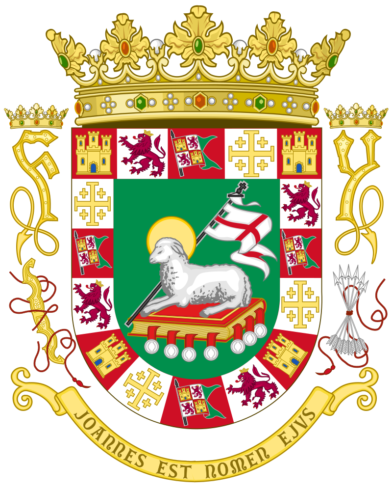
The Coat of Arms of Puerto Rico is historically and culturally significant. First granted by the Spanish Crown in 1511, it is the oldest heraldic achievement in the Americas.
The current version of the Coat of Arms, officially re-adopted by the Commonwealth of Puerto Rico in 1976, contains several symbolic elements:
- Green Background: The green background symbolizes the island’s lush vegetation and stands for hope and courtesy.
- Lamb of God: The lamb, a symbol of peace, purity, humility, and integrity, is a central figure in the Coat of Arms. It holds a white flag with a red cross, representing a truce or the knowledge to cease fighting.
- Bordure with Castles and Lions: The border of the shield features 16 symbols, including castles and lions. The castles represent the Kingdom of Castile, and the lions symbolize the Kingdom of León. These elements signify these kingdoms’ unity and influence on Puerto Rican history.
- F and Y Symbols: To the right of the shield is an “F” for Ferdinand, and to the left, a “Y” for Isabella, the Catholic monarchs of the Spanish Empire during the discovery of Puerto Rico.
- Motto: The Latin motto, “Joannes Est Nomen Ejus,” translates to “John is his name,” referring to St. John the Baptist.
The Coat of Arms encapsulates the diverse influences that shaped Puerto Rico, including its Spanish colonial past, Christian heritage, and natural beauty.
Historical Evolution and the Meaning Behind Changes
The flag of Puerto Rico has experienced a dynamic evolution, closely mirroring the island’s political and cultural journey.
Initially conceived in 1895 by Puerto Rican revolutionaries in solidarity with Cuba’s independence struggle, the design mirrored the Cuban flag with inverted colors. This early version, crafted during the island’s Spanish colonial era, symbolized resistance and national identity.
Following the Spanish-American War and the subsequent U.S. governance, the flag’s usage was initially discouraged and seen as a symbol of defiance.
However, the flag was officially adopted in 1952, coinciding with Puerto Rico’s transition to a Commonwealth. This change marked a significant moment, promoting Puerto Rican identity within the new political framework.
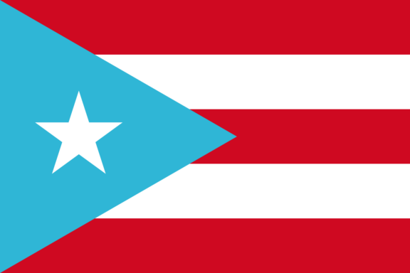
Over the years, the flag has seen variations, particularly in the shade of blue used in the triangle, fluctuating between a light blue, reminiscent of the earlier Grito de Lares flag, and a darker shade akin to the U.S. flag. These changes subtly reflect the island’s evolving relationship with the United States.
The flag’s evolution from a revolutionary emblem to a recognized symbol of Commonwealth status encapsulates Puerto Rico’s complex and nuanced history.
Overall Symbolic Meaning of the Flag
The flag of Puerto Rico stands as a powerful emblem of the island’s enduring spirit and unique political and cultural journey. Beyond its elements, the flag encapsulates the strength and pride of the Puerto Rican people.
It serves as a vivid reminder of the island’s struggles and achievements while symbolizing its aspirations and character within the broader context of its relationship with the United States.
Similar Flags to the Flag of Puerto Rico
The flag of Puerto Rico shares similarities with a few other flags, primarily due to shared historical contexts or similar design inspirations:
Cuban Flag
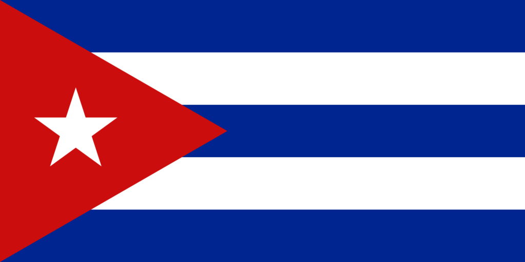
The most direct resemblance is with the Cuban flag. Both flags feature a similar layout of stripes and a star within a triangle.
This design similarity stems from historical solidarity, as the Puerto Rican flag was intentionally modeled after the Cuban flag to express mutual support in their struggles for independence from Spain.
Chilean Flag
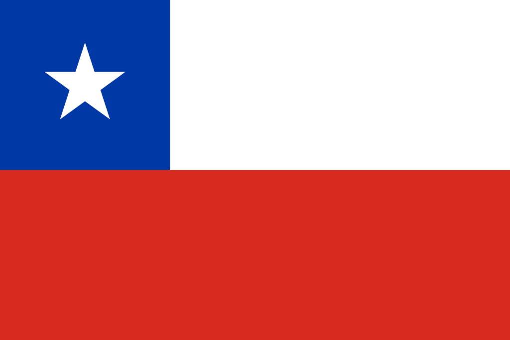
Chile’s flag resembles Puerto Rico’s flag, particularly with the lone star on a blue field. However, the Chilean flag has a different stripe configuration.
The resemblance here is more in using common symbolic elements, like the star representing independence and the blue field symbolizing the sky.
Costa Rican Flag
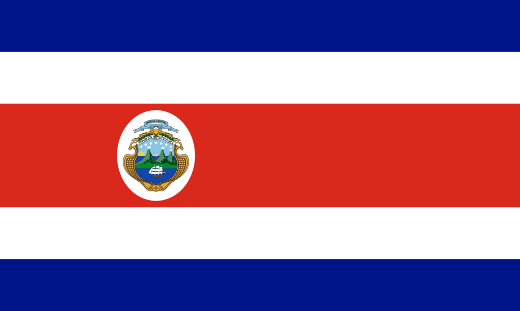
The flag of Costa Rica shares the color scheme of red, white, and blue with Puerto Rico’s flag. While the design is different, with Costa Rica featuring horizontal stripes and a coat of arms, these colors reflect common democratic and liberty-oriented values often found in national symbols across the Americas.
Final Thoughts
The flag of Puerto Rico stands as a vibrant emblem of the island’s unique heritage, distinctively marking its place in the global flags. It holds profound significance, a deep sense of significance, and the harmony and pride of Puerto Ricans.
Image Sources and Copyright Information
- Puerto Rican Flag on Beach at Sunset: © Vania Nettleford/Shutterstock