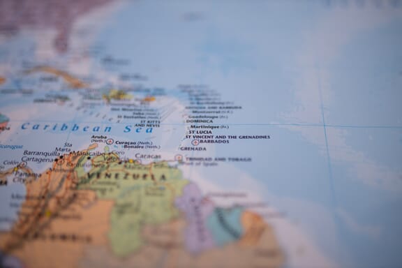
Saint Vincent and the Grenadines is located in the Caribbean region at latitude 12.984305 and longitude -61.287228 and is part of the North American continent.
The DMS coordinates for the center of the country are:
- 12° 59' 3.50'' N
- 61° 17' 14.02'' W
You can see the location of Saint Vincent and the Grenadines on the world map below:
The country has no neighboring countries/land borders.
Maritime Borders
Saint Vincent and the Grenadines borders with the Caribbean Sea.
Saint Vincent and the Grenadines Related Content
- Caribbean Islands Map with Countries, Sovereignty, and Capitals
- The World’s Least Known and Least Visited Countries
- The World’s Smallest Countries
Saint Vincent and the Grenadines Key Facts
| Country | Saint Vincent and the Grenadines |
| Coordinates | Latitude: 12.984305 Longitude: -61.287228 |
| Country Codes | Alpha 2: VC Alpha 3: VCT |
| Country Flag Emoji | 🇻🇨 |
| Int. Phone Prefix | +1-784 |
| Capital city | Kingstown |
| Continent Subcontinent | North America Caribbean |
| Country Area | 389 sq km |
| Population 2021 | 111,269 World Rank: 181 |
| Median Age | 33 |
| Life expectancy | 69.6 |
| Major languages | English |
| UTC/GMT Time | Number of time zones: 1
|
| Internet TLD | .vc |
| Biggest Airport | Argyle International Airport (SVD) |
| Average temperature | 26.80 °C 80.24 °F |
| Administrative Divisions | 6 parishes |
| Political system | Parliamentary democracy |
Saint Vincent and the Grenadines Economy Facts
| World Bank Income Group | Upper middle income |
| World Bank Region | Latin America & Caribbean |
| Currency | Eastern Caribbean Dollar (XCD) |
| GDP in 2020 | $0.9 (billions of USD) World Rank: 181 |
| GDP per capita in 2020 | $7,861 World Rank: 76 |
| Major Industries / Economic Sectors | Tourism, manufacturing, agriculture, energy |
| Top 5 Import Countries | United States, China, Japan, Brazil, South Korea |
| Top 5 Export Countries | United States, China, Japan, Brazil, South Korea |
Biggest Cities in Saint Vincent and the Grenadines
Here are the largest cities in Saint Vincent and the Grenadines based on 2021 data:
| City | Population |
|---|
| Kingstown | 25,000 |