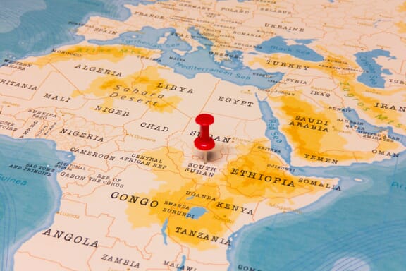
South Sudan is located in the Southern Africa region at latitude 7.730724 and longitude 30.063535 and is part of the African continent.
The DMS coordinates for the center of the country are:
- 6.8770° N
- 31.3070° E
You can see the location of South Sudan on the world map below:
South Sudan Neighboring Countries
The neighboring countries of South Sudan (SS) are:
- Central African Republic (CF)
- Congo (the Democratic Republic of the) (CD)
- Ethiopia (ET)
- Kenya (KE)
- Sudan (SD)
- Uganda (UG)
South Sudan is a landlocked country, which means it does not have direct access to the open ocean.
South Sudan Related Content
South Sudan Key Facts
| Country | South Sudan |
| Coordinates | Latitude: 7.730724 Longitude: 30.063535 |
| Country Codes | Alpha 2: SS Alpha 3: SSD |
| Country Flag Emoji | 🇸🇸 |
| Int. Phone Prefix | +211 |
| Capital city | Juba |
| Continent Subcontinent | Africa Southern Africa |
| Country Area | 644,329 sq km |
| Population 2021 | 11,381,377 World Rank: 82 |
| Median Age | 16.1 |
| Life expectancy | 55 |
| Major languages | English (official), Arabic (includes Juba and Sudanese variants), regional languages include Dinka, Nuer, Bari, Zande, Shilluk |
| UTC/GMT Time | Number of time zones: 1
|
| Internet TLD | .ss |
| Biggest Airport | Juba International Airport (JUB) |
| Average temperature | 27.00 °C 80.60 °F |
| Administrative Divisions | 10 states |
| Political system | Presidential representative democratic republic |
South Sudan Economy Facts
| World Bank Income Group | Low income |
| World Bank Region | Sub-Saharan Africa |
| Currency | South Sudanese Pound (SSP) |
| GDP in 2020 | $13.4 (billions of USD) World Rank: 132 |
| GDP per capita in 2020 | $600 World Rank: 185 |
| Major Industries / Economic Sectors | Oil and gas, manufacturing, agriculture, energy |
| Top 5 Import Countries | China, United Arab Emirates, Kenya, India, Uganda |
| Top 5 Export Countries | China, United Arab Emirates, Kenya, India, Uganda |
Biggest Cities in South Sudan
Here are the largest cities in South Sudan based on 2021 data:
| City | Population |
|---|
| Juba | 372,410 | Bor | 315,351 | Yei | 185,000 | Wau | 163,442 | Malakal | 147,450 | Gogrial | 50,065 | Aweil | 46,705 | Yambio | 40,382 | Rumbek | 32,083 | Torit | 17,957 |
Map of South Sudan with the Largest Cities
Other Countries in the Southern Africa Region
- Where are the Seychelles?
- Where is Angola?
- Where is Botswana?
- Where is Burundi?
- Where is Eswatini (formerly named Swaziland)?
- Where is Kenya?
- Where is Lesotho?
- Where is Madagascar?
- Where is Malawi?
- Where is Mauritius?
- Where is Mozambique?
- Where is Namibia?
- Where is Rwanda?
- Where is South Africa?
- Where is the Congo?
- Where is Uganda?
- Where is Zambia?
- Where is Zimbabwe?