Eswatini is located in the Southern Africa region at latitude -26.522503 and longitude 31.465866 and is part of the African continent.
The DMS coordinates for the center of the country are:
- 26° 31' 21.01'' S
- 31° 27' 57.12'' E
You can see the location of Eswatini on the world map below:
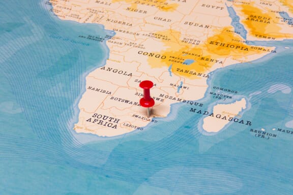
Eswatini Neighboring Countries
The neighboring countries of Eswatini (SZ) are:
- Mozambique (MZ)
- South Africa (ZA)
Eswatini is a landlocked country, which means it does not have direct access to the open ocean.
Eswatini Related Content
Eswatini Key Facts
| Country | Eswatini |
| Coordinates | Latitude: -26.522503 Longitude: 31.465866 |
| Country Codes | Alpha 2: SZ Alpha 3: SWZ |
| Country Flag Emoji | 🇸🇿 |
| Int. Phone Prefix | +268 |
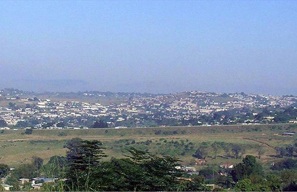
| Capital city | Mbabane |
| Continent Subcontinent | Africa Southern Africa |
| Country Area | 17,364 sq km |
| Population 2021 | 1,172,369 World Rank: 156 |
| Median Age | 21.5 |
| Life expectancy | 57.1 |
| Major languages | English (official, used for government business), siSwati (official) |
| UTC/GMT Time | Number of time zones: 1
|
| Internet TLD | .sz |
| Biggest Airport | Matsapha Airport Manzini (MTS) |
| Average temperature | 21.40 °C 70.52 °F |
| Administrative Divisions | 4 regions |
| Political system | Monarchy |
Eswatini Economy Facts
| World Bank Income Group | Lower middle income |
| World Bank Region | Sub-Saharan Africa |
| Currency | Lilangeni (SZL) |
| GDP in 2020 | $4 (billions of USD) World Rank: 160 |
| GDP per capita in 2020 | $3,435 World Rank: 126 |
| Major Industries / Economic Sectors | Sugar, wood pulp, soft drinks, textiles |
| Top 5 Import Countries | South Africa, United States, China, Germany, Japan |
| Top 5 Export Countries | South Africa, United States, Mozambique, Germany, United Kingdom |
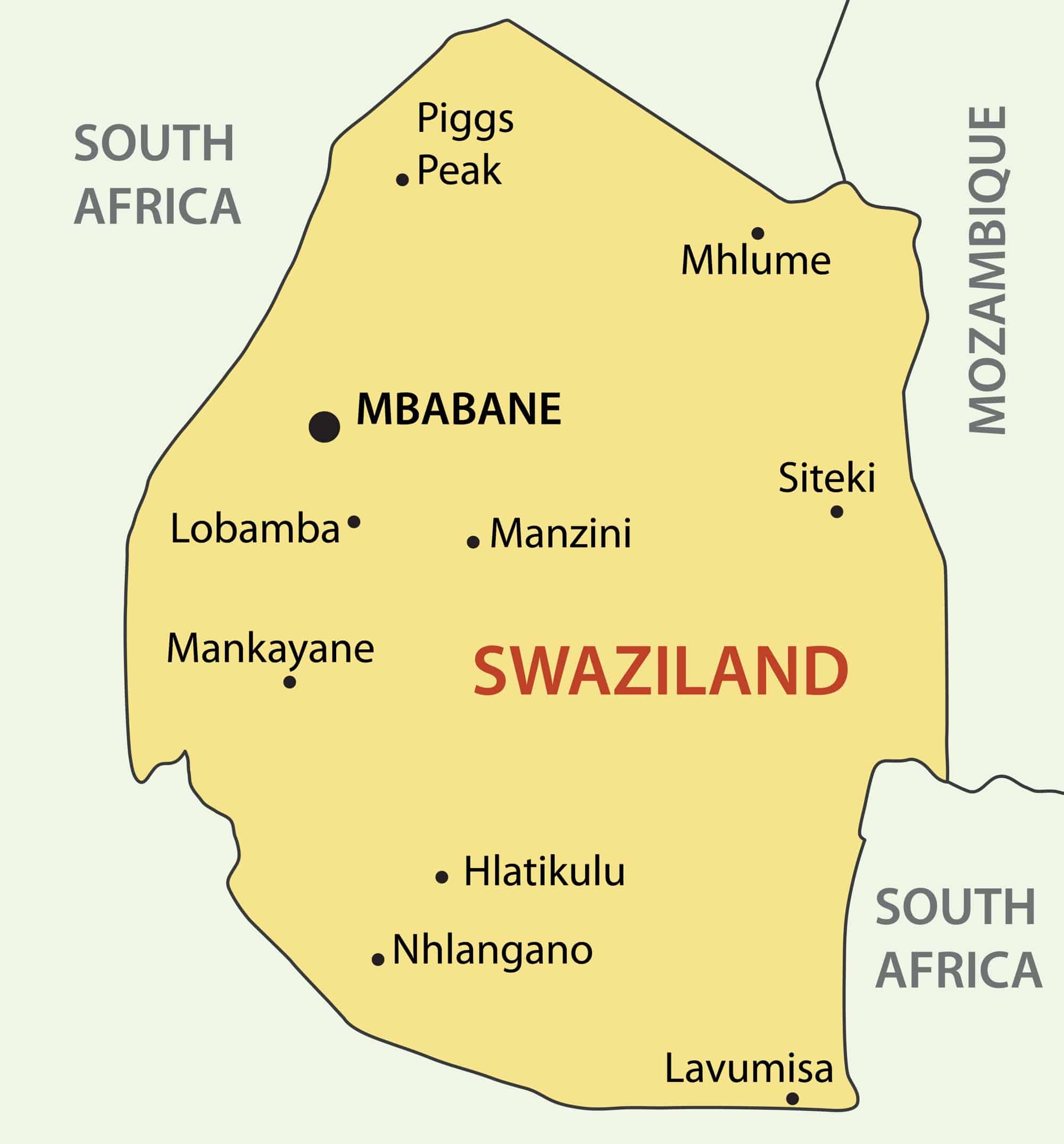
Biggest Cities in Eswatini
Here are the largest cities in Eswatini based on 2021 data:
| City | Population |
|---|
| Manzini | 110,508 | Mbabane | 94,874 | Mhlume | 7,761 | Siteki | 6,152 | Lobamba | 5,800 | Piggs Peak | 5,750 | Lavumisa | 3,695 | Hlatikulu | 2,748 |
Map of Eswatini with the Largest Cities
Other Countries in the Southern Africa Region
- Where are the Seychelles?
- Where is Angola?
- Where is Botswana?
- Where is Burundi?
- Where is Kenya?
- Where is Lesotho?
- Where is Madagascar?
- Where is Malawi?
- Where is Mauritius?
- Where is Mozambique?
- Where is Namibia?
- Where is Rwanda?
- Where is South Africa?
- Where is South Sudan?
- Where is the Congo?
- Where is Uganda?
- Where is Zambia?
- Where is Zimbabwe?
Map and Regions of Eswatini
Swaziland, or the Kingdom of Eswatini, is a small country on the continent of Africa.
It is an entirely landlocked nation, sharing most of its borders with South Africa. To the northeast, it borders Mozambique.
Swaziland is one of the smallest countries in Africa, with a total area of 17,364 km2. The population is 1.16 million as of 2020.
The current king is Mswati III. He has held power since 1986.
Eswatini Map Regions
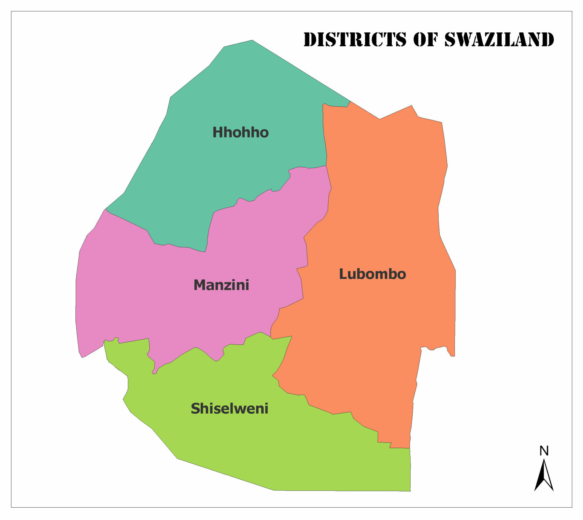
The map of Eswatini is divided into four regions:
- Hhohho
- Lubombo
- Manzini
- Shiselweni
Each region is further divided into administrative units called tinkhundla, which are then split further into imiphakatsi.
Each of the tinkhundla elects a representative in the House of Assembly.
Hhohho
In the northwest is the Hhohho region, which King Mswati II established in 1903. The territory is 3,625 km2, and it has a population of 320,651. It has the smallest area of the regions of Swaziland.
Its borders include the Manzini region in the southwest, Lubombo in the southeast, and South Africa to the north and west.
The capital city, Mbabane, also serves as the national capital.
Tourism and forestry are the two primary economic industries that support this region of Swaziland. The hiking trails at the Malolotja Nature Preserve and the Umhlanga Festival are top-rated attractions in the area.
Hhohho has 14 tinkhundla: Hhukwini, Lobamba, Madlangempisi, Maphalaleni, Mayiwane, Mbabane East, Mbabane West, Mhlangtane, Motjane, Ndzingeni, Nkhaba, Ntfonjeni, Piggs Peak, and Timpisini.
Manzini
The western part of Swaziland is called the Manzini Region, which is 4,093 km2 and home to 355,945 people. Hhohho borders to the north, Lubombo to the east, Shiselweni to the south, and South Africa to the west.
The capital city, Manzini, is a hub for industry and agriculture. The primary processing plants and manufacturers and an international airport are all close to the city center.
This region of Swaziland has 16 tinkhundla: Ekukhanyeni, Hlambanyatsi, Kwaluseni, Lamgabhi, Lobamba Lomdzala, Ludzeludze, Mafutseni, Mahlangatja, Mangcongco, Manzini North, Manzini South, Mkhiweni, Mtfongwaneni, Ngwempisi, Nhlambeni, and Ntondozi.
Lubombo
The easternmost region is Lubombo, with an area of 5,849 km2 and a population of 212,531. It is the largest of the regions but has the second-least number of residents.
Lubombo borders all three other regions along the western edge– Hhohho is to the northwest, Manzini to the central west, and Shiselweni to the southwest.
That capital is Siteki.
Lubombo has 11 tinkhundla: Dvokodvweni, Hlane, Lomahasha, Lubuli, Lugongolweni, Matsanjemi North, Mhlume, Mpholonjeni, Nkilongo, Siphofaneni, and Sithobela.
Shiselweni
The southern Swaziland region of Shiselweni has the lowest population, at 204,111, and is the second-smallest in area, at 3,786 km2.
Both Manzini and Lubombo border to the north, with South Africa surrounding the remaining edges.
The capital city is Nhlangano.
Shiselweni has 14 tinkhundla: Gege, Hosea, Kubuta, Maseyisini, Matsanjeni South, Mtsambama, Ngudzeni, Nkwene, Sandleni, Shiselweni I, Shiselweni II, Sigwe, Somntongo, and Zombodze.
Government
As the last monarchy in Africa, Swaziland is the only African nation with a king as the head of state. King Mswati III has held the position since April 25, 1986.
The king, or Ngwenyama, rules alongside his mother, the Ndlovukati. The former rules Swaziland, while the latter controls all national rituals. She may also serve in place of her son, should they die during their rule.
Kings are polygamous, with their first two wives chosen by his council. One wife must come from the Matsebula tribe, and the other must come from the Motsa tribe. Any sons born to these wives are not allowed to become king.
Traditionally, kings do not officially marry their wives until they become pregnant and prove they can bear children. Once married, though, a wife can serve as the Ndlovukati if the king’s mother dies.
The position comes with complete power over all three branches of government, but most decision-making is done through the House of Assembly, which has 82 members. Of those 82 members, 55 are elected, ten are appointed by the king, and four are women, with one coming from each of Swaziland’s regions.
There is also a Senate with 30 members, ten of whom are appointed by the House. The remaining members are set by the king, but at least ten of them must be women.
Eswatini: Geography
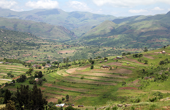
There are four distinct geographic zones within Swaziland based on the area’s elevation: Highveld, Middleveld, the Lubombo zone, and Lowveld.
The Highveld zone is dominated by granite and sandstone mountains. At the summit of Mt. Buleumbu, the highest point is 1,862 meters tall. Around one-third of Swaziland is highveld.
One-fourth of the country is Middleveld, with an altitude between 610-760 meters. Most of the population has settled in this area because of the fertile soil.
Lowveld lands cover 40% of Swaziland, where the elevation is between 152-305 meters. It is made up of savanna and grasslands.
Finally, the Lubombo zone occupies 5% of the nation. It is a sharp transition from the lowlands to soaring mountain summits and plunging gorges.
Language
The official languages of Eswatini include Swazi and English.
The Swazi/Eswatini language is also native to parts of South Africa, Lesotho, and Mozambique.
Economy & Currency
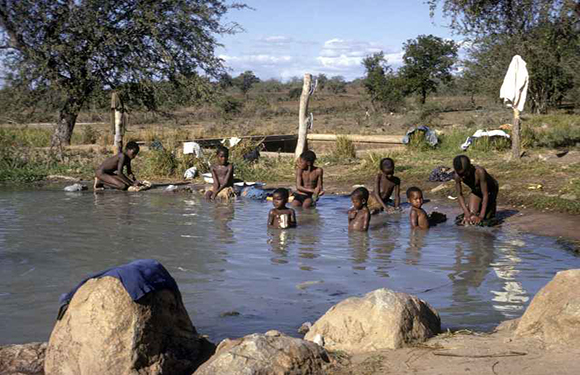
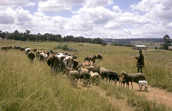
Most of Eswatini’s economy is based on subsistence farming, with families selling their surplus goods to other families in a marketplace setting.
Farmers raise corn, beans, peas, cattle, and goats. Sugarcane, timber, citrus, and cotton are key cash crops.
Their currency is the Lilangeni, which, like the U.S. dollar, is based on the 100-cent system. They also accept the South African rand.
Religion
It is estimated that 90% of Eswatini residents identify as some sect of Christianity, such as Protestant, Anglican, Indigenous African, African Zionist, and Roman Catholic, 2% practice Islam, and the remaining 8% either don’t identify as religious or practice traditional African religions.
Tourism
Following an increase in international visitors in the 70s and 80s, the Eswatini tourism industry has declined since the end of the Mozambican Civil War.
To reinvigorate interest in the small nation, Mozambique, South Africa, and Eswatini signed the Lubombo Route agreement, allowing travelers to visit all three countries without requiring multiple visas.