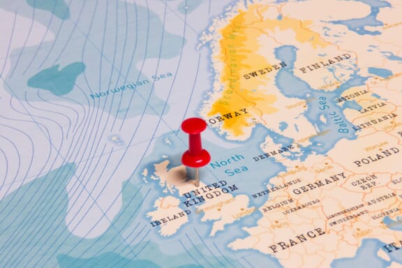
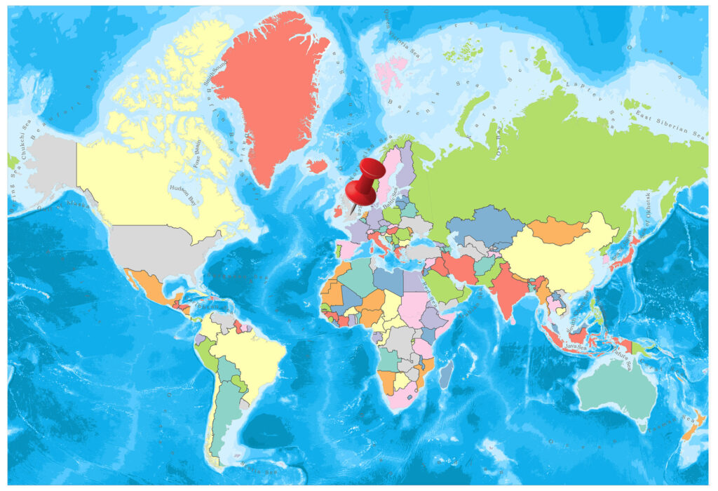
United Kingdom is located in the Northern Europe region at latitude 55.378051 and longitude -3.435973 and is part of the European continent.
The DMS coordinates for the center of the country are:
- 55° 22' 40.98'' N
- 3° 26' 9.50'' W
You can see the location of United Kingdom on the world map below:
United Kingdom Neighboring Countries
The neighboring countries of United Kingdom (GB) are:
- Ireland (IE)
Maritime Borders
United Kingdom borders with the North Sea, Atlantic Ocean, and the Irish Sea.
United Kingdom of Great Britain and Northern Ireland (the) Related Content
- The United Kingdom Flag Map and Meaning
- What is the Capital of the United Kingdom?
- Regions of England Map and Tourist Attractions
- Counties of England (Map and Facts)
- 20 Reasons to Visit England
United Kingdom Key Facts
| Country | United Kingdom of Great Britain and Northern Ireland (the) |
| Coordinates | Latitude: 55.378051 Longitude: -3.435973 |
| Country Codes | Alpha 2: GB Alpha 3: GBR |
| Country Flag Emoji | 🇬🇧 |
| Int. Phone Prefix | +44 |
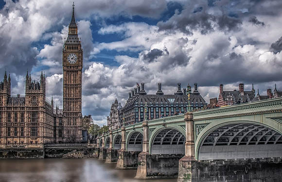
| Capital city | London |
| Continent Subcontinent | Europe Northern Europe |
| Country Area | 243,610 sq km |
| Population 2021 | 67,326,569 World Rank: 22 |
| Median Age | 39.6 |
| Life expectancy | 80.7 |
| Major languages | English |
| UTC/GMT Time | Number of time zones: 9
|
| Internet TLD | .gb .uk |
| Biggest Airport | Heathrow Airport (London) |
| Average temperature | 13.50 °C 56.30 °F |
| Administrative Divisions | 3 countries 1 province 32 council areas 27 two-tier counties 11 districts 77 unitary authorities 36 metropolitan districts 32 London boroughs 1 city corporation |
| Political system | Parliamentary democracy |
United Kingdom Economy Facts
| World Bank Income Group | High income |
| World Bank Region | Europe & Central Asia |
| Currency | Pound Sterling (GBP) |
| GDP in 2020 | $2756.9 (billions of USD) World Rank: 5 |
| GDP per capita in 2020 | $41,098 World Rank: 23 |
| Major Industries / Economic Sectors | Manufacturing, services, agriculture, energy |
| Top 5 Import Countries | Germany, China, United States, Netherlands, Belgium |
| Top 5 Export Countries | United States, Germany, Netherlands, China, France |
Biggest Cities in United Kingdom
Here are the largest cities in United Kingdom based on 2021 data:
| City | Population |
|---|
| London | 11,120,000 | Birmingham | 1,137,100 | Leeds | 789,194 | Glasgow | 626,410 | Bristol | 567,111 | Manchester | 547,627 | Sheffield | 518,090 | Liverpool | 513,441 | Edinburgh | 488,050 | Leicester | 464,395 |
Map of United Kingdom with the Largest Cities
Other Countries in the Northern Europe Region
United Kingdom Political Map: Countries and Counties of the United Kingdom
There are a total of four countries in the United Kingdom.
These countries are Scotland, North Ireland, Wales and England.
Countries of the UK Map
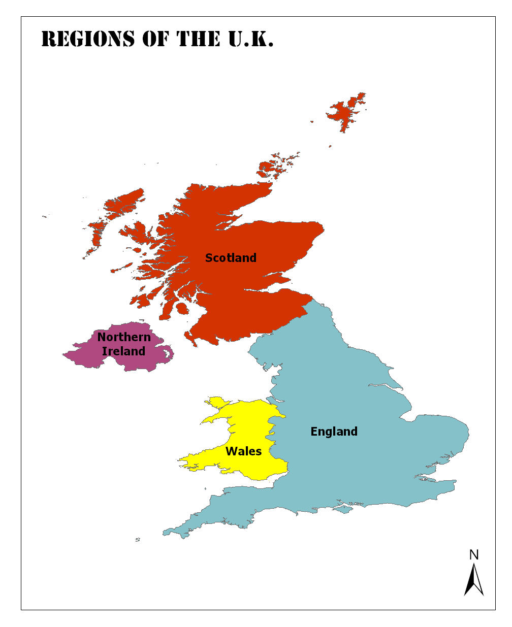
Countries of the United Kingdom
In the United Kingdom, a unitary sovereign state; Wales, Scotland and Northern Ireland acquired a form of autonomy within a process.
Although the UK Parliament and the Government of the United Kingdom maintain the governance of the countries within the scope of the specified issues, most of their internal affairs are governed by the Northern Ireland Parliament, the Scottish Parliament and the National Assembly of Wales.
Furthermore, England is the largest and most populous country in the UK, and the administration is fully under the responsibility of the UK Parliament in London.
The capitals and population of the countries linked to the United Kingdom are as follows:
England
The population is 54,786,300, and the capital is London. The largest and most central of the four countries that constitute the United Kingdom. It is located in the western part of Europe, on the Great Britain. The people of England are called the English.
Northern Ireland
Its population is 1,851,600, and the capital city is Belfast. The most important lakes of the country are Lough Neagh, the largest freshwater source in the British Isles, with an area of 392 km², and the other important lake is Lough Erne in the Fermanagh Count.
Furthermore, the largest island in Northern Ireland is the island of Rathlin on the coast of Antrim. Moreover, the Sperrin Mountains is a region where the country’s gold needs are met. Granite is also found around the Mourne Mountains. The highest point of the country is Slieve Donard, 848 meters above the Mourne Mountains.
Scotland
Its population is 5,373,000, and the capital is Edinburgh. It is the second UK country with the most population after England.
Scotland is the northernmost island of the British Isle, covering an area of 77,900 square kilometers and approximately 32,3 percent of the total surface area of the United Kingdom.
To the south of the UK neighboring country is the North Sea to the east and the Atlantic Ocean to the west.
Wales
Its population is 3,099,100, and the capital city is Cardiff. Wales is on the west side of the British Isle. Moreover, it has an area of 20,779 km². It has a coastline of 230 miles.
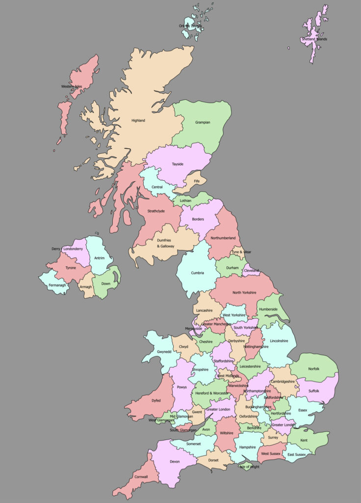
United Kingdom Political Map (with Counties)
Also read:
United Kingdom: Overview
- Population: 67,782,742 (March 2020)
- Capital: London, Edinburgh, Cardif, Belfast
- Language: English
- Bordering Countries: Republic of Ireland
- Land Area: 130,395 square miles
- Coastline: 12,400km [6]
- Highest Point: Ben Nevis at 1344m
- Latitude & Longitude: 55.3781 Degrees north, 3.4360 Degrees west
England is the largest and most crowded of the four countries that make up the United Kingdom.
The country that occupies the vast majority of Great Britain is located in the west of Europe. England is called Angleland in history. The country takes its name from Anglus, the Germanic people who invaded the island with the Saxons in the 5th century.
Beginning by the historic Celts, the UK is awe-inspiring with its villages, its monuments, and its cathedrals, which come to life till day. The UK is one of the places where millions of people want to live in language, literature, schools, art, music, architecture and prosperity.
Geography
The United Kingdom is primarily split into four separate countries as we can see from the political map of the United Kingdom – England, Wales, Scotland, and Northern Ireland.
England is located in the central and southern parts of the UK. Wales is located in the south west and shares a land border with England. Scotland is located in the north and shares a land border with England. Finally, Northern Ireland is located to the west, across the Irish Sea, and shares a land border with the Republic of Ireland. As an Island, the British Isles is bordered by four different seas:
- English Channel
- North Sea
- Irish Sea
- Atlantic Ocean
In terms of physical land geography, the UK is predominantly formed from rolling hills [4]. It has several mountain ranges including Ben Nevis and Snowdon. Furthermore, it has some large natural lakes including Lough Neagh, and Windamere in the Lake District. As an Island, the British Isles also have a varied and rugged coastline.
Most of England is covered with low hills. However, as we head north, the mountainous area is increasing. The Pennine Mountains, known as the backbone of Britain, divide the country from north to south. Scafell Pike Summit with a height of 978 m, the highest point in the country that dates back to about 300 million years ago.
Having the Irish Sea, North Sea, and Atlantic Ocean shores, England is considered to be the major port of London, Liverpool, and Newcastle ports.
Britain’s climate has a variable structure. In the country where the Gulf Stream hot water currents affect the climate considerably, the winters are soft and the summers are cool. In the natural habitats in the country, mostly small animals mostly live in small numbers of large mammals. On the other hand, the country is home to many bird species.
Governance
Great Britain is accepted as the parliamentary majority. Although the state is officially a monarchy, the ruling is in the hands of the prime minister who is in charge of the parliament.
England is a parliamentary monarchy of the United Kingdom, where Wales, Scotland and Northern Ireland are member states. It is based on a non-written constitution; the constitution is not a single document.
Political institutions have been born from laws and customs laws that have been in force for centuries with the relations between monarchy, government, and parliament.
In this respect, all power is ultimately based on a legislative body called parliament. Until recently, the United Kingdom was ruled by the capital London, under a central structure.
Now every country, except England, has its parliament, which has the authority to make independent decisions in certain areas.
Monarchy and Parliament
The ruler is the president of the kingdom and theoretically combines the powers of executive, legislative and judicial personality. But in practice, the powers are as separate as in every democracy, and since the centuries, according to customary law, the monarchy has only played a limited political role.
Today, the position of the throne, which is the symbol of the historical continuity of the country, is limited to ceremonial functions. The president of the state usually reads the annual “Message of the Queen” prepared by the government.
Climate
The UK climate, which is heavily depressed by ocean influences, is highly variable. Winter is generally soft and summers are cool. The golf stream hot water stream has a great influence on the climate of the islands. Despite being in the north latitude, the average temperature in winter is 7 °C.
In winter, the western parts of Britain are more humid, windy and warm. The eastern regions are affected by cold and dry winds coming from Europe. The average temperature in summer is 27 °C in the south and 15 °C in the north.
Religion
The main religion in the United Kingdom is Christianity. However, the United Kingdom is a very religious society where other religions are widely welcomed and accepted, and different religions have a free atmosphere without expressing themselves.
Industry and Tourism
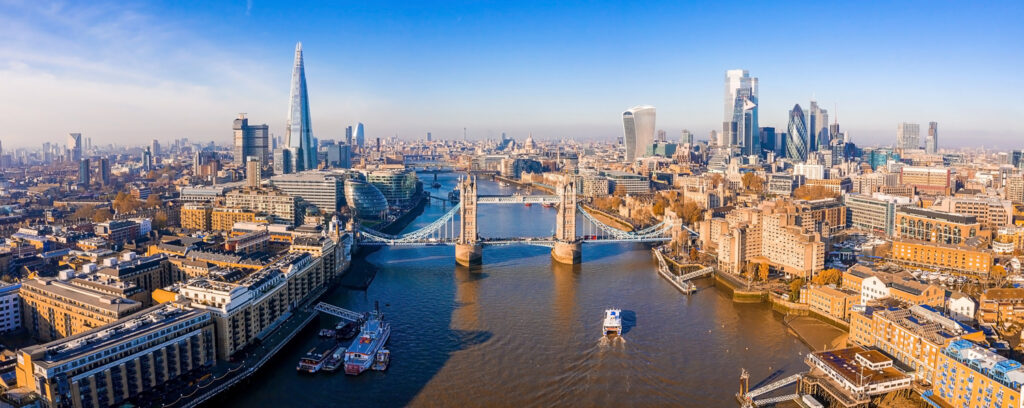
The United Kingdom is one of the world’s leading commercial centers and is the country that attracts the most investment in Europe. London is the financial center of the world. The United Kingdom is one of the top ten producer countries in the world.
It has the world’s largest industries such as: Health, Information and Communication Technologies and Creative Industries.
Maritime is an important part of UK life, as it is in England’s history. It has one of the largest marine trade fleets in the world. The UK maritime trade fleet has about 10% of the world’s ships.
Art
With its rich cultural and historical heritage, England has some of the most famous museums in the world, art galleries, and artistic sites where you can visit historical artifacts. You can also closely follow world-renowned musicals, cinemas, theaters, concerts, operas, ballet and dance shows and culture and art life.
The British Museum in London, the National Gallery, the Royal Scottish Museum in Edinburgh, Cardiff in Belfast The International Arena and the Ulster Museum are just a few of the world’s famous museums. The gates of England have been open to people from different languages for centuries, and they welcome all kinds of beliefs and thoughts with tolerance. You can be part of this rich culture without feeling alienated.
Sports
The English are a society that cares about the spore in general terms. Schools also include sporting activities in social activity programs. The magnificent beauty and large English parks are the most natural sports fields. Apart from that, it is possible to join sports complexes which have many sports facilities together at a reasonable price.
Important Sites
The United Kingdom of Great Britain has 32 UNESCO World Heritage Sites including 27 cultural sites, 4 natural sites, and one mixed site:
- The Tower of London (1988)
- Durham Castle and Cathedral (1986)
- City of Bath (1987)
- Blenheim Palace (1987)
- Stonehenge, Avebury and Associated Sites (1986)
- Henderson Island (1988)
- St Kilda (1986)
- Royal Botanical Gardens, Kew
- New Lanark (2001)
The UK has a rich cultural heritage spanning back into the Stone Age and beyond. Furthemore, it has a great range of natural landmarks and national parks.
Transport Systems
The United Kingdom has an extensive transport system despite its relatively small size as you can see from the United Kingdom map. Main methods of transport include road and rail [5].
Road – the UK has a well-developed motorway system that connects major cities. For example, the M1 stretches from Leeds in the north, through to London in the south. Roads are maintained by the Highways Agency, and the Department for Transport.
Rail – Railways in the UK were once some of the most extensive and efficient in the world. In recent decades, rail travel has declined, but the UK still operates a host of major rail lines. Popular railway lines include the South Western Main Line, South Wales Main Line, and the West Coast Main Line. The UK also has several major airports facilitating millions of passengers per year.
Main international airports include London Heathrow, London Gatwick, Manchester, Edinburgh, and Birmingham.
Famous Tourist Attractions
The United Kingdom has some of the most famous tourist attractions in the world [3]. Many of these attractions are located within the capital of England – London. There is a plethora of sites, and parks in other regions too however:
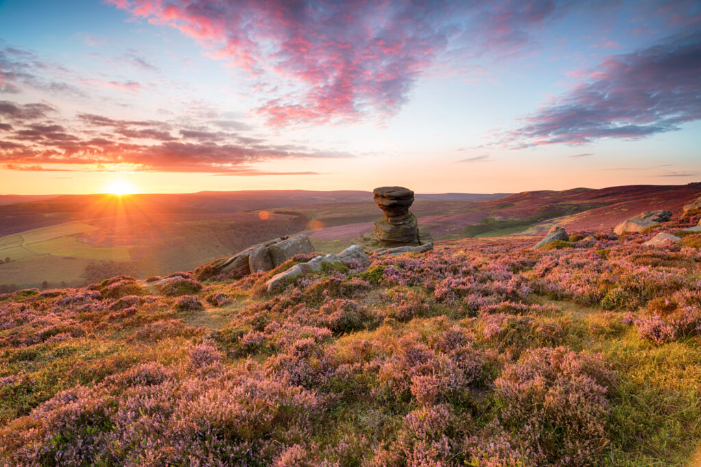
- The Peak District National Park
- Stonehenge
- Hadrian’s Wall
- Edinburgh Castle
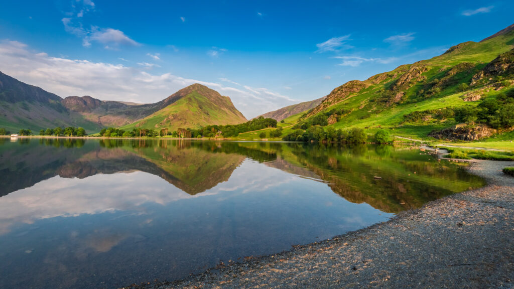
- The Lake District
- The Tower of London
- Tower Bridge
- Natural History Museum
- Snowdon National Park
- The Giant’s Causeway
National Parks like the Peak District and Lake District are renowned for their natural beauty – they have captured the imagination of poets and writers. Furthermore, the United Kingdom has a host of ancient historical sites like Stonehenge.
Whether you want to explore the history and culture of London, or travel into the rural areas of the UK, there is something for everyone.
Currency
The official currency of the United Kingdom is the Pound Sterling [2]. The main unit of currency is £1 and the subunit is 100 pence. Current coins include 1p, 2p, 5p, 10p, 20p, 50p, £1, and £2. Current banknotes include £5, £10, £20, and £50.
The Pound Sterling is the oldest currency still in continuous usage. Currency distribution and inflation rates are set by the Bank of England (Otherwise known as the Central Bank). Moreover, circulation of new currency is also organized by the Bank of England. The Pound Sterling is considered one of the most important currencies in the world.
Political System & Economy
The United Kingdom is a Constitutional Monarchy that also operates a democratic parliament system. The Head of State is Queen Elizabeth II. Whilst having sovereign power, the Prime Minister and British Government actually have executive power and control the running of the union.
Government is split into two main sections – the House of Lords, and the House of Commons. MPs are elected by the general public, and the party of the Prime Minister is also elected via a general election.
In terms of economy, the United Kingdom is classified as highly developed and has the sixth-largest economy in the world. It’s population has a high quality of life and it has a Human Development Index of 0.920 which is ranked 15th.
The UK is one of the main importers in the world and mainly offers services. It has a large financial sector with many banks operating in London. Main industries include agriculture, construction, manufacturing, mining, and service industries.
United Kingdom FAQs
Which countries are in the UK?
The United Kingdom of Great Britain includes four countries – England, Scotland, Wales, and Northern Ireland. People often assume that the Republic of Ireland is also a part of the UK – it shares a land border with Northern Ireland, but is a separate country and not part of the UK.
What are the 48 Counties of England?
Bedfordshire, Berkshire, City of Bristol, Buckinghamshire, Cambridgeshire, Cheshire, City of London, Cornwall, Cumbria, Derbyshire, Devon, Dorset, Durham, East Riding of Yorkshire, East Sussex, Essex, Gloucestershire, Greater London, Greater Manchester, Hampshire, Herefordshire, Hertfordshire, Isle of Wight, Kent, Lancashire, Leicestershire, Lincolnshire, Merseyside, Norfolk, North Yorkshire, Northamptonshire, Northumberland, Nottinghamshire, Oxfordshire, Rutland, Shropshire, Somerset, South Yorkshire, Staffordshire, Suffolk, Surrey, Tyne and Wear, Warwickshire, West Midlands, West Sussex, West Yorkshire, Wiltshire, Worcestershire.
Is Scotland ruled by England?
No. Scotland is part of the United Kingdom and has a political union with England that was established in 1707. Scotland has a host of MP’s that represent them in Parliament.
Where is the UK in the world political map?
The British Isles are located to the north of France and northwest of Belgium and The Netherlands. The Island is separated from mainland Europe by the North Sea, and the English Channel.
Sources
- https://whc.unesco.org/en/statesparties/gb
- https://www.investopedia.com/articles/forex/11/british-pound-what-every-fx-trader-should-know.asp
- https://www.planetware.com/tourist-attractions/england-eng.htm
- http://projectbritain.com/geography.html
- http://projectbritain.com/transport.html
- https://thecommonwealth.org/our-member-countries/united-kingdom