There are two arctic regions in the northern and southern parts of the world.
Although both regions are similar in temperature, there are significant differences between animal life and survival conditions. As the South Pole has rougher weather conditions, there are no mammals are living in the Antarctica near the South Pole.


What Animal Live in the North Pole?
Here is a list of the animals living on the North Pole:
1. Polar Bear
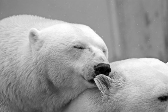
It is known as the white bear because of its color. Polar bear is the biggest carnivorous animal on the land.
Due to its thick fur, the polar bear, unaffected by the pole’s coldness, can move comfortably on land, in water and on ice.
These enormous animals, unfortunately, face extinction because of global warming. Worldwide, the number of poles has decreased by 40% in 14 years and is estimated to be around 20 thousand.
2. Snowy Owl
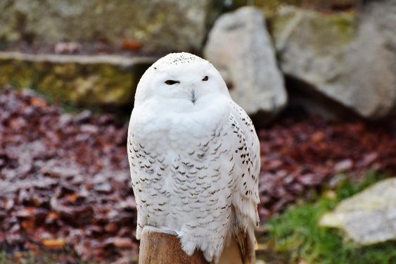
A white bird known for its big yellow eyes. It is fed primarily by eating small mammals and birds, including rodents.
The owls hunt in complete silence. The whole body is covered with soft and thin fur. The fur is a natural silencer during flight.
3. Arctic Fox
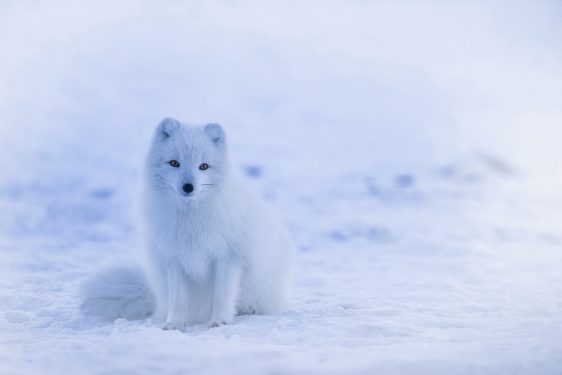
This perfect creature has a lot of pigment in its eyes to protect its eyes against sunlight reflected off snow and ice, and even a double-colored eye is quite common.
The scallops are covered with a thick coat of feathers specific to wild dogs, which is called rabbit foot. Although they come from the same family as the wolves, they love to hang out alone, not as a group.
4. White Whale
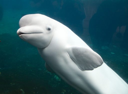
A white whale is basically a slow-moving mammal fed with fish. They can also eat octopus, ink fish, crab, shrimp.
The search for food on the sea floor typically takes place at depths of up to 300 meters, but it can also be submerged at least twice as deep. The colors are completely white. It can extend up to 5 meters and reach up to 1.5 tonnes.
5. Arctic Hare
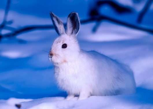
The Arctic Rabbit survives winter conditions with thick fur and heats up in the pits opened in the snow or the soil.
Unlike other rabbits, the Polar Rabbit has shorter ears. It is tall and resistant to cold. The Polar Rabbit can run 60 miles an hour. The predatory species threatening the Polar Rabbit are arctic, pole fox, crust, falcon and snow owl.
6. Lemming
Lemmings are small rodent mammals, similar to rats, who live in the mountains and near the poles of North America and Eurasia.
The number of Lemmings is growing so much between 3-4 years that their food is heavily scarce and they migrate massively all over the center.
7. Musk Ox
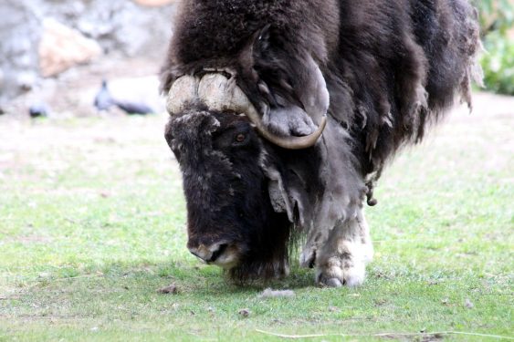
The musk ox takes its name from the pungent smell of a musky goby that radiates from its post.
Musk ox (Ovibos moschatus) is a member of the group of mammals that ruminate like goats, sheep and cattle. They live in Canada’s northern Greenland.
8. Reindeer
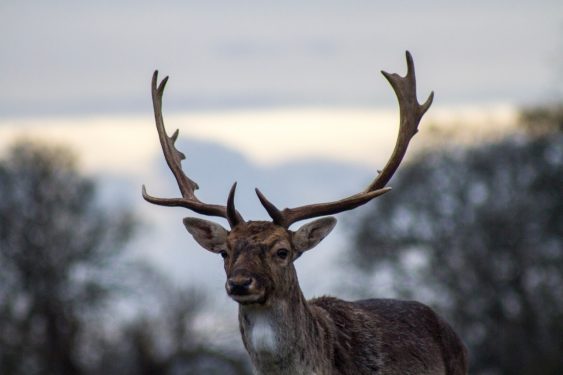
It is one of the most well-known large animals of the Arctic Circle.
Collected under a single species (Rangifer tarandus), these two-tiered mammals now live in the northern part of North America, extending from Spitzberg (Svalbard) to Eastern Siberia, one of the closest island groups to Scandinavia and the North Pole.
Image Sources and Copyright Information
- Map Highlighting the North Pole and Surrounding Arctic Region: © spatuletail/Shutterstock.com
- Map of the Arctic Region with North Pole: © Peter Hermes Furian/Shutterstock