Red, rolling sand dunes as far as the eye can see, a scorching sun, a hazy oasis rippling in the distance… These things, plus some cacti and a camel or two, are what many of us associate with deserts. But what about the coldest place on Earth? Is Antarctica a desert?
Yes, believe it or not, Antarctica is a desert. Despite being the opposite of the common perception of a desert in many ways, Antarctica’s icy landscape is actually the largest desert in the world.
Understanding Deserts: Definition and Classification
What is a desert, exactly? Most experts agree that a desert is a geographic area that receives less than 25 centimeters (10 inches) of precipitation in a year. Due to low levels of precipitation, these areas often have very little plant coverage and may lack sustainable water sources. It’s worth remembering, however, that precipitation levels — not temperature, geology, or wildlife — are what define a desert.

There are several different types of deserts, each with its own unique characteristics, and we’ll outline each one with examples in this section.
Polar Desert
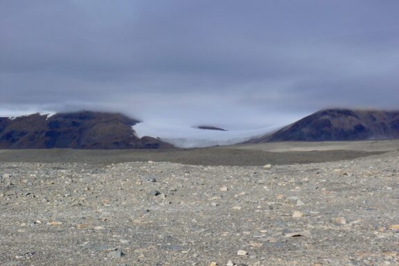
As the name suggests, polar deserts are located at the earth’s poles. There is an Arctic desert at the North Pole, and the Antarctic desert is located at the South Pole.
In contrast to the other types of deserts, polar deserts contain vast amounts of water in the form of ice and snow. In fact, the Antarctic ice sheet contains about 70% of the Earth’s fresh water. This water isn’t readily accessible to plants and animals, and this contributes to the barren landscapes found in these deserts.
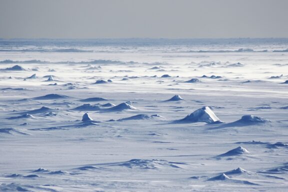
How does an area that gets a similar amount of precipitation to the Sahara Desert end up with so much water? Since it’s so cold in Antarctica, any snow that does fall tends to stay there and can remain for millions of years.
Subtropical Desert
Some of the planet’s subtropical deserts include the Kalahari, the Tanami, and the Sahara, which is the largest hot desert in the world.
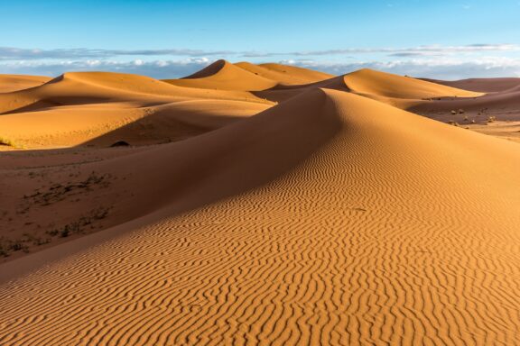
Subtropical deserts are created by the movement of air circulation patterns and are found along the Tropic of Cancer, 15° to 30° north of the equator, and along the Tropic of Capricorn, 15° to 30° south of the equator. As the air reaches this area, it descends and warms, which prevents cloud formation and leads to little precipitation.
Coastal Desert
The Namib Desert in Southern Africa and the Atacama Desert in Western South America are two prime examples of coastal deserts. These types of deserts are located on the west coasts of continents between 20° and 30° latitude.
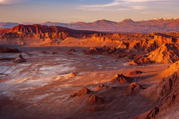
Coastal deserts are created by cool ocean currents coming into contact with the shore, which often creates layers of fog but does not cause precipitation. Cool winters and long, hot summers are typical of these deserts.
Rain Shadow Desert
Rain shadow deserts exist near mountain ranges that cause prevailing winds to rise. When the air rises, it cools and forms clouds that drop moisture on one side of the mountain range. By the time the air passes the mountains, there isn’t much moisture left. The air also warms as it descends on the other side of the mountains, making cloud formation unlikely.
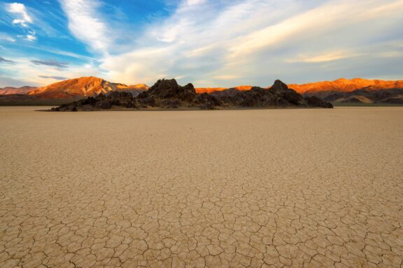
Death Valley in the Western US is an example of a rain shadow desert. It exists in the rain shadow of the Sierra Nevada mountain range and is the driest place on the continent.
Interior Desert
Interior deserts, sometimes also referred to as inland deserts, are found far from coasts, near the centers of continents. By the time winds reach these areas, they carry little to no moisture, which means very low levels of precipitation.
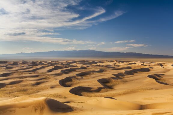
A good example of an interior desert is the Gobi Desert in Asia, which lies in Mongolia and China. As well as its status as an interior desert located a great distance from the ocean, the Gobi Desert is also in the rain shadow of the Himalayan mountain range.
Why is Antarctica a Desert?
Antarctica is a desert because it sees less than 25 centimeters (10 inches) of precipitation each year. In fact, it’s the driest place on the planet. Amazingly, the entire continent of Antarctica is a desert. On average as a whole, it receives less than 5 cm (2 in) of snow or rainfall each year.
Most of the desert’s precipitation falls along the coastal areas where the average reaches 20 cm (8 in) annually. Much less moisture falls further inland — the McMurdo Dry Valleys in Antarctica haven’t seen any precipitation in millions of years!
The Antarctic Polar Desert: Unique Features and Wildlife
The Antarctic Polar Desert is like no other place on Earth. It is the driest, coldest, and windiest continent on the planet, and it’s also the only continent without a permanent human population.
Geographic Features of Antarctica
Antarctica is situated around the South Pole and is surrounded by the Southern Ocean. The two major geographic regions of the continent are West Antarctica and East Antarctica, divided by the Transantarctic Mountains. Roughly 98% of the continent is covered by the Antarctic ice sheet, which is made up of 27 million km3 of ice.
Among Antarctica’s superlatives is also the fact that it’s got the highest average elevation of any continent. Its highest point is located atop the Vinson Massif, which is located in the Ellsworth Mountains of East Antarctica.
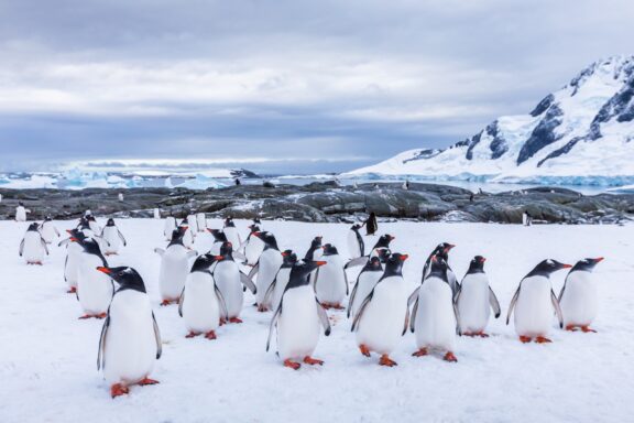
Wildlife in Antarctica
Plants and animals that are able to live in Antarctica must be well-suited to life in cold, harsh conditions. Many of the species present on the continent today are thought to be descendants of species that have lived in the area for millions of years and have weathered multiple ice ages.
Many of the animals that are able to thrive in and around Antarctica are marine life such as penguins, whales, squid, and seals. The small Antarctic krill are an important food source for many of these animals. There are also many birds that can be found around Antarctica, including albatrosses, petrels, gulls, and more.
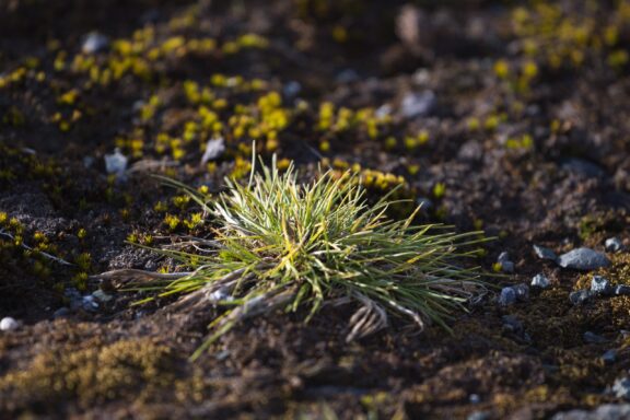
Plant life in Antarctica is very limited. A combination of freezing temperatures, poor soil quality, low sunlight, and lack of moisture all contribute to a landscape that is uninhabitable for most plants. Among the relatively few species that are able to survive are several types of mosses and liverworts as well as just two types of small flowering plants, one of which is Antarctic hair grass.
The low levels of plant and animal diversity in the Antarctic desert are characteristic of many deserts around the world. Harsh environments require unique adaptations for survival, and a lack of precipitation makes it hard for life to flourish.
Comparing Antarctica to Other Deserts
Our world is home to some massive deserts; they cover about 33% of all land on the planet and can be found on every continent. The polar deserts are especially large, but they aren’t the only giant deserts on Earth.
The table below details the largest deserts in the world and highlights the Antarctic desert as the biggest of them all.
| Desert | Desert Type | Area (million sq miles) | Area (million sq km) |
| Antarctic | polar | 5.50 | 14.24 |
| Arctic | polar | 5.40 | 14.19 |
| Sahara | subtropical | 3.50 | 9.14 |
| Arabian | subtropical | 1.00 | 2.56 |
| Gobi | interior (cold winter) | 0.50 | 1.29 |
| Patagonian | rain shadow (cold winter) | 0.26 | 0.67 |
| Great Victoria | subtropical | 0.25 | 0.64 |
| Kalahari | subtropical | 0.22 | 0.57 |
| Great Basin | rain shadow (cold winter) | 0.19 | 0.49 |
| Syrian | subtropical | 0.19 | 0.49 |
Tundra vs. Desert: Differentiating Polar Ecosystems
We’ve established that Antarctica is indeed a desert — the largest desert in the world. But is it also a tundra? Where are tundras located on the globe?
Along with its status as a desert, parts of Antarctica are also tundra. A tundra is broadly defined as treeless, mostly level or rolling land in a cold climate. They exist mostly north of the Arctic Circle and above the timberline on very high mountains (these are known as alpine tundras).
The two types of polar climates, according to the Köppen climate classification, are ice cap climate and tundra. Ice cap climates are defined by having monthly average temperatures that never exceed 0°C (32°F), and tundra climates have an average temperature between 0-10°C (32-50°F) during their warmest month. For this reason, most of Antarctica is too cold to be classified as tundra.
The only tundras to be found in the Southern Hemisphere are in some regions of Patagonia at the southern tip of South America and in the northernmost reaches of the Antarctic peninsula.
Exploring Antarctica: Tourism and Scientific Research
The extreme environment in Antarctica makes it mostly uninhabitable for humans. There aren’t any permanent residents on the continent, but there is some human activity in the form of tourism and scientific research.
Tourism in Antarctica
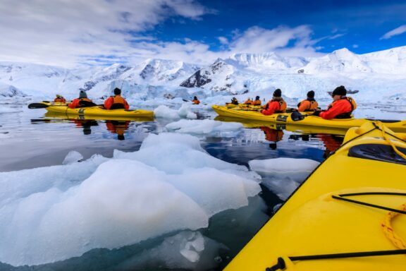
A trip to the remote, icy vastness of Antarctica may not be everyone’s idea of a holiday, but a growing number of tourists are interested in doing just that.
Tourism to Antarctica started around 1950 when sightseeing flights were organized by Australian and New Zealand airlines. In the years that have followed, tourism numbers have grown, and tour companies now bring tourists to the southernmost continent by boat and offer a chance to take part in wildlife excursions, mountain climbing, water sports, and more.
Today, around 170,000 tourists visit Antarctica each year, mostly from English-speaking countries. There are concerns that rising levels of tourism in the area are not sustainable and pose a threat to the ecosystem and wildlife. The International Association of Antarctica Tour Operators (IAATO) has set sustainability goals in place in an attempt to mitigate risks and negative impacts.
Since no country owns the land in Antarctica, it’s not necessary for visitors to apply for a visa. Instead, they must obtain a permit from a country that has signed the Antarctic Treaty. These are regularly facilitated through tour operators.
Scientific Research in Antarctica
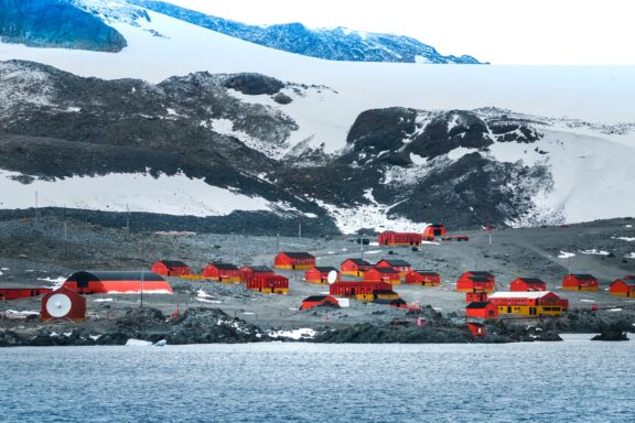
Antarctica is an especially exciting place for scientific researchers for several reasons. One of these is its remoteness: since there has been so little human activity on the continent, there is still a great deal to discover. Another is that Antarctica’s massive ice sheets have a profound effect on the planet’s climate and weather systems. There are 70 permanent research stations in Antarctica representing 29 different countries.
The Antarctic ice sheet is over 4 km deep at its thickest point, and this ancient ice contains a record of the planet’s climate over the past million years. Scientists are also able to learn valuable information about how human activity has affected the planet. In 1985, scientists at British Antarctic Survey (BAS) discovered a hole in the ozone layer above the continent that had been created by man-made chemicals.
At the start of 2023, researchers discovered five new meteorites in Antarctica, one of which is among the largest ever found on the continent.
More About Antarctica
Is Antarctica the largest desert?
Yes, Antarctica is the largest desert in the world, covering an area of 14.24 million km2 (5.5 million mi2). The world’s largest hot desert is the Sahara, located in Africa.
How big is Antarctica?
Antarctica is the fifth-largest continent and is about 40% larger than Europe. It is roughly the size of the United States and Mexico combined, or twice the size of Australia.
Is it illegal to go to Antarctica?
No, it is not illegal to visit Antarctica. Since it is not a country and is not owned by any single nation, it is not necessary to obtain a visa to visit the continent. However, tour operators are required to have permits to operate in Antarctica, and they can get permits on the behalf of tourists.
There are no regular passenger flights to Antarctica because of harsh environmental conditions.
Why is Antarctica guarded?
Military activity is prohibited in Antarctica, but the continent is guarded to protect the environment and support scientific research efforts. The Antarctic Treaty was signed by 12 nations and is aimed at promoting peace and cooperation in the region.
Image Sources and Copyright Information
- Antarctic Map with Regions and Ice Sheets: © Rainer Lesniewski/Shutterstock